Right side scores 3.0 vs left's 2.5 due to superior scenery on both legs. Takeoff captures the visually distinctive Orinoco Delta's waterway complexity, while landing offers the Thames estuary, London's urban geography, and the Chiltern Hills—genuine landmarks with clear visual interest. The left side's inland Venezuelan plains and open English countryside lack comparable geographic drama or landmark density.
Flown BLA to LHR? Did we get it right?
Flight Path
Barcelona to London is 4,572 miles (7,358 km), a flight of about 8 hours 15 minutes.
North Atlantic Ocean (5+ hours of open water with no visible landmarks), Azores archipelago (may be visible as distant islands if flight path passes nearby at cruise altitude, though typically 100+ miles south of direct routing), Irish coastline and Celtic Sea (approaching UK airspace), English Channel (final approach phase)
Great circle distance and headings ›Phase by phase
Takeoff from BLA
RIGHTRight side captures the Caribbean coastline and Orinoco Delta region during initial climb. The delta's intricate waterways and mangrove systems are visible from 3,000–8,000 feet, offering genuine geographic interest absent on the left side's inland terrain.
Landing at LHR
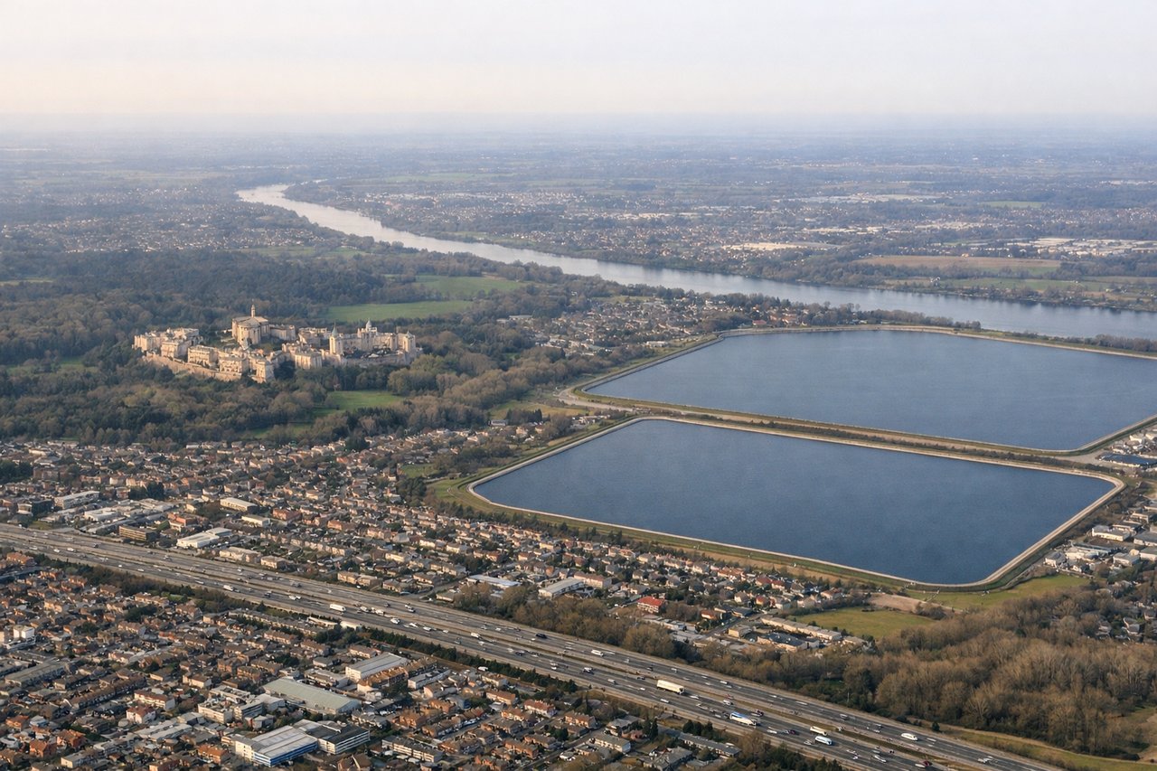
RIGHTRight side offers superior approach scenery into Heathrow. During westerly operations (70% of the time), aircraft descend over the Thames estuary, London's urban sprawl, and the distinctive Thames meanders. Even during easterly operations, the approach crosses the Chiltern Hills and the Home Counties' patchwork landscape—more visually varied than the left side's open countryside.
Will your flight be in sunlight?
Pick a date and time in the Sun Map to watch the sun move across your whole flight.
About This Route
Which side of the plane should I sit on flying from General Jose Antonio Anzoategui International (BLA) to Heathrow (LHR)?
Sit on the Right side of the plane for the best views on flights from Barcelona to London. Right side scores 3.0 vs left's 2.5 due to superior scenery on both legs. Takeoff captures the visually distinctive Orinoco Delta's waterway complexity, while landing offers the Thames estuary, London's urban geography, and the Chiltern Hills—genuine landmarks with clear visual interest. The left side's inland Venezuelan plains and open English countryside lack comparable geographic drama or landmark density.
What can I see during takeoff from General Jose Antonio Anzoategui International in Barcelona?
During takeoff from General Jose Antonio Anzoategui International (BLA), sit on the Right side for the best views. Right side captures the Caribbean coastline and Orinoco Delta region during initial climb. The delta's intricate waterways and mangrove systems are visible from 3,000–8,000 feet, offering genuine geographic interest absent on the left side's inland terrain. Notable sights include: Orinoco River Delta (complex channel network), Caribbean Sea coastline, Maturín region inland plains, Anzoategui coastal wetlands.
What can I see when landing at Heathrow in London?
When landing at Heathrow (LHR), sit on the Right side for the best views. Right side offers superior approach scenery into Heathrow. During westerly operations (70% of the time), aircraft descend over the Thames estuary, London's urban sprawl, and the distinctive Thames meanders. Even during easterly operations, the approach crosses the Chiltern Hills and the Home Counties' patchwork landscape—more visually varied than the left side's open countryside. Notable sights include: Thames River and estuary (distinctive meanders), London urban area and Greater London sprawl, Chiltern Hills (low but visible ridge), Windsor area and surrounding Home Counties patchwork fields.
How long is the flight from Barcelona to London?
The flight from General Jose Antonio Anzoategui International (BLA) to Heathrow (LHR) takes about 8 hours 15 minutes. The shortest flight path between them is 4,572 miles (7,358 km); winds and air traffic control usually add a few percent.
What does the Barcelona to London flight path pass over?
North Atlantic Ocean (5+ hours of open water with no visible landmarks), Azores archipelago (may be visible as distant islands if flight path passes nearby at cruise altitude, though typically 100+ miles south of direct routing), Irish coastline and Celtic Sea (approaching UK airspace), English Channel (final approach phase)