Left side delivers the best views at both ends of this short flight — Bellingham Bay and the San Juan Islands on departure, then the Seattle skyline and Elliott Bay on approach. The right side sees mostly the Cascade foothills throughout.
Flight Path
The flight tracks roughly south along the I-5 corridor. Midpoint features include the Skagit River delta and Skagit Bay visible to the west, the agricultural flats of the Skagit Valley below, and the foothills of the North Cascades to the east. Mount Baker is visible to the northeast early in the flight on clear days.
Great circle distance and headings ›Phase by phase
Takeoff from BLI
LEFTBLI's primary departure runway is 16 (heading south), so the left/east side gives you views over Bellingham Bay and the San Juan Islands archipelago spread across the water. You'll also catch Lummi Island close in and the broader Salish Sea before the aircraft tracks south.
Landing at SEA
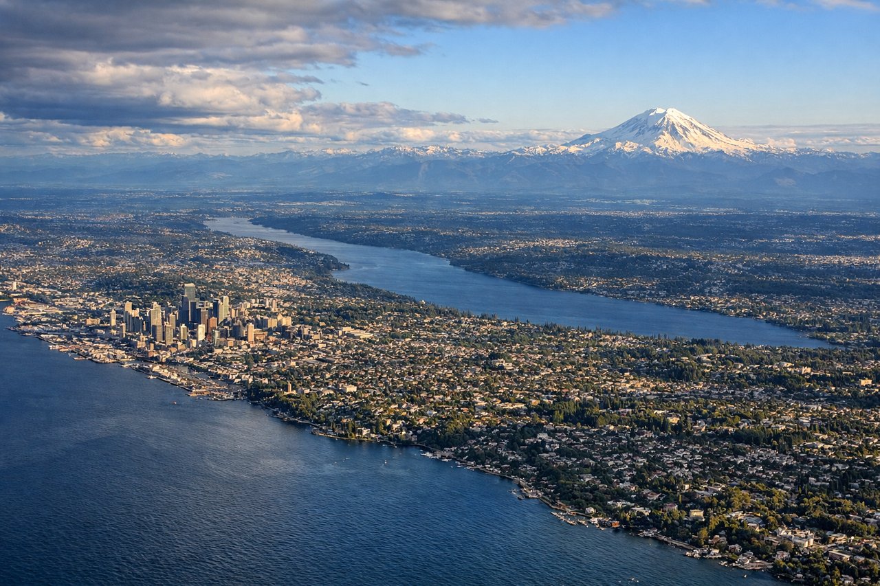
LEFTSEA's primary arrival from the north typically uses runways 16L/16R, with the approach tracking south over the city. The left/east side gives a clear view of downtown Seattle, Elliott Bay, and Mount Rainier dominating the southeastern horizon on clear days.
Landmarks on this routeAll landmarks →
Will your flight be in sunlight?
See exactly which side of the plane gets sun and shade at your departure time.
About This Route
Which side of the plane should I sit on flying from Bellingham International (BLI) to Seattle Tacoma International (SEA)?
Sit on the Left side of the plane for the best views on flights from Bellingham to Seattle. Left side delivers the best views at both ends of this short flight — Bellingham Bay and the San Juan Islands on departure, then the Seattle skyline and Elliott Bay on approach. The right side sees mostly the Cascade foothills throughout.
What can I see during takeoff from Bellingham International in Bellingham?
During takeoff from Bellingham International (BLI), sit on the Left side for the best views. BLI's primary departure runway is 16 (heading south), so the left/east side gives you views over Bellingham Bay and the San Juan Islands archipelago spread across the water. You'll also catch Lummi Island close in and the broader Salish Sea before the aircraft tracks south. Notable sights include: Bellingham Bay, Lummi Island, San Juan Islands, Chuckanut Bay.
What can I see when landing at Seattle Tacoma International in Seattle?
When landing at Seattle Tacoma International (SEA), sit on the Left side for the best views. SEA's primary arrival from the north typically uses runways 16L/16R, with the approach tracking south over the city. The left/east side gives a clear view of downtown Seattle, Elliott Bay, and Mount Rainier dominating the southeastern horizon on clear days. Notable sights include: Downtown Seattle skyline, Elliott Bay, Mount Rainier, Lake Washington.
How long is the flight from Bellingham to Seattle?
The flight from Bellingham International (BLI) to Seattle Tacoma International (SEA) takes Approximately 25-35 minutes.
What does the Bellingham to Seattle flight path pass over?
The flight tracks roughly south along the I-5 corridor. Midpoint features include the Skagit River delta and Skagit Bay visible to the west, the agricultural flats of the Skagit Valley below, and the foothills of the North Cascades to the east. Mount Baker is visible to the northeast early in the flight on clear days.