The right side edges ahead because both the takeoff and landing sequences reveal genuine terrain features—hills near Bangalore and the first Himalayan foothills near Amritsar—while the left side stays largely over flat, featureless plains throughout the flight.
Flown BLR to ATQ? Did we get it right?
Flight Path
Bangalore to Amritsar is 1,292 miles (2,080 km), a flight of about 3 hours 5 minutes.
Deccan Plateau, Narmada River valley, Malwa Plateau farmland, and the flat alluvial plains of Madhya Pradesh and Rajasthan before descending into Punjab
Great circle distance and headings ›Phase by phase
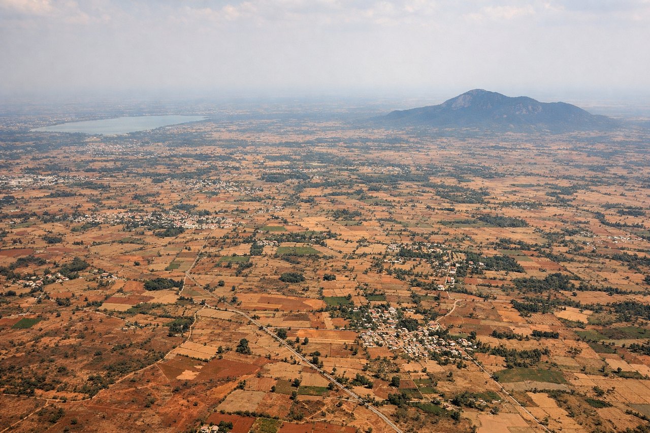
Takeoff from BLR
RIGHTDeparting BLR northbound, the right side offers glimpses of Bangalore's eastern tech corridor and the granite hills near Nandi Hills as the aircraft climbs and turns onto its northerly heading. The left side mostly shows flat farmland and reservoirs with less definition.
Landing at ATQ
RIGHTOn approach into Amritsar from the south, the right side faces east toward the first low ridgelines of the Himalayan foothills, visible as a hazy blue line on clear days, along with the braided channels of the Beas River. The left side mainly shows flat Punjab farmland stretching toward the Pakistan border with no major relief.
Will your flight be in sunlight?
Pick a date and time in the Sun Map to watch the sun move across your whole flight.
About This Route
Which side of the plane should I sit on flying from Kempegowda International Airport Bengaluru (BLR) to Amritsar (ATQ)?
Sit on the Right side of the plane for the best views on flights from Bangalore to Amritsar. The right side edges ahead because both the takeoff and landing sequences reveal genuine terrain features—hills near Bangalore and the first Himalayan foothills near Amritsar—while the left side stays largely over flat, featureless plains throughout the flight.
What can I see during takeoff from Kempegowda International Airport Bengaluru in Bangalore?
During takeoff from Kempegowda International Airport Bengaluru (BLR), sit on the Right side for the best views. Departing BLR northbound, the right side offers glimpses of Bangalore's eastern tech corridor and the granite hills near Nandi Hills as the aircraft climbs and turns onto its northerly heading. The left side mostly shows flat farmland and reservoirs with less definition. Notable sights include: Bangalore urban sprawl, Nandi Hills granite outcrops, scattered reservoirs, Deccan plateau farmland.
What can I see when landing at Amritsar in Amritsar?
When landing at Amritsar (ATQ), sit on the Right side for the best views. On approach into Amritsar from the south, the right side faces east toward the first low ridgelines of the Himalayan foothills, visible as a hazy blue line on clear days, along with the braided channels of the Beas River. The left side mainly shows flat Punjab farmland stretching toward the Pakistan border with no major relief. Notable sights include: Himalayan foothills silhouette, Beas River channels, Punjab wheat fields, Amritsar's urban grid near the Golden Temple.
How long is the flight from Bangalore to Amritsar?
The flight from Kempegowda International Airport Bengaluru (BLR) to Amritsar (ATQ) takes about 3 hours 5 minutes. The shortest flight path between them is 1,292 miles (2,080 km); winds and air traffic control usually add a few percent.
What does the Bangalore to Amritsar flight path pass over?
Deccan Plateau, Narmada River valley, Malwa Plateau farmland, and the flat alluvial plains of Madhya Pradesh and Rajasthan before descending into Punjab