Right side scores higher (3.0 vs 2.5) due to superior geographic variety and landmark density. The Deccan Plateau terrain during takeoff and the Brahmaputra River valley with tea gardens during landing provide more visual interest than the left side's flat plains. The river's distinctive meanders and the transition from plateau to river valley create meaningful scenic progression across the flight.
Flown BLR to GAU? Did we get it right?
Flight Path
Bangalore to Guwahati is 1,267 miles (2,039 km), a flight of about 3 hours 5 minutes.
Transition from Deccan Plateau (southern Karnataka) through the flat plains of Telangana and Andhra Pradesh, crossing into the Brahmaputra River valley system as the flight approaches Assam. The landscape shifts from semi-arid plateau to increasingly green agricultural plains and river deltas. No major mountain ranges cross this route; the terrain is predominantly low-lying with gradual elevation changes.
Great circle distance and headings ›Phase by phase
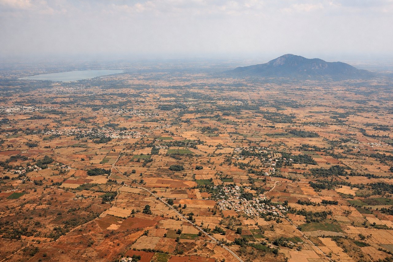
Takeoff from BLR
RIGHTRight side captures the Deccan Plateau terrain and scattered lakes around Bangalore during climb-out. Left side faces open plains with minimal visual interest during the initial departure phase.

Landing at GAU
RIGHTRight side offers views of the Brahmaputra River valley, tea gardens of Assam, and the approach to Guwahati with the river's distinctive meanders visible during descent. Left side shows only flat plains with minimal geographic features.
Will your flight be in sunlight?
Pick a date and time in the Sun Map to watch the sun move across your whole flight.
About This Route
Which side of the plane should I sit on flying from Kempegowda International Airport Bengaluru (BLR) to Lokpriya Gopinath Bordoloi International Airport (GAU)?
Sit on the Right side of the plane for the best views on flights from Bangalore to Guwahati. Right side scores higher (3.0 vs 2.5) due to superior geographic variety and landmark density. The Deccan Plateau terrain during takeoff and the Brahmaputra River valley with tea gardens during landing provide more visual interest than the left side's flat plains. The river's distinctive meanders and the transition from plateau to river valley create meaningful scenic progression across the flight.
What can I see during takeoff from Kempegowda International Airport Bengaluru in Bangalore?
During takeoff from Kempegowda International Airport Bengaluru (BLR), sit on the Right side for the best views. Right side captures the Deccan Plateau terrain and scattered lakes around Bangalore during climb-out. Left side faces open plains with minimal visual interest during the initial departure phase. Notable sights include: Deccan Plateau escarpment, Hesaraghatta Lake, scattered agricultural fields of rural Karnataka.
What can I see when landing at Lokpriya Gopinath Bordoloi International Airport in Guwahati?
When landing at Lokpriya Gopinath Bordoloi International Airport (GAU), sit on the Right side for the best views. Right side offers views of the Brahmaputra River valley, tea gardens of Assam, and the approach to Guwahati with the river's distinctive meanders visible during descent. Left side shows only flat plains with minimal geographic features. Notable sights include: Brahmaputra River with characteristic meanders, Assam tea gardens (visible as geometric plantation patterns), Guwahati city sprawl along the river, Nilachal Hills.
How long is the flight from Bangalore to Guwahati?
The flight from Kempegowda International Airport Bengaluru (BLR) to Lokpriya Gopinath Bordoloi International Airport (GAU) takes about 3 hours 5 minutes. The shortest flight path between them is 1,267 miles (2,039 km); winds and air traffic control usually add a few percent.
What does the Bangalore to Guwahati flight path pass over?
Transition from Deccan Plateau (southern Karnataka) through the flat plains of Telangana and Andhra Pradesh, crossing into the Brahmaputra River valley system as the flight approaches Assam. The landscape shifts from semi-arid plateau to increasingly green agricultural plains and river deltas. No major mountain ranges cross this route; the terrain is predominantly low-lying with gradual elevation changes.