While both sides spend most of the flight over open water, the right side captures the volcanic highlands of northern Sumatra during cruise and the dramatic Singapore skyline and harbor on final approach, giving it more variety and visual payoff than the left, which is dominated by featureless Bay of Bengal ocean.
Flight Path
Bay of Bengal open water, waters near the Nicobar Islands, northern Sumatra coastline near Aceh, Strait of Malacca shipping lanes
Great circle distance and headings ›Phase by phase

Takeoff from BLR
LEFTAfter departure from Bengaluru, the initial climb and turn toward the southeast puts Bengaluru's northern suburbs and the Nandi Hills on the left side of the aircraft, giving a brief but genuine glimpse of terrain relief before the long flat stretch toward the coast.
Landing at SIN
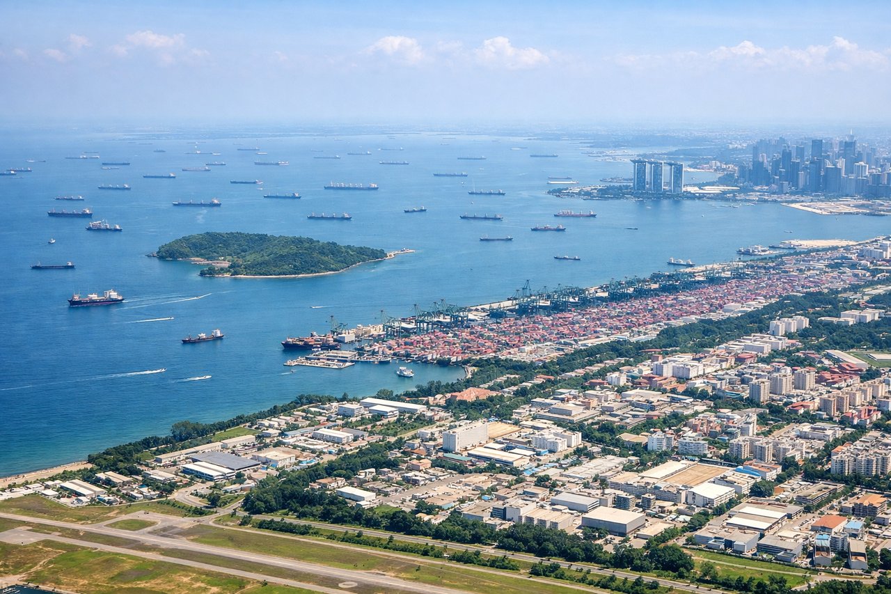
RIGHTOn final approach into Changi, the descent path brings Singapore's skyline, harbor, and Sentosa Island into view on the right side of the aircraft, offering the most visually striking scenery of the entire flight.
Landmarks on this routeAll landmarks →
Will your flight be in sunlight?
See exactly which side of the plane gets sun and shade at your departure time.
About This Route
Which side of the plane should I sit on flying from Kempegowda International Airport Bengaluru (BLR) to Singapore Changi (SIN)?
Sit on the Right side of the plane for the best views on flights from Bangalore to Singapore. While both sides spend most of the flight over open water, the right side captures the volcanic highlands of northern Sumatra during cruise and the dramatic Singapore skyline and harbor on final approach, giving it more variety and visual payoff than the left, which is dominated by featureless Bay of Bengal ocean.
What can I see during takeoff from Kempegowda International Airport Bengaluru in Bangalore?
During takeoff from Kempegowda International Airport Bengaluru (BLR), sit on the Left side for the best views. After departure from Bengaluru, the initial climb and turn toward the southeast puts Bengaluru's northern suburbs and the Nandi Hills on the left side of the aircraft, giving a brief but genuine glimpse of terrain relief before the long flat stretch toward the coast. Notable sights include: Bengaluru city sprawl, Devanahalli countryside, Nandi Hills, Bannerghatta forest belt in the distance.
What can I see when landing at Singapore Changi in Singapore?
When landing at Singapore Changi (SIN), sit on the Right side for the best views. On final approach into Changi, the descent path brings Singapore's skyline, harbor, and Sentosa Island into view on the right side of the aircraft, offering the most visually striking scenery of the entire flight. Notable sights include: Marina Bay Sands and CBD skyline, Keppel Harbour container port, Sentosa Island, Singapore Strait shipping lanes.
How long is the flight from Bangalore to Singapore?
The flight from Kempegowda International Airport Bengaluru (BLR) to Singapore Changi (SIN) takes 4h 15m.
What does the Bangalore to Singapore flight path pass over?
Bay of Bengal open water, waters near the Nicobar Islands, northern Sumatra coastline near Aceh, Strait of Malacca shipping lanes