Right side scores higher due to superior landing scenery at Sydney—the harbour, Opera House, Harbour Bridge, and Blue Mountains provide iconic, recognizable landmarks and dramatic visual interest. While takeoff from Bloomington-Normal is modest on both sides, the right side's advantage during the 14+ hour cruise (viewing the Pacific Ocean, approaching Australia's east coast, and the Sydney approach) outweighs the left side's flat Illinois departure.
Flown BMI to SYD? Did we get it right?
Flight Path
Bloomington/Normal to Sydney is 9,163 miles (14,747 km), a flight of about 14 hours 35 minutes.
Pacific Ocean (open water for 10+ hours), Hawaiian Islands (if visible during northern Pacific routing—typically too far north), Australian east coast approaching Sydney including Queensland and New South Wales coastline, Great Dividing Range inland from the coast
Great circle distance and headings ›Phase by phase
Takeoff from BMI
RIGHTRight side captures the Illinois prairie landscape and potential views of the Bloomington-Normal urban area during initial climb. Left side faces open farmland with minimal visual interest during departure.
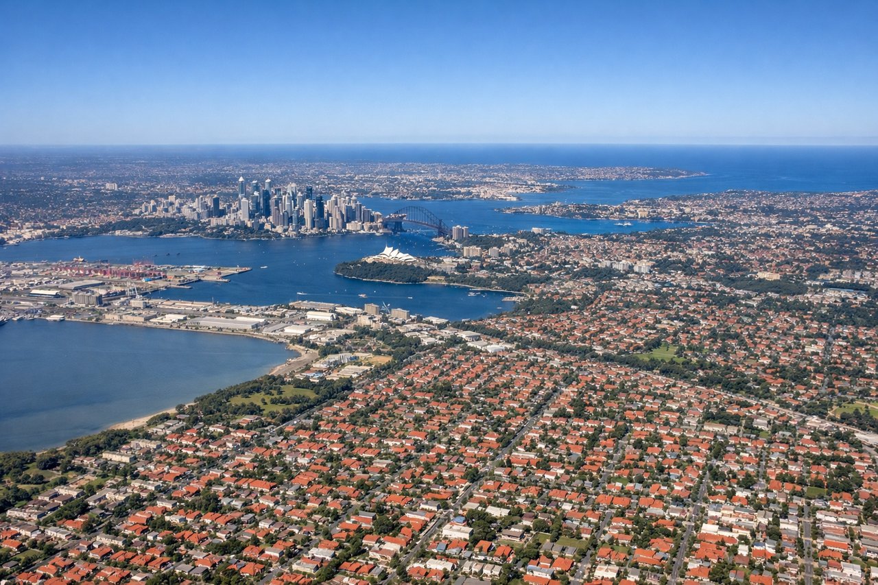
Landing at SYD
RIGHTRight side (typically west-facing on approach to Sydney's north-south runways) offers views of Sydney Harbour, the Blue Mountains in the distance, and the city's eastern suburbs during descent. Left side faces the Tasman Sea and open ocean for most of the approach.
Will your flight be in sunlight?
Pick a date and time in the Sun Map to watch the sun move across your whole flight.
About This Route
Which side of the plane should I sit on flying from Central Illinois Regional Airport at Bloomington-Normal (BMI) to Kingsford Smith International Airport (SYD)?
Sit on the Right side of the plane for the best views on flights from Bloomington/Normal to Sydney. Right side scores higher due to superior landing scenery at Sydney—the harbour, Opera House, Harbour Bridge, and Blue Mountains provide iconic, recognizable landmarks and dramatic visual interest. While takeoff from Bloomington-Normal is modest on both sides, the right side's advantage during the 14+ hour cruise (viewing the Pacific Ocean, approaching Australia's east coast, and the Sydney approach) outweighs the left side's flat Illinois departure.
What can I see during takeoff from Central Illinois Regional Airport at Bloomington-Normal in Bloomington/Normal?
During takeoff from Central Illinois Regional Airport at Bloomington-Normal (BMI), sit on the Right side for the best views. Right side captures the Illinois prairie landscape and potential views of the Bloomington-Normal urban area during initial climb. Left side faces open farmland with minimal visual interest during departure. Notable sights include: Bloomington-Normal metropolitan area, Illinois prairie grid pattern, Salt Fork Vermilion River valley.
What can I see when landing at Kingsford Smith International Airport in Sydney?
When landing at Kingsford Smith International Airport (SYD), sit on the Right side for the best views. Right side (typically west-facing on approach to Sydney's north-south runways) offers views of Sydney Harbour, the Blue Mountains in the distance, and the city's eastern suburbs during descent. Left side faces the Tasman Sea and open ocean for most of the approach. Notable sights include: Sydney Harbour with Opera House and Harbour Bridge, Blue Mountains escarpment to the west, Parramatta River, Sydney's eastern beaches and coastal suburbs.
How long is the flight from Bloomington/Normal to Sydney?
The flight from Central Illinois Regional Airport at Bloomington-Normal (BMI) to Kingsford Smith International Airport (SYD) takes about 14 hours 35 minutes. The shortest flight path between them is 9,163 miles (14,747 km); winds and air traffic control usually add a few percent.
What does the Bloomington/Normal to Sydney flight path pass over?
Pacific Ocean (open water for 10+ hours), Hawaiian Islands (if visible during northern Pacific routing—typically too far north), Australian east coast approaching Sydney including Queensland and New South Wales coastline, Great Dividing Range inland from the coast