Nashville to Pensacola is 392 miles (630 km), a flight of about 1 hour 15 minutes.
Right-side seats win overall because the takeoff view of Nashville and the Cumberland River is more visually distinctive and engaging than the landing approach. While the landing offers nice coastal views, the river and city geography on departure provides clearer, more recognizable landmarks.
Flight Path
The flight path crosses central Alabama, passing east of Birmingham. You'll see the Tennessee River valley transitioning to the rolling Appalachian foothills, then flatten into the coastal plain. The Alabama-Georgia border region shows distinct topographic changes. As you approach the Gulf, the landscape becomes increasingly flat with pine forests and wetlands becoming more prominent. No major mountain ranges are visible, but the gradual elevation drop from 1,000+ feet in Tennessee to sea level at Pensacola is noticeable in the terrain's character.
Great circle distance and headings ›Phase by phase
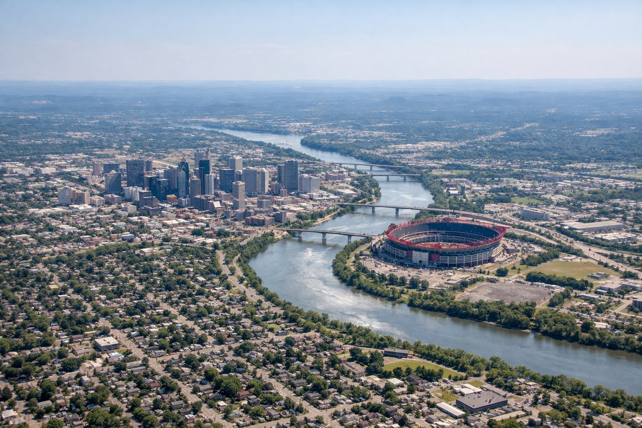
Takeoff from BNA
RIGHTRight-side seats capture the Cumberland River winding through downtown Nashville and the surrounding urban sprawl as you climb out. BNA typically departs to the north or northeast, so right seats get the best angle on the river's distinctive curves and the city grid below.
Landing at PNS
LEFTLeft-side seats offer views of Pensacola Bay and the barrier islands as you descend into PNS. The approach typically comes from the north or northeast, and left seats frame the distinctive blue waters of the bay, the white sand beaches of Pensacola Beach and Santa Rosa Island, and the narrow sound between them.
Landmarks on this routeAll landmarks →
Will your flight be in sunlight?
Pick a date and time in the Sun Map to watch the sun move across your whole flight.
About This Route
Which side of the plane should I sit on flying from Nashville International (BNA) to Pensacola Rgnl (PNS)?
Sit on the Right side of the plane for the best views on flights from Nashville to Pensacola. Right-side seats win overall because the takeoff view of Nashville and the Cumberland River is more visually distinctive and engaging than the landing approach. While the landing offers nice coastal views, the river and city geography on departure provides clearer, more recognizable landmarks.
What can I see during takeoff from Nashville International in Nashville?
During takeoff from Nashville International (BNA), sit on the Right side for the best views. Right-side seats capture the Cumberland River winding through downtown Nashville and the surrounding urban sprawl as you climb out. BNA typically departs to the north or northeast, so right seats get the best angle on the river's distinctive curves and the city grid below. Notable sights include: Cumberland River (meandering through downtown), Nashville urban grid, Percy Priest Lake (visible to the east during climb), rolling Tennessee hills to the north.
What can I see when landing at Pensacola Rgnl in Pensacola?
When landing at Pensacola Rgnl (PNS), sit on the Left side for the best views. Left-side seats offer views of Pensacola Bay and the barrier islands as you descend into PNS. The approach typically comes from the north or northeast, and left seats frame the distinctive blue waters of the bay, the white sand beaches of Pensacola Beach and Santa Rosa Island, and the narrow sound between them. Notable sights include: Pensacola Bay (large shallow estuary), Santa Rosa Island (barrier island with beaches), Pensacola Beach, East Bay (narrower water body to the east).
How long is the flight from Nashville to Pensacola?
The flight from Nashville International (BNA) to Pensacola Rgnl (PNS) takes about 1 hour 15 minutes. The shortest flight path between them is 392 miles (630 km); winds and air traffic control usually add a few percent.
What does the Nashville to Pensacola flight path pass over?
The flight path crosses central Alabama, passing east of Birmingham. You'll see the Tennessee River valley transitioning to the rolling Appalachian foothills, then flatten into the coastal plain. The Alabama-Georgia border region shows distinct topographic changes. As you approach the Gulf, the landscape becomes increasingly flat with pine forests and wetlands becoming more prominent. No major mountain ranges are visible, but the gradual elevation drop from 1,000+ feet in Tennessee to sea level at Pensacola is noticeable in the terrain's character.