Right side scores higher (3.5 vs 2.5) due to superior scenery during both takeoff and landing phases. Takeoff captures Bogotá's urban landscape and the dramatic Cordillera Oriental escarpment; landing provides extensive views of the Dominican coast, Caribbean waters, and the Cordillera Septentrional. Left side faces primarily high plateau terrain on departure and open ocean on arrival, offering less visual variety and fewer recognizable landmarks.
Flown BOG to POP? Did we get it right?
Flight Path
Bogota to Puerto Plata is 1,068 miles (1,718 km), a flight of about 3 hours 15 minutes.
Caribbean Sea crossing with no significant landmarks; flight path passes over open water between Colombia's Caribbean coast and Dominican Republic's northern coast. At cruise altitude (approximately 35,000 feet), the horizon shows only ocean and sky with no visible land features for roughly 2 hours of the flight.
Great circle distance and headings ›Phase by phase
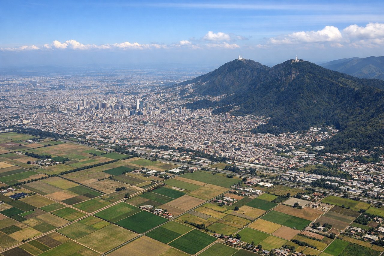
Takeoff from BOG
RIGHTRight side captures Bogotá's urban sprawl and the dramatic eastern escarpment of the Cordillera Oriental as the aircraft climbs northwestward. Left side faces the high Andes plateau with limited visual drama during initial climb.
Landing at POP
RIGHTRight side offers the most dramatic approach into Puerto Plata, with views of the northern Dominican coast, the Atlantic Ocean, and the Cordillera Septentrional mountains inland. Left side faces open ocean for most of the descent and approach.
Will your flight be in sunlight?
Pick a date and time in the Sun Map to watch the sun move across your whole flight.
About This Route
Which side of the plane should I sit on flying from Eldorado International (BOG) to Gregorio Luperon International (POP)?
Sit on the Right side of the plane for the best views on flights from Bogota to Puerto Plata. Right side scores higher (3.5 vs 2.5) due to superior scenery during both takeoff and landing phases. Takeoff captures Bogotá's urban landscape and the dramatic Cordillera Oriental escarpment; landing provides extensive views of the Dominican coast, Caribbean waters, and the Cordillera Septentrional. Left side faces primarily high plateau terrain on departure and open ocean on arrival, offering less visual variety and fewer recognizable landmarks.
What can I see during takeoff from Eldorado International in Bogota?
During takeoff from Eldorado International (BOG), sit on the Right side for the best views. Right side captures Bogotá's urban sprawl and the dramatic eastern escarpment of the Cordillera Oriental as the aircraft climbs northwestward. Left side faces the high Andes plateau with limited visual drama during initial climb. Notable sights include: Bogotá city grid and surrounding urban development, Cordillera Oriental ridge line to the east, Monserrate peak (3,152 m) visible on the eastern skyline.
What can I see when landing at Gregorio Luperon International in Puerto Plata?
When landing at Gregorio Luperon International (POP), sit on the Right side for the best views. Right side offers the most dramatic approach into Puerto Plata, with views of the northern Dominican coast, the Atlantic Ocean, and the Cordillera Septentrional mountains inland. Left side faces open ocean for most of the descent and approach. Notable sights include: Puerto Plata harbor and coastal city, Cordillera Septentrional mountain range inland, Atlantic coastline with beaches and reef formations, Gregorio Luperon International Airport runway aligned with the coast.
How long is the flight from Bogota to Puerto Plata?
The flight from Eldorado International (BOG) to Gregorio Luperon International (POP) takes about 3 hours 15 minutes. The shortest flight path between them is 1,068 miles (1,718 km); winds and air traffic control usually add a few percent.
What does the Bogota to Puerto Plata flight path pass over?
Caribbean Sea crossing with no significant landmarks; flight path passes over open water between Colombia's Caribbean coast and Dominican Republic's northern coast. At cruise altitude (approximately 35,000 feet), the horizon shows only ocean and sky with no visible land features for roughly 2 hours of the flight.