Left side scores higher due to the dramatic Boise foothills and Owyhee Mountains during takeoff, which provide genuine terrain drama and visual interest. While the landing approach favors the right side with Blue Ridge views, the takeoff experience is more visually compelling and the cruise phase over the Rocky Mountains and Great Plains offers more varied scenery when viewed from the left. The full flight experience on the left side provides better landmark density and terrain variety.
Flown BOI to IAD? Did we get it right?
Flight Path
Boise to Washington is 2,020 miles (3,251 km), a flight of about 4 hours 45 minutes.
Rocky Mountains (central Idaho and western Wyoming), Great Basin and high desert plateau (Utah and Nevada), Wasatch Range (Utah), Green River (Utah), Colorado Plateau, Colorado River canyons, Rocky Mountain Front (Colorado and Wyoming), Great Plains (eastern Colorado and Kansas), Flint Hills (Kansas), Missouri River valley (Missouri), Mississippi River valley (Illinois and Missouri), Appalachian foothills (Ohio and West Virginia)
Great circle distance and headings ›Phase by phase
Takeoff from BOI
LEFTLeft side captures the Boise foothills and initial climb over the Owyhee Mountains to the northwest. Right side faces southeast toward flat terrain and the Snake River Plain with minimal elevation change.
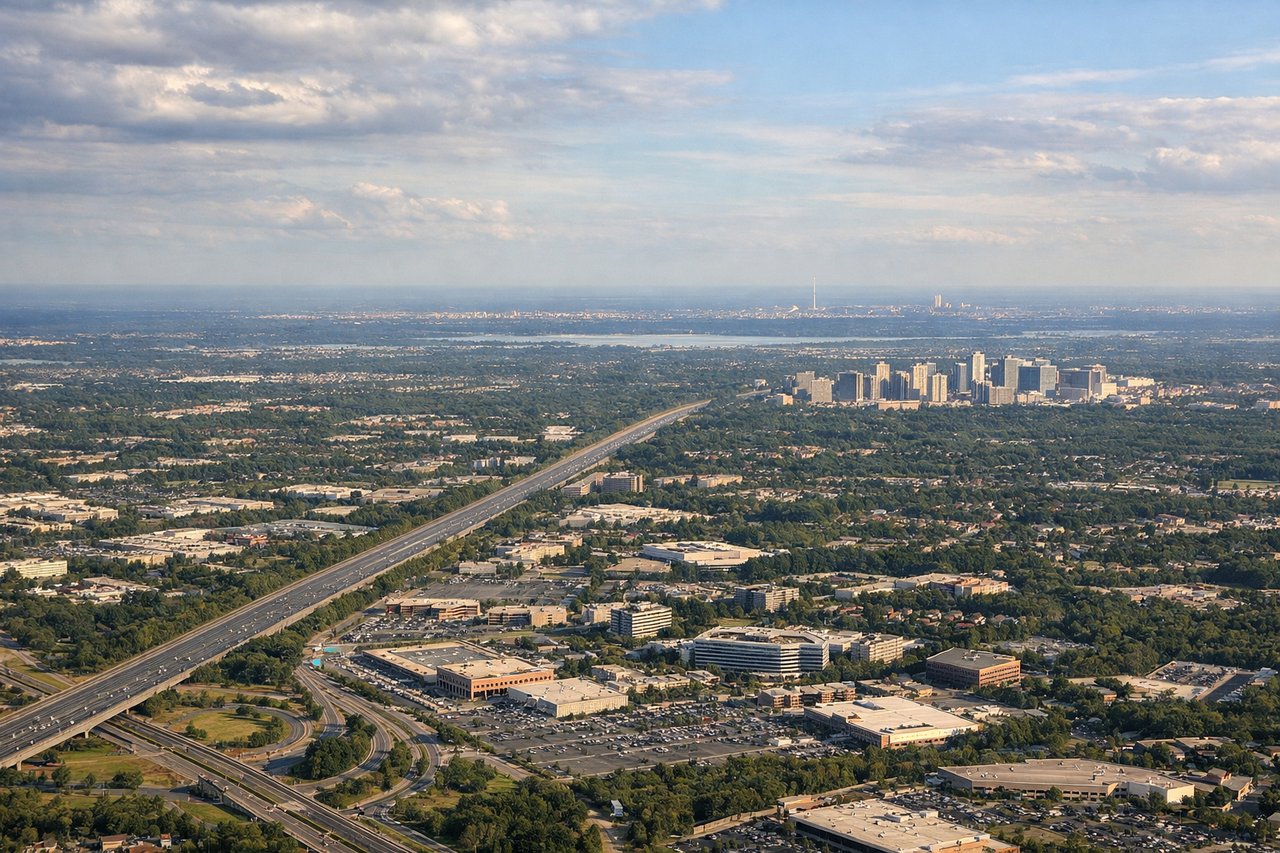
Landing at IAD
RIGHTRight side (east) provides views of the Piedmont region, the Blue Ridge Mountains, and the Shenandoah Valley during descent into IAD. Left side (west) faces the Appalachian plateau with less dramatic relief and fewer recognizable landmarks during the approach corridor.
Will your flight be in sunlight?
Pick a date and time in the Sun Map to watch the sun move across your whole flight.
About This Route
Which side of the plane should I sit on flying from Boise Air Terminal (BOI) to Washington Dulles International (IAD)?
Sit on the Left side of the plane for the best views on flights from Boise to Washington. Left side scores higher due to the dramatic Boise foothills and Owyhee Mountains during takeoff, which provide genuine terrain drama and visual interest. While the landing approach favors the right side with Blue Ridge views, the takeoff experience is more visually compelling and the cruise phase over the Rocky Mountains and Great Plains offers more varied scenery when viewed from the left. The full flight experience on the left side provides better landmark density and terrain variety.
What can I see during takeoff from Boise Air Terminal in Boise?
During takeoff from Boise Air Terminal (BOI), sit on the Left side for the best views. Left side captures the Boise foothills and initial climb over the Owyhee Mountains to the northwest. Right side faces southeast toward flat terrain and the Snake River Plain with minimal elevation change. Notable sights include: Boise foothills (immediate northwest), Owyhee Mountains (distant northwest), Bogus Basin ski area (north of Boise), Snake River valley (southeast).
What can I see when landing at Washington Dulles International in Washington?
When landing at Washington Dulles International (IAD), sit on the Right side for the best views. Right side (east) provides views of the Piedmont region, the Blue Ridge Mountains, and the Shenandoah Valley during descent into IAD. Left side (west) faces the Appalachian plateau with less dramatic relief and fewer recognizable landmarks during the approach corridor. Notable sights include: Blue Ridge Mountains (eastern horizon), Shenandoah Valley (middle distance), Piedmont foothills (foreground during descent), Washington DC metropolitan sprawl (final approach).
How long is the flight from Boise to Washington?
The flight from Boise Air Terminal (BOI) to Washington Dulles International (IAD) takes about 4 hours 45 minutes. The shortest flight path between them is 2,020 miles (3,251 km); winds and air traffic control usually add a few percent.
What does the Boise to Washington flight path pass over?
Rocky Mountains (central Idaho and western Wyoming), Great Basin and high desert plateau (Utah and Nevada), Wasatch Range (Utah), Green River (Utah), Colorado Plateau, Colorado River canyons, Rocky Mountain Front (Colorado and Wyoming), Great Plains (eastern Colorado and Kansas), Flint Hills (Kansas), Missouri River valley (Missouri), Mississippi River valley (Illinois and Missouri), Appalachian foothills (Ohio and West Virginia)