While the left side has the better Boise departure view, the right side wins overall due to the dramatic Phoenix arrival over the Valley of the Sun and also captures the Nevada-Utah high desert and portions of the Grand Canyon region during the cruise portion of the flight.
Flown BOI to PHX? Did we get it right?
Flight Path
Boise to Phoenix is 736 miles (1,184 km), a flight of about 1 hour 55 minutes.
The flight tracks roughly south-southeast over the Nevada-Utah border region, crossing the Great Basin desert with its characteristic basin-and-range topography. Passengers may see portions of the Nevada desert near Elko, the Virgin River Gorge area near the Utah-Arizona border, and the high plateaus of the Arizona Strip north of the Grand Canyon. The Kaibab Plateau and the North Rim of the Grand Canyon may be visible on the right side during cruise, appearing as a forested plateau edge dropping into canyon terrain roughly 50-60 miles to the west depending on exact routing.
Great circle distance and headings ›Phase by phase
Takeoff from BOI
LEFTBoise typically departs south on runway 10L/28R or uses runway 10R, meaning a southbound climb puts the Boise Front foothills and the Treasure Valley on the left. The left side gets a clear look at the Snake River Plain spreading west and the Owyhee Mountains rising to the southwest.
Landing at PHX
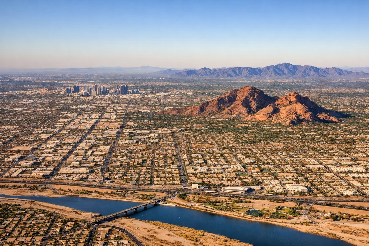
RIGHTPhoenix Sky Harbor primarily uses runways 8/26 and 7R/25L, with arrivals often coming from the north or northwest. A northwest approach puts the right side facing the Phoenix metro grid, South Mountain Park, and the distinctive urban sprawl of the Valley of the Sun spreading to the east and southeast.
Will your flight be in sunlight?
Pick a date and time in the Sun Map to watch the sun move across your whole flight.
About This Route
Which side of the plane should I sit on flying from Boise Air Terminal (BOI) to Phoenix Sky Harbor International (PHX)?
Sit on the Right side of the plane for the best views on flights from Boise to Phoenix. While the left side has the better Boise departure view, the right side wins overall due to the dramatic Phoenix arrival over the Valley of the Sun and also captures the Nevada-Utah high desert and portions of the Grand Canyon region during the cruise portion of the flight.
What can I see during takeoff from Boise Air Terminal in Boise?
During takeoff from Boise Air Terminal (BOI), sit on the Left side for the best views. Boise typically departs south on runway 10L/28R or uses runway 10R, meaning a southbound climb puts the Boise Front foothills and the Treasure Valley on the left. The left side gets a clear look at the Snake River Plain spreading west and the Owyhee Mountains rising to the southwest. Notable sights include: Owyhee Mountains to the southwest, Snake River Plain stretching west, Boise city grid below, Lucky Peak Reservoir to the east.
What can I see when landing at Phoenix Sky Harbor International in Phoenix?
When landing at Phoenix Sky Harbor International (PHX), sit on the Right side for the best views. Phoenix Sky Harbor primarily uses runways 8/26 and 7R/25L, with arrivals often coming from the north or northwest. A northwest approach puts the right side facing the Phoenix metro grid, South Mountain Park, and the distinctive urban sprawl of the Valley of the Sun spreading to the east and southeast. Notable sights include: South Mountain Park and preserve, Phoenix downtown skyline, Salt River bed and Tempe Town Lake, Superstition Mountains on the distant eastern horizon.
How long is the flight from Boise to Phoenix?
The flight from Boise Air Terminal (BOI) to Phoenix Sky Harbor International (PHX) takes about 1 hour 55 minutes. The shortest flight path between them is 736 miles (1,184 km); winds and air traffic control usually add a few percent.
What does the Boise to Phoenix flight path pass over?
The flight tracks roughly south-southeast over the Nevada-Utah border region, crossing the Great Basin desert with its characteristic basin-and-range topography. Passengers may see portions of the Nevada desert near Elko, the Virgin River Gorge area near the Utah-Arizona border, and the high plateaus of the Arizona Strip north of the Grand Canyon. The Kaibab Plateau and the North Rim of the Grand Canyon may be visible on the right side during cruise, appearing as a forested plateau edge dropping into canyon terrain roughly 50-60 miles to the west depending on exact routing.