The takeoff views from Bonaire's Caribbean coastline and Klein Bonaire are more visually distinctive and dramatic than the landing approach. The turquoise waters and island geography provide clearer, more photogenic scenery than the gradual suburban transition into Atlanta.
Flown BON to ATL? Did we get it right?
Flight Path
Kralendijk to Atlanta is 1,802 miles (2,899 km), a flight of about 4 hours 15 minutes.
Gulf of Mexico coastline (Florida panhandle and Alabama coast visible during cruise), Mississippi River delta region, Tennessee River valley, Cumberland Plateau ridgelines in central Tennessee
Great circle distance and headings ›Phase by phase
Takeoff from BON
RIGHTRight side offers immediate views of Bonaire's coastline and the Caribbean Sea. The island's western shore and shallow turquoise waters are distinctive during initial climb-out, with Klein Bonaire visible offshore to the west.
Landing at ATL
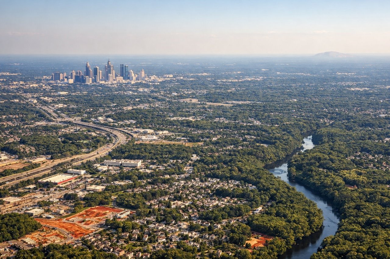
LEFTLeft side provides views of the Appalachian foothills and the Atlanta metropolitan area during descent. The terrain transitions from forested piedmont to urban sprawl, with the city's skyline and surrounding ridge lines visible on approach.
Will your flight be in sunlight?
Pick a date and time in the Sun Map to watch the sun move across your whole flight.
About This Route
Which side of the plane should I sit on flying from Flamingo (BON) to The William B Hartsfield Atlanta International (ATL)?
Sit on the Right side of the plane for the best views on flights from Kralendijk to Atlanta. The takeoff views from Bonaire's Caribbean coastline and Klein Bonaire are more visually distinctive and dramatic than the landing approach. The turquoise waters and island geography provide clearer, more photogenic scenery than the gradual suburban transition into Atlanta.
What can I see during takeoff from Flamingo in Kralendijk?
During takeoff from Flamingo (BON), sit on the Right side for the best views. Right side offers immediate views of Bonaire's coastline and the Caribbean Sea. The island's western shore and shallow turquoise waters are distinctive during initial climb-out, with Klein Bonaire visible offshore to the west. Notable sights include: Bonaire's western coastline, Klein Bonaire island, Caribbean Sea, Lac Bay (eastern lagoon visible on left during turn).
What can I see when landing at The William B Hartsfield Atlanta International in Atlanta?
When landing at The William B Hartsfield Atlanta International (ATL), sit on the Left side for the best views. Left side provides views of the Appalachian foothills and the Atlanta metropolitan area during descent. The terrain transitions from forested piedmont to urban sprawl, with the city's skyline and surrounding ridge lines visible on approach. Notable sights include: Appalachian foothills, Chattahoochee River valley, Atlanta metropolitan area, Stone Mountain (visible as a distinctive dome-shaped granite outcrop to the east).
How long is the flight from Kralendijk to Atlanta?
The flight from Flamingo (BON) to The William B Hartsfield Atlanta International (ATL) takes about 4 hours 15 minutes. The shortest flight path between them is 1,802 miles (2,899 km); winds and air traffic control usually add a few percent.
What does the Kralendijk to Atlanta flight path pass over?
Gulf of Mexico coastline (Florida panhandle and Alabama coast visible during cruise), Mississippi River delta region, Tennessee River valley, Cumberland Plateau ridgelines in central Tennessee