Left side scores higher due to the scenic Boston Harbor departure with Atlantic coastline visibility and the dramatic New England coast during climb-out. While the landing approach on the right offers volcanic views, the takeoff experience on the left—featuring one of North America's most distinctive harbors and coastal geography—provides more consistent visual interest across the full flight. The cruise segment over the Atlantic and Caribbean offers limited scenery on both sides, but the departure advantage tips the overall score leftward.
Flown BOS to GUA? Did we get it right?
Flight Path
Boston to Guatemala City is 2,244 miles (3,611 km), a flight of about 5 hours 15 minutes.
Atlantic Ocean (5+ hours of open water dominates cruise phase), Bahamas archipelago (visible if flight path passes near—typically not on direct routing), Caribbean Sea, Yucatan Peninsula (possible southern horizon view during descent phase), Central American coastline approaching Guatemala
Great circle distance and headings ›Phase by phase

Takeoff from BOS
LEFTLeft side captures Boston Harbor, the Atlantic coastline, and the New England coast during climb-out. Right side faces inland toward flat Massachusetts terrain with minimal visual interest during departure.
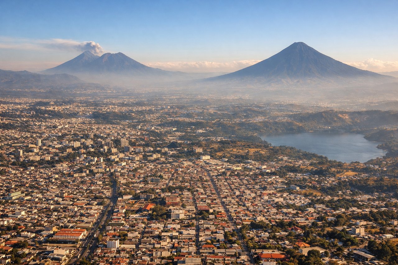
Landing at GUA
RIGHTRight side offers views of Guatemala's volcanic landscape and the approach to La Aurora airport. The descent path typically brings volcanic peaks and the Guatemala City basin into view. Left side faces the Pacific coastal plains with less dramatic terrain.
Will your flight be in sunlight?
Pick a date and time in the Sun Map to watch the sun move across your whole flight.
About This Route
Which side of the plane should I sit on flying from General Edward Lawrence Logan International (BOS) to La Aurora (GUA)?
Sit on the Left side of the plane for the best views on flights from Boston to Guatemala City. Left side scores higher due to the scenic Boston Harbor departure with Atlantic coastline visibility and the dramatic New England coast during climb-out. While the landing approach on the right offers volcanic views, the takeoff experience on the left—featuring one of North America's most distinctive harbors and coastal geography—provides more consistent visual interest across the full flight. The cruise segment over the Atlantic and Caribbean offers limited scenery on both sides, but the departure advantage tips the overall score leftward.
What can I see during takeoff from General Edward Lawrence Logan International in Boston?
During takeoff from General Edward Lawrence Logan International (BOS), sit on the Left side for the best views. Left side captures Boston Harbor, the Atlantic coastline, and the New England coast during climb-out. Right side faces inland toward flat Massachusetts terrain with minimal visual interest during departure. Notable sights include: Boston Harbor with islands, Atlantic coastline, Cape Cod peninsula (visible at distance during climb), New England forested terrain.
What can I see when landing at La Aurora in Guatemala City?
When landing at La Aurora (GUA), sit on the Right side for the best views. Right side offers views of Guatemala's volcanic landscape and the approach to La Aurora airport. The descent path typically brings volcanic peaks and the Guatemala City basin into view. Left side faces the Pacific coastal plains with less dramatic terrain. Notable sights include: Volcán de Agua, Volcán de Fuego, Guatemala City basin, Central American highlands.
How long is the flight from Boston to Guatemala City?
The flight from General Edward Lawrence Logan International (BOS) to La Aurora (GUA) takes about 5 hours 15 minutes. The shortest flight path between them is 2,244 miles (3,611 km); winds and air traffic control usually add a few percent.
What does the Boston to Guatemala City flight path pass over?
Atlantic Ocean (5+ hours of open water dominates cruise phase), Bahamas archipelago (visible if flight path passes near—typically not on direct routing), Caribbean Sea, Yucatan Peninsula (possible southern horizon view during descent phase), Central American coastline approaching Guatemala