The left side consistently tracks closer to the Atlantic coastline and its harbors, bays, and river mouths at both ends of the flight, while the right side offers only inland Piedmont and coastal-plain terrain with little variation.
Flown BOS to JAX? Did we get it right?
Flight Path
Boston to Jacksonville is 1,011 miles (1,626 km), a flight of about 2 hours 45 minutes.
The route's midpoint lies near the Chesapeake Bay–Outer Banks region of Virginia and North Carolina, where the flight path runs roughly parallel to the barrier islands and sounds of the mid-Atlantic coast before continuing south over the Carolina and Georgia lowlands toward Jacksonville.
Great circle distance and headings ›Phase by phase
Takeoff from BOS
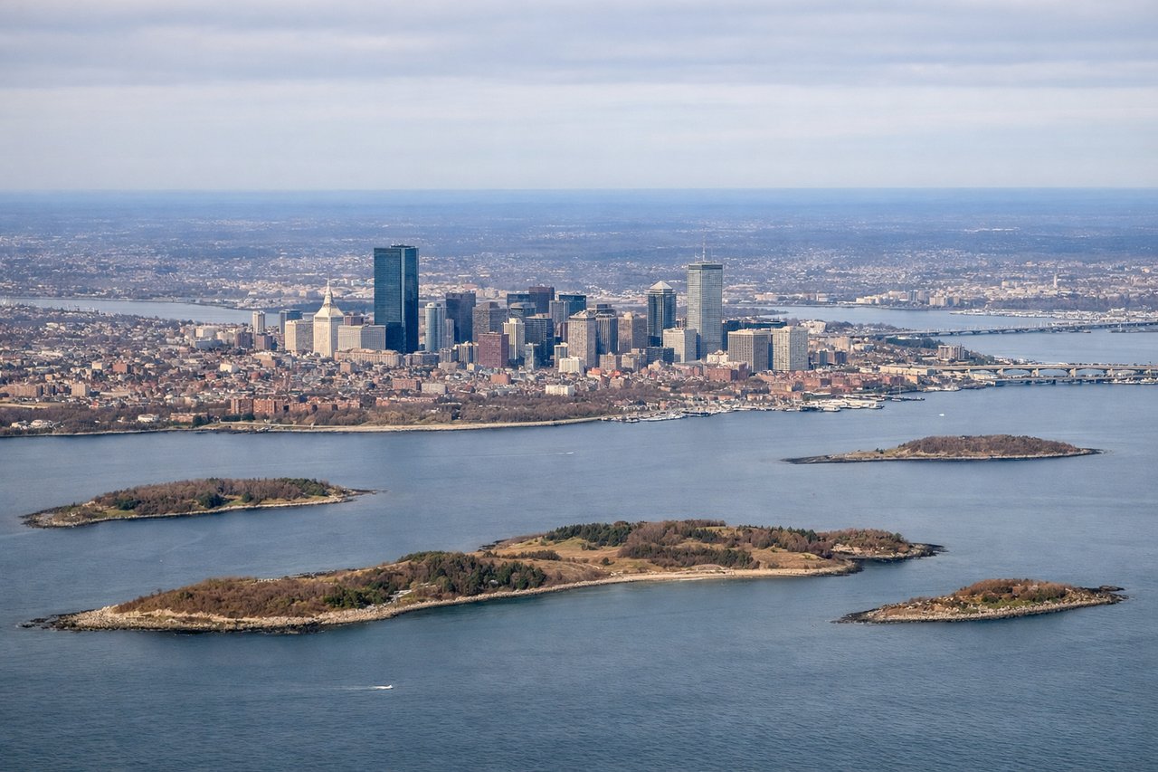
LEFTDeparting BOS toward the southwest on runway 22, the climb-out banks over South Boston, Quincy Bay, and the Boston Harbor Islands, giving left-side passengers a last look at the harbor and Atlantic shoreline before the route turns south. The right side shows only the flatter western suburbs.
Landing at JAX
LEFTOn approach into JAX, arrivals from the north typically swing over the St. Johns River and the coastal strip near Jacksonville Beach before turning onto final for runway 08/26, giving left-side views of the river mouth, barrier beaches, and downtown Jacksonville's skyline. The right side mostly shows inland pine flatwoods.
Will your flight be in sunlight?
Pick a date and time in the Sun Map to watch the sun move across your whole flight.
About This Route
Which side of the plane should I sit on flying from General Edward Lawrence Logan International (BOS) to Jacksonville International (JAX)?
Sit on the Left side of the plane for the best views on flights from Boston to Jacksonville. The left side consistently tracks closer to the Atlantic coastline and its harbors, bays, and river mouths at both ends of the flight, while the right side offers only inland Piedmont and coastal-plain terrain with little variation.
What can I see during takeoff from General Edward Lawrence Logan International in Boston?
During takeoff from General Edward Lawrence Logan International (BOS), sit on the Left side for the best views. Departing BOS toward the southwest on runway 22, the climb-out banks over South Boston, Quincy Bay, and the Boston Harbor Islands, giving left-side passengers a last look at the harbor and Atlantic shoreline before the route turns south. The right side shows only the flatter western suburbs. Notable sights include: Boston Harbor Islands, Quincy Bay, South Boston/Dorchester shoreline, Atlantic Ocean horizon.
What can I see when landing at Jacksonville International in Jacksonville?
When landing at Jacksonville International (JAX), sit on the Left side for the best views. On approach into JAX, arrivals from the north typically swing over the St. Johns River and the coastal strip near Jacksonville Beach before turning onto final for runway 08/26, giving left-side views of the river mouth, barrier beaches, and downtown Jacksonville's skyline. The right side mostly shows inland pine flatwoods. Notable sights include: St. Johns River mouth, Jacksonville Beach/Atlantic shoreline, downtown Jacksonville skyline, Mayport naval channel.
How long is the flight from Boston to Jacksonville?
The flight from General Edward Lawrence Logan International (BOS) to Jacksonville International (JAX) takes about 2 hours 45 minutes. The shortest flight path between them is 1,011 miles (1,626 km); winds and air traffic control usually add a few percent.
What does the Boston to Jacksonville flight path pass over?
The route's midpoint lies near the Chesapeake Bay–Outer Banks region of Virginia and North Carolina, where the flight path runs roughly parallel to the barrier islands and sounds of the mid-Atlantic coast before continuing south over the Carolina and Georgia lowlands toward Jacksonville.