Right side scores higher (3.5 vs 2.5) due to superior scenery on both takeoff and landing. Departure from Balikpapan's coastal harbor and the Makassar Strait provides maritime and urban interest, while the approach into Delhi over the Yamuna River's meanders and the Indo-Gangetic Plain's agricultural landscape offers distinctive geographical features and visual variety. Left side is dominated by featureless rainforest and flat plains with minimal landmark density.
Flown BPN to DEL? Did we get it right?
Flight Path
Balikpapan to Delhi is 3,343 miles (5,380 km), a flight of about 6 hours 50 minutes.
The flight path crosses the Bay of Bengal and the Indian subcontinent's western coast. Notable features include the Andaman Sea's open waters, the Irrawaddy Delta region of Myanmar (visible if route passes nearby), the Bay of Bengal's expanse, the Western Ghats mountain range along India's west coast (if visible during descent), and the transition from coastal regions to the Indo-Gangetic Plain as the aircraft approaches Delhi from the south or southeast.
Great circle distance and headings ›Phase by phase
Takeoff from BPN
RIGHTRight side captures Balikpapan's coastal harbor and the Makassar Strait during initial climb. The city's port facilities and nearby Penajam Peninsula are visible during the northeast departure turn, offering urban and maritime scenery. Left side departs over inland Kalimantan rainforest with minimal distinguishing features.
Landing at DEL
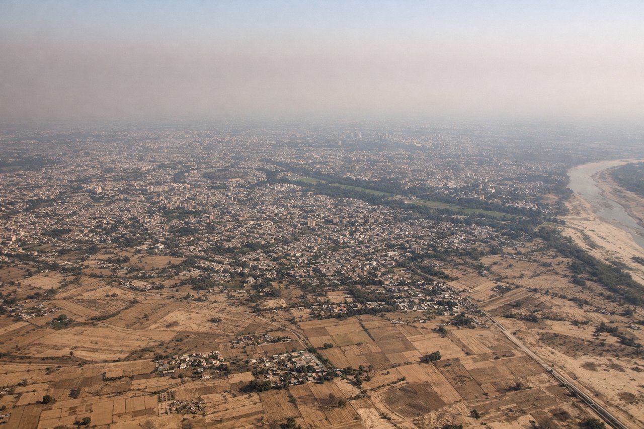
RIGHTRight side offers superior approach scenery into Delhi. The descent path over the Indo-Gangetic Plain reveals the Yamuna River's distinctive curves, agricultural patchwork, and the sprawling urban footprint of Delhi's southern and eastern districts. Left side approaches over flat, featureless plains with minimal visual interest.
Will your flight be in sunlight?
Pick a date and time in the Sun Map to watch the sun move across your whole flight.
About This Route
Which side of the plane should I sit on flying from Sultan Aji Muhammad Sulaiman Sepinggan International Airport (BPN) to Indira Gandhi International (DEL)?
Sit on the Right side of the plane for the best views on flights from Balikpapan to Delhi. Right side scores higher (3.5 vs 2.5) due to superior scenery on both takeoff and landing. Departure from Balikpapan's coastal harbor and the Makassar Strait provides maritime and urban interest, while the approach into Delhi over the Yamuna River's meanders and the Indo-Gangetic Plain's agricultural landscape offers distinctive geographical features and visual variety. Left side is dominated by featureless rainforest and flat plains with minimal landmark density.
What can I see during takeoff from Sultan Aji Muhammad Sulaiman Sepinggan International Airport in Balikpapan?
During takeoff from Sultan Aji Muhammad Sulaiman Sepinggan International Airport (BPN), sit on the Right side for the best views. Right side captures Balikpapan's coastal harbor and the Makassar Strait during initial climb. The city's port facilities and nearby Penajam Peninsula are visible during the northeast departure turn, offering urban and maritime scenery. Left side departs over inland Kalimantan rainforest with minimal distinguishing features. Notable sights include: Balikpapan harbor and port infrastructure, Makassar Strait coastline, Penajam Peninsula, oil and gas facilities along the coast.
What can I see when landing at Indira Gandhi International in Delhi?
When landing at Indira Gandhi International (DEL), sit on the Right side for the best views. Right side offers superior approach scenery into Delhi. The descent path over the Indo-Gangetic Plain reveals the Yamuna River's distinctive curves, agricultural patchwork, and the sprawling urban footprint of Delhi's southern and eastern districts. Left side approaches over flat, featureless plains with minimal visual interest. Notable sights include: Yamuna River with its characteristic meanders, Delhi's urban sprawl and city districts, agricultural fields of the Indo-Gangetic Plain, Indira Gandhi International Airport complex.
How long is the flight from Balikpapan to Delhi?
The flight from Sultan Aji Muhammad Sulaiman Sepinggan International Airport (BPN) to Indira Gandhi International (DEL) takes about 6 hours 50 minutes. The shortest flight path between them is 3,343 miles (5,380 km); winds and air traffic control usually add a few percent.
What does the Balikpapan to Delhi flight path pass over?
The flight path crosses the Bay of Bengal and the Indian subcontinent's western coast. Notable features include the Andaman Sea's open waters, the Irrawaddy Delta region of Myanmar (visible if route passes nearby), the Bay of Bengal's expanse, the Western Ghats mountain range along India's west coast (if visible during descent), and the transition from coastal regions to the Indo-Gangetic Plain as the aircraft approaches Delhi from the south or southeast.