The right side strings together a wider variety of dramatic scenery across the whole flight: the western Alps near Mont Blanc shortly after departure, Mediterranean islands like Corsica and Sardinia during the sea crossing, the open Sahara, and finally the Virunga volcanoes and Lake Kivu on arrival into Rwanda. The left side has strong moments too, particularly Lake Victoria and the snow-capped Rwenzori range, but these only appear near the very end of the journey.
Flown BRU to KGL? Did we get it right?
Flight Path
Brussels to Kigali is 3,953 miles (6,362 km), a flight of about 8 hours 25 minutes.
The flight's midpoint lies over the Libyan Sahara near Kufra Oasis, with vast open sand and gravel desert stretching to the horizon on both sides, occasionally broken by dry wadis and isolated rock outcrops.
Great circle distance and headings ›


Phase by phase
Takeoff from BRU
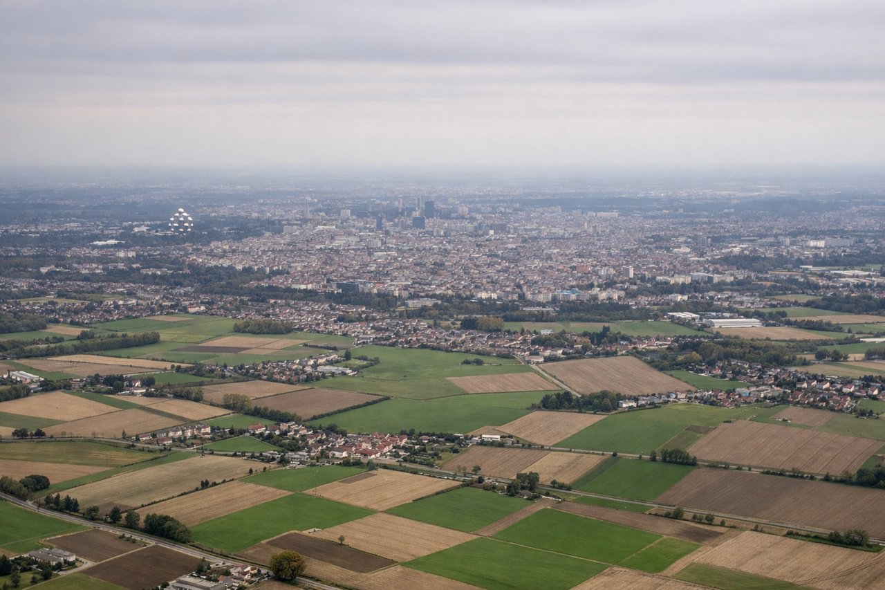
LEFTBrussels typically departs to the west on runway 25 and then banks left to pick up the southbound routing toward Africa, swinging the city directly under the left wing. Passengers on that side get a brief but clear look at Brussels' dense urban core and the green farmland beyond before the plane straightens onto its southerly track.
Landing at KGL
RIGHTOn approach into Kigali from the north, the final turn toward runway 28 brings the Virunga volcanic chain and Lake Kivu into view on the right side as the aircraft descends over Rwanda's hilly terrain. These dramatic volcanic peaks and the lake's steep shoreline give the right side a much stronger visual payoff than the flatter savanna typically seen on the left during this approach.
Will your flight be in sunlight?
Pick a date and time in the Sun Map to watch the sun move across your whole flight.
About This Route
Which side of the plane should I sit on flying from Brussels Natl (BRU) to Kigali International (KGL)?
Sit on the Right side of the plane for the best views on flights from Brussels to Kigali. The right side strings together a wider variety of dramatic scenery across the whole flight: the western Alps near Mont Blanc shortly after departure, Mediterranean islands like Corsica and Sardinia during the sea crossing, the open Sahara, and finally the Virunga volcanoes and Lake Kivu on arrival into Rwanda. The left side has strong moments too, particularly Lake Victoria and the snow-capped Rwenzori range, but these only appear near the very end of the journey.
What can I see during takeoff from Brussels Natl in Brussels?
During takeoff from Brussels Natl (BRU), sit on the Left side for the best views. Brussels typically departs to the west on runway 25 and then banks left to pick up the southbound routing toward Africa, swinging the city directly under the left wing. Passengers on that side get a brief but clear look at Brussels' dense urban core and the green farmland beyond before the plane straightens onto its southerly track. Notable sights include: Brussels city center and the Senne river corridor, EU Quarter rooftops, patchwork Belgian farmland, distant Atomium silhouette.
What can I see when landing at Kigali International in Kigali?
When landing at Kigali International (KGL), sit on the Right side for the best views. On approach into Kigali from the north, the final turn toward runway 28 brings the Virunga volcanic chain and Lake Kivu into view on the right side as the aircraft descends over Rwanda's hilly terrain. These dramatic volcanic peaks and the lake's steep shoreline give the right side a much stronger visual payoff than the flatter savanna typically seen on the left during this approach. Notable sights include: Lake Kivu, Virunga volcanic peaks (Karisimbi, Bisoke, Nyiragongo), Rwanda's terraced green hills, Kigali's hilltop skyline.
How long is the flight from Brussels to Kigali?
The flight from Brussels Natl (BRU) to Kigali International (KGL) takes about 8 hours 25 minutes. The shortest flight path between them is 3,953 miles (6,362 km); winds and air traffic control usually add a few percent.
What does the Brussels to Kigali flight path pass over?
The flight's midpoint lies over the Libyan Sahara near Kufra Oasis, with vast open sand and gravel desert stretching to the horizon on both sides, occasionally broken by dry wadis and isolated rock outcrops.