The left side scores higher due to the dramatic Tian Shan mountain scenery during takeoff from Manas, which provides significant visual variety and landmark density. While Beijing's landing approach on the right side is notable, the majority of the flight crosses monotonous steppe and plains on both sides. The Tian Shan departure gives the left side a decisive advantage for overall scenic value across the full flight duration.
Flight Path
Dzungarian Basin (flat, arid), Altai Mountains (distant, far north), Gobi Desert transition zone, Yanqing District foothills approaching Beijing
Great circle distance and headings ›


Phase by phase
Takeoff from BSZ
LEFTLeft side captures the Tian Shan mountain range immediately after departure from Manas, with dramatic peaks and valleys visible during climb-out. Right side shows flat steppe terrain with minimal visual interest.
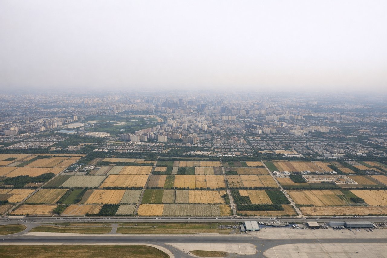
Landing at PEK
RIGHTRight side offers the approach into Beijing Capital International Airport with views of the North China Plain, urban sprawl, and the city's distinctive grid layout. Left side shows only flat, hazy plains with minimal landmark definition during descent.
Landmarks on this routeAll landmarks →
Will your flight be in sunlight?
See exactly which side of the plane gets sun and shade at your departure time.
About This Route
Which side of the plane should I sit on flying from Manas International Airport (BSZ) to Capital (PEK)?
Sit on the Left side of the plane for the best views on flights from Bishkek to Beijing. The left side scores higher due to the dramatic Tian Shan mountain scenery during takeoff from Manas, which provides significant visual variety and landmark density. While Beijing's landing approach on the right side is notable, the majority of the flight crosses monotonous steppe and plains on both sides. The Tian Shan departure gives the left side a decisive advantage for overall scenic value across the full flight duration.
What can I see during takeoff from Manas International Airport in Bishkek?
During takeoff from Manas International Airport (BSZ), sit on the Left side for the best views. Left side captures the Tian Shan mountain range immediately after departure from Manas, with dramatic peaks and valleys visible during climb-out. Right side shows flat steppe terrain with minimal visual interest. Notable sights include: Tian Shan peaks (Chon Kemin range), Chu River valley, Bishkek urban sprawl fading into agricultural plains.
What can I see when landing at Capital in Beijing?
When landing at Capital (PEK), sit on the Right side for the best views. Right side offers the approach into Beijing Capital International Airport with views of the North China Plain, urban sprawl, and the city's distinctive grid layout. Left side shows only flat, hazy plains with minimal landmark definition during descent. Notable sights include: Beijing urban grid and high-rise districts, North China Plain agricultural fields, Ming Tombs region (northwest of city), Yanqing District foothills.
How long is the flight from Bishkek to Beijing?
The flight from Manas International Airport (BSZ) to Capital (PEK) takes 3h 15m.
What does the Bishkek to Beijing flight path pass over?
Dzungarian Basin (flat, arid), Altai Mountains (distant, far north), Gobi Desert transition zone, Yanqing District foothills approaching Beijing