While takeoff favors the right side with island and strait views, the left side offers a stronger overall experience thanks to the Jakarta skyline and Thousand Islands visible during the landing sequence, adding urban scenery that the right side lacks.
Flight Path
Cruise passes over the Karimata Strait and the Java Sea, with the Bangka-Belitung island group visible off to the east before the descent toward Jakarta's coast.
Great circle distance and headings ›Phase by phase
Takeoff from BTH
RIGHTDeparting BTH on runway 22, the climb-out heads southwest over the Riau Archipelago, giving right-side passengers views of Batam's coastline, the Singapore Strait shipping lanes, and glimpses of eastern Sumatra's low coastal plain in the distance.
Landing at CGK
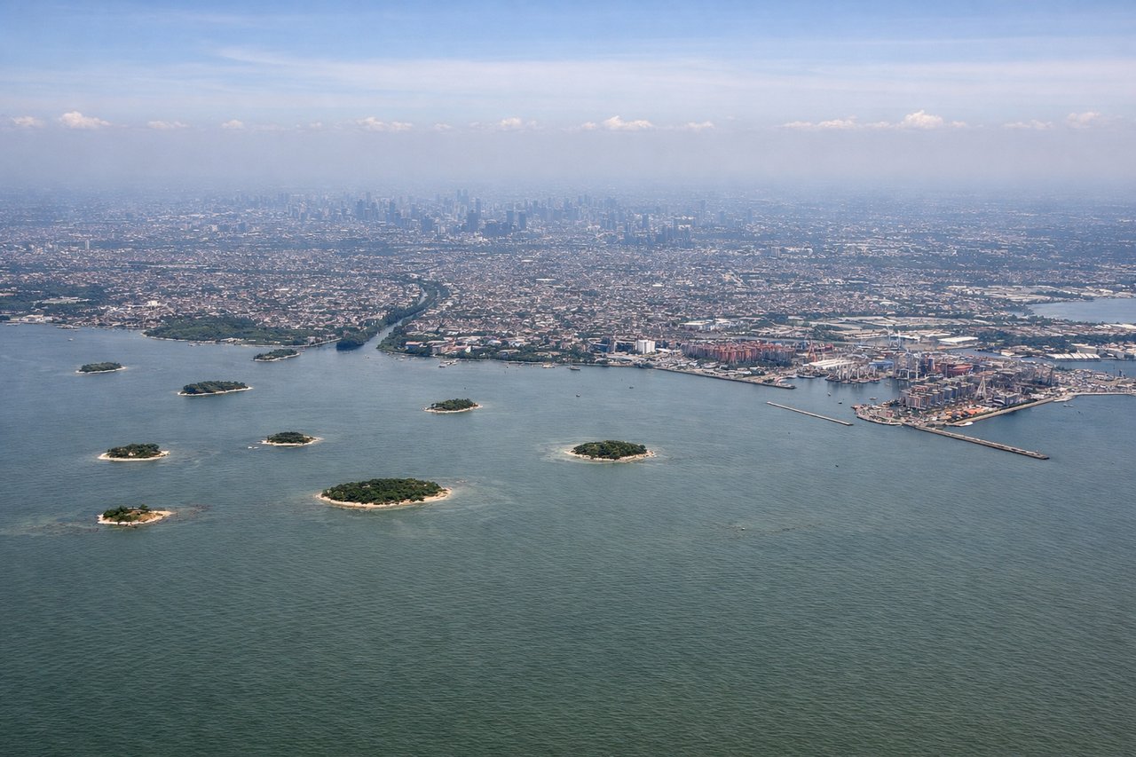
LEFTOn approach into CGK, the final turn typically brings the aircraft in from the north over the Java Sea, and if landing westbound on runway 25, the left side faces south toward Jakarta's dense skyline and the Kepulauan Seribu islands can be seen scattered in the sea behind.
Landmarks on this routeAll landmarks →
Will your flight be in sunlight?
See exactly which side of the plane gets sun and shade at your departure time.
About This Route
Which side of the plane should I sit on flying from Hang Nadim International Airport (BTH) to Soekarno Hatta International (CGK)?
Sit on the Left side of the plane for the best views on flights from Batam to Jakarta. While takeoff favors the right side with island and strait views, the left side offers a stronger overall experience thanks to the Jakarta skyline and Thousand Islands visible during the landing sequence, adding urban scenery that the right side lacks.
What can I see during takeoff from Hang Nadim International Airport in Batam?
During takeoff from Hang Nadim International Airport (BTH), sit on the Right side for the best views. Departing BTH on runway 22, the climb-out heads southwest over the Riau Archipelago, giving right-side passengers views of Batam's coastline, the Singapore Strait shipping lanes, and glimpses of eastern Sumatra's low coastal plain in the distance. Notable sights include: Batam coastline, Singapore Strait, Riau Archipelago islands, distant Sumatra coast.
What can I see when landing at Soekarno Hatta International in Jakarta?
When landing at Soekarno Hatta International (CGK), sit on the Left side for the best views. On approach into CGK, the final turn typically brings the aircraft in from the north over the Java Sea, and if landing westbound on runway 25, the left side faces south toward Jakarta's dense skyline and the Kepulauan Seribu islands can be seen scattered in the sea behind. Notable sights include: Jakarta city skyline, Kepulauan Seribu (Thousand Islands), Java Sea coastline, Jakarta Bay.
How long is the flight from Batam to Jakarta?
The flight from Hang Nadim International Airport (BTH) to Soekarno Hatta International (CGK) takes 1h 25m.
What does the Batam to Jakarta flight path pass over?
Cruise passes over the Karimata Strait and the Java Sea, with the Bangka-Belitung island group visible off to the east before the descent toward Jakarta's coast.