While left side wins at takeoff for the Mississippi River views, the right side delivers the more spectacular and sustained scenery: the Texas Hill Country, New Mexico desert terrain, Arizona's Sonoran Desert, and the dramatic LAX ocean approach over Santa Monica Bay all favor the right side for most of the flight.
Flown BTR to LAX? Did we get it right?
Flight Path
Baton Rouge to Los Angeles is 1,606 miles (2,584 km), a flight of about 4 hours.
The flight tracks west-northwest over the Texas Hill Country and Edwards Plateau, then crosses the Chihuahuan Desert of New Mexico near Las Cruces, passes over southern Arizona's Sonoran Desert and the Tucson Basin, crosses the Colorado Desert of southern California, and descends over the Los Angeles Basin. The Rio Grande valley near El Paso and the rugged Organ Mountains of New Mexico are notable midpoint features visible from altitude.
Great circle distance and headings ›


Phase by phase
Takeoff from BTR
LEFTBTR's primary departure runway 13 sends aircraft southeast before turning west-northwest. Left side captures the Mississippi River's wide bend through Baton Rouge, the downtown skyline, and the industrial corridor along the river. Right side faces mostly flat suburban sprawl.
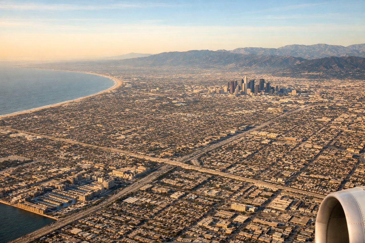
Landing at LAX
RIGHTLAX's primary arrival runways 24L/24R bring aircraft in from the east over the Los Angeles Basin. The right side faces south, giving clear views of the Santa Monica Bay coastline, Palos Verdes Peninsula, and the Pacific Ocean as you descend over the city. Left side looks north toward the San Fernando Valley and Santa Monica Mountains but misses the dramatic ocean approach.
Will your flight be in sunlight?
Pick a date and time in the Sun Map to watch the sun move across your whole flight.
About This Route
Which side of the plane should I sit on flying from Baton Rouge Metro Ryan Fld (BTR) to Los Angeles International (LAX)?
Sit on the Right side of the plane for the best views on flights from Baton Rouge to Los Angeles. While left side wins at takeoff for the Mississippi River views, the right side delivers the more spectacular and sustained scenery: the Texas Hill Country, New Mexico desert terrain, Arizona's Sonoran Desert, and the dramatic LAX ocean approach over Santa Monica Bay all favor the right side for most of the flight.
What can I see during takeoff from Baton Rouge Metro Ryan Fld in Baton Rouge?
During takeoff from Baton Rouge Metro Ryan Fld (BTR), sit on the Left side for the best views. BTR's primary departure runway 13 sends aircraft southeast before turning west-northwest. Left side captures the Mississippi River's wide bend through Baton Rouge, the downtown skyline, and the industrial corridor along the river. Right side faces mostly flat suburban sprawl. Notable sights include: Mississippi River bend at Baton Rouge, downtown Baton Rouge skyline, Atchafalaya Basin wetlands to the northwest, Port Allen industrial waterfront.
What can I see when landing at Los Angeles International in Los Angeles?
When landing at Los Angeles International (LAX), sit on the Right side for the best views. LAX's primary arrival runways 24L/24R bring aircraft in from the east over the Los Angeles Basin. The right side faces south, giving clear views of the Santa Monica Bay coastline, Palos Verdes Peninsula, and the Pacific Ocean as you descend over the city. Left side looks north toward the San Fernando Valley and Santa Monica Mountains but misses the dramatic ocean approach. Notable sights include: Santa Monica Bay and Pacific Ocean coastline, Palos Verdes Peninsula, Los Angeles Basin urban grid, Marina del Rey harbor.
How long is the flight from Baton Rouge to Los Angeles?
The flight from Baton Rouge Metro Ryan Fld (BTR) to Los Angeles International (LAX) takes about 4 hours. The shortest flight path between them is 1,606 miles (2,584 km); winds and air traffic control usually add a few percent.
What does the Baton Rouge to Los Angeles flight path pass over?
The flight tracks west-northwest over the Texas Hill Country and Edwards Plateau, then crosses the Chihuahuan Desert of New Mexico near Las Cruces, passes over southern Arizona's Sonoran Desert and the Tucson Basin, crosses the Colorado Desert of southern California, and descends over the Los Angeles Basin. The Rio Grande valley near El Paso and the rugged Organ Mountains of New Mexico are notable midpoint features visible from altitude.