The takeoff views from the right side—Chesapeake Bay and its estuaries—offer more dramatic and extended scenic value than the landing approach. The Bay's scale and the intricate river system are visually striking during climb-out.
Flown BWI to CHS? Did we get it right?
Flight Path
Baltimore to Charleston is 473 miles (761 km), a flight of about 1 hour 45 minutes.
The flight path crosses the Appalachian foothills and Piedmont region. Notable features include the Shenandoah Valley (visible to the left/west during cruise), the Blue Ridge Mountains as a distant ridge on the western horizon, and the Roanoke area in southwestern Virginia. The Neuse River and coastal plains of North Carolina become visible in the final descent phase.
Great circle distance and headings ›Phase by phase
Takeoff from BWI
RIGHTRight-side seats offer views of the Patapsco River estuary and Chesapeake Bay as the aircraft climbs southwestward out of BWI. The water features are distinctive and visible within the first 10-15 minutes of flight.
Landing at CHS
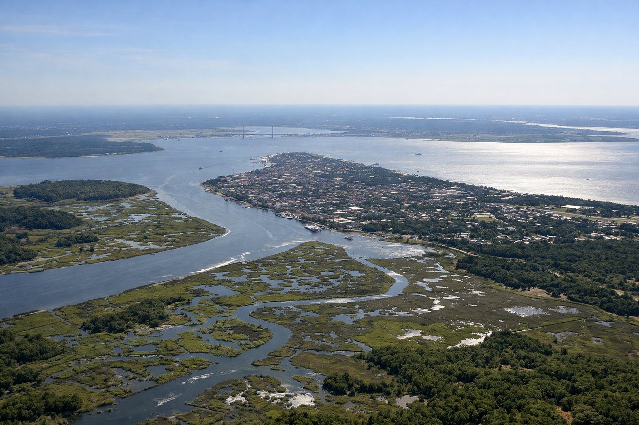
LEFTLeft-side seats provide clear views of the Ashley River, Cooper River confluence, and Charleston Harbor during the descent approach from the north. These water features frame the city and are visually prominent in the final 15-20 minutes before touchdown.
Will your flight be in sunlight?
Pick a date and time in the Sun Map to watch the sun move across your whole flight.
About This Route
Which side of the plane should I sit on flying from Baltimore Washington International (BWI) to Charleston Afb International (CHS)?
Sit on the Right side of the plane for the best views on flights from Baltimore to Charleston. The takeoff views from the right side—Chesapeake Bay and its estuaries—offer more dramatic and extended scenic value than the landing approach. The Bay's scale and the intricate river system are visually striking during climb-out.
What can I see during takeoff from Baltimore Washington International in Baltimore?
During takeoff from Baltimore Washington International (BWI), sit on the Right side for the best views. Right-side seats offer views of the Patapsco River estuary and Chesapeake Bay as the aircraft climbs southwestward out of BWI. The water features are distinctive and visible within the first 10-15 minutes of flight. Notable sights include: Patapsco River estuary, Chesapeake Bay, Baltimore Harbor, Patuxent River.
What can I see when landing at Charleston Afb International in Charleston?
When landing at Charleston Afb International (CHS), sit on the Left side for the best views. Left-side seats provide clear views of the Ashley River, Cooper River confluence, and Charleston Harbor during the descent approach from the north. These water features frame the city and are visually prominent in the final 15-20 minutes before touchdown. Notable sights include: Ashley River, Cooper River, Charleston Harbor, Charleston peninsula and downtown district.
How long is the flight from Baltimore to Charleston?
The flight from Baltimore Washington International (BWI) to Charleston Afb International (CHS) takes about 1 hour 45 minutes. The shortest flight path between them is 473 miles (761 km); winds and air traffic control usually add a few percent.
What does the Baltimore to Charleston flight path pass over?
The flight path crosses the Appalachian foothills and Piedmont region. Notable features include the Shenandoah Valley (visible to the left/west during cruise), the Blue Ridge Mountains as a distant ridge on the western horizon, and the Roanoke area in southwestern Virginia. The Neuse River and coastal plains of North Carolina become visible in the final descent phase.