Takeoff from BWI offers more compelling scenery with the Chesapeake Bay estuary and Baltimore Harbor. While the Cincinnati approach provides decent views of the Little Miami River and city, the BWI departure is more visually distinctive and geographically dramatic.
Flown BWI to CVG? Did we get it right?
Flight Path
Baltimore to Cincinnati is 429 miles (690 km), a flight of about 1 hour 15 minutes.
The flight path crosses the Appalachian foothills of West Virginia and eastern Kentucky. Notable features include the New River Gorge region (visible as a deep valley system in central West Virginia), the Kanawha River valley, and the transition from the Appalachian plateau to the Ohio River basin. The terrain becomes increasingly rolling and forested as you approach Cincinnati from the northeast.
Great circle distance and headings ›Phase by phase
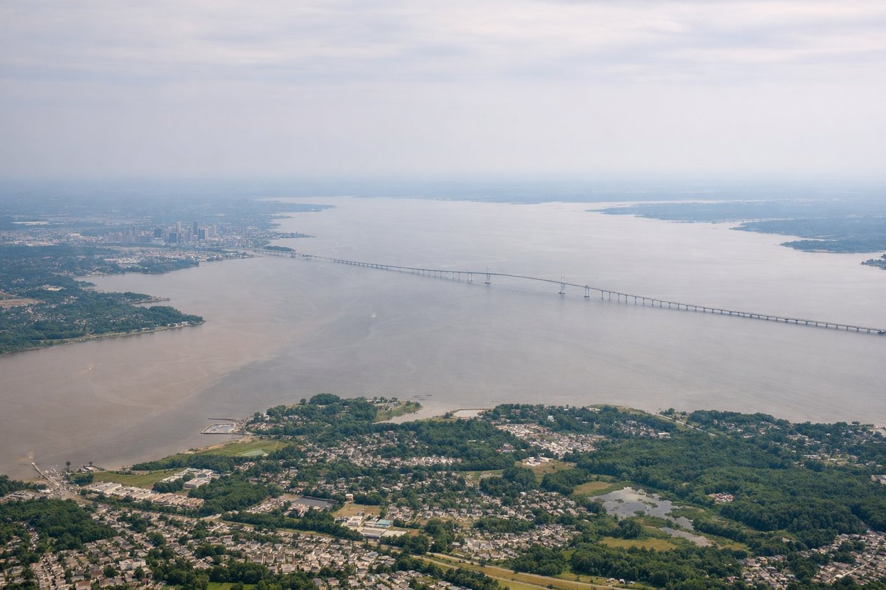
Takeoff from BWI
LEFTLeft side offers views of the Patapsco River estuary and Baltimore Harbor as you climb out over the Chesapeake Bay region. Right side faces inland toward less distinctive terrain.
Landing at CVG
RIGHTRight side provides views of the Little Miami River valley and the Cincinnati metropolitan area as you descend into CVG. The river's distinctive meandering path and surrounding green space are clearly visible during approach.
Will your flight be in sunlight?
Pick a date and time in the Sun Map to watch the sun move across your whole flight.
About This Route
Which side of the plane should I sit on flying from Baltimore Washington International (BWI) to Cincinnati Northern Kentucky International (CVG)?
Sit on the Left side of the plane for the best views on flights from Baltimore to Cincinnati. Takeoff from BWI offers more compelling scenery with the Chesapeake Bay estuary and Baltimore Harbor. While the Cincinnati approach provides decent views of the Little Miami River and city, the BWI departure is more visually distinctive and geographically dramatic.
What can I see during takeoff from Baltimore Washington International in Baltimore?
During takeoff from Baltimore Washington International (BWI), sit on the Left side for the best views. Left side offers views of the Patapsco River estuary and Baltimore Harbor as you climb out over the Chesapeake Bay region. Right side faces inland toward less distinctive terrain. Notable sights include: Patapsco River estuary, Chesapeake Bay (distant), Baltimore Harbor and Inner Harbor, Patuxent River to the south.
What can I see when landing at Cincinnati Northern Kentucky International in Cincinnati?
When landing at Cincinnati Northern Kentucky International (CVG), sit on the Right side for the best views. Right side provides views of the Little Miami River valley and the Cincinnati metropolitan area as you descend into CVG. The river's distinctive meandering path and surrounding green space are clearly visible during approach. Notable sights include: Little Miami River (meandering valley), Cincinnati skyline and downtown district, Ohio River (distant), surrounding forested hills of southwestern Ohio.
How long is the flight from Baltimore to Cincinnati?
The flight from Baltimore Washington International (BWI) to Cincinnati Northern Kentucky International (CVG) takes about 1 hour 15 minutes. The shortest flight path between them is 429 miles (690 km); winds and air traffic control usually add a few percent.
What does the Baltimore to Cincinnati flight path pass over?
The flight path crosses the Appalachian foothills of West Virginia and eastern Kentucky. Notable features include the New River Gorge region (visible as a deep valley system in central West Virginia), the Kanawha River valley, and the transition from the Appalachian plateau to the Ohio River basin. The terrain becomes increasingly rolling and forested as you approach Cincinnati from the northeast.