While takeoff offers Chesapeake Bay views on the right, the landing approach on the left provides more dramatic and varied scenery—the Andes Mountains, Gulf of Guayaquil, and extensive mangrove delta system make for a more visually compelling final descent.
Flight Path
The flight path crosses the Gulf of Mexico (visible as open water for roughly 2-3 hours of flight), the Yucatan Peninsula's northern coast, Central America's Caribbean coastline, and the northern coast of South America including the Caribbean Sea. The Andes Mountains become visible on the eastern horizon during the final descent phase into Ecuador.
Great circle distance and headings ›.jpeg?width=600)


Phase by phase
Takeoff from BWI
RIGHTRight-side seats offer views of the Chesapeake Bay and its tributaries during the initial climb-out from BWI. The bay's distinctive shape and surrounding marshlands are clearly visible within the first 10-15 minutes of flight.
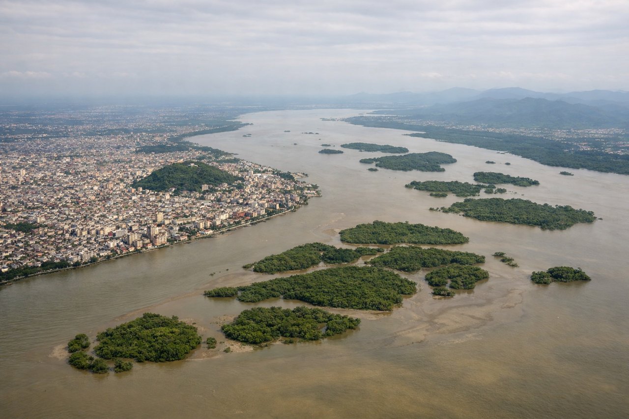
Landing at GYE
LEFTLeft-side seats provide excellent views during the descent into Guayaquil. You'll see the Andes Mountains rising inland to the east, and the Pacific coastline with the Gulf of Guayaquil's estuaries and mangrove forests as you approach from the west.
Landmarks on this routeAll landmarks →
Will your flight be in sunlight?
See exactly which side of the plane gets sun and shade at your departure time.
About This Route
Which side of the plane should I sit on flying from Baltimore Washington International (BWI) to Simon Bolivar International (GYE)?
Sit on the Left side of the plane for the best views on flights from Baltimore to Guayaquil. While takeoff offers Chesapeake Bay views on the right, the landing approach on the left provides more dramatic and varied scenery—the Andes Mountains, Gulf of Guayaquil, and extensive mangrove delta system make for a more visually compelling final descent.
What can I see during takeoff from Baltimore Washington International in Baltimore?
During takeoff from Baltimore Washington International (BWI), sit on the Right side for the best views. Right-side seats offer views of the Chesapeake Bay and its tributaries during the initial climb-out from BWI. The bay's distinctive shape and surrounding marshlands are clearly visible within the first 10-15 minutes of flight. Notable sights include: Chesapeake Bay, Patapsco River estuary, Baltimore Harbor, Potomac River valley.
What can I see when landing at Simon Bolivar International in Guayaquil?
When landing at Simon Bolivar International (GYE), sit on the Left side for the best views. Left-side seats provide excellent views during the descent into Guayaquil. You'll see the Andes Mountains rising inland to the east, and the Pacific coastline with the Gulf of Guayaquil's estuaries and mangrove forests as you approach from the west. Notable sights include: Andes Mountains (distant), Gulf of Guayaquil, Guayas River delta and mangrove forests, Pacific coastline.
How long is the flight from Baltimore to Guayaquil?
The flight from Baltimore Washington International (BWI) to Simon Bolivar International (GYE) takes 5h 20m.
What does the Baltimore to Guayaquil flight path pass over?
The flight path crosses the Gulf of Mexico (visible as open water for roughly 2-3 hours of flight), the Yucatan Peninsula's northern coast, Central America's Caribbean coastline, and the northern coast of South America including the Caribbean Sea. The Andes Mountains become visible on the eastern horizon during the final descent phase into Ecuador.