While the BWI departure offers urban harbor scenery, the SIG landing provides superior scenic value with the dramatic approach over San Juan Bay and the Caribbean coastline. The full flight path crosses 5+ hours of open Atlantic Ocean (scoring max 2.0 for that segment), but the landing sequence on the right side delivers distinctive tropical island and urban waterfront views that outweigh the modest Baltimore departure advantage. Right side scores 3.5 overall; left side 2.5.
Flown BWI to SIG? Did we get it right?
Flight Path
Baltimore to San Juan is 1,565 miles (2,519 km), a flight of about 4 hours 15 minutes.
The flight path crosses the Atlantic Ocean for approximately 4 hours. Notable geographic features along the route include: the continental shelf edge southeast of the Carolinas (visible only on lower-altitude segments), the Gulf Stream's warm-water corridor (not visually distinctive from altitude), and the approach to Puerto Rico's northern coast with the Atlantic meeting the Caribbean. No major mountain ranges, islands, or dramatic terrain features are visible during the cruise phase over open ocean. The Bahamas and Turks and Caicos Islands lie south of the typical flight corridor and are not usually visible. Passengers should expect extended periods of open ocean with minimal landmark variation during cruise.
Great circle distance and headings ›Phase by phase
Takeoff from BWI
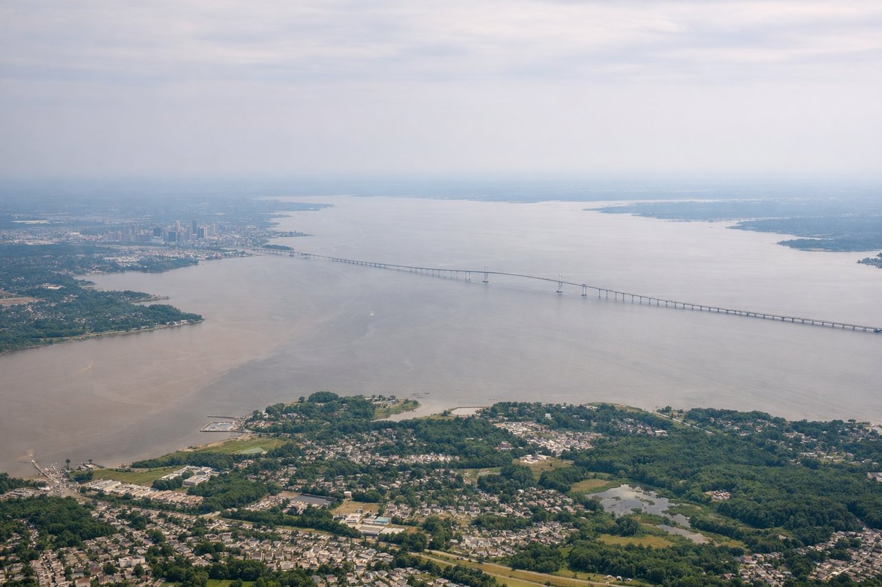
LEFTBWI's primary runway 10/28 typically uses runway 28 for eastbound departures (prevailing westerlies). Left-side passengers see the Patapsco River estuary, Baltimore Harbor, and the city skyline during initial climb before turning southeast over Chesapeake Bay.
Landing at SIG
RIGHTSIG uses runway 09 (eastbound) for most operations due to prevailing trade winds. Right-side passengers descending from the northwest see the dramatic approach over San Juan Bay, the city of San Juan spreading across the coastal plain, and the transition from open Atlantic to the island's developed northern coast.
Will your flight be in sunlight?
Pick a date and time in the Sun Map to watch the sun move across your whole flight.
About This Route
Which side of the plane should I sit on flying from Baltimore Washington International (BWI) to Fernando Luis Ribas Dominicci (SIG)?
Sit on the Right side of the plane for the best views on flights from Baltimore to San Juan. While the BWI departure offers urban harbor scenery, the SIG landing provides superior scenic value with the dramatic approach over San Juan Bay and the Caribbean coastline. The full flight path crosses 5+ hours of open Atlantic Ocean (scoring max 2.0 for that segment), but the landing sequence on the right side delivers distinctive tropical island and urban waterfront views that outweigh the modest Baltimore departure advantage. Right side scores 3.5 overall; left side 2.5.
What can I see during takeoff from Baltimore Washington International in Baltimore?
During takeoff from Baltimore Washington International (BWI), sit on the Left side for the best views. BWI's primary runway 10/28 typically uses runway 28 for eastbound departures (prevailing westerlies). Left-side passengers see the Patapsco River estuary, Baltimore Harbor, and the city skyline during initial climb before turning southeast over Chesapeake Bay. Notable sights include: Baltimore Harbor and Inner Harbor, Patapsco River estuary, Chesapeake Bay, downtown Baltimore skyline.
What can I see when landing at Fernando Luis Ribas Dominicci in San Juan?
When landing at Fernando Luis Ribas Dominicci (SIG), sit on the Right side for the best views. SIG uses runway 09 (eastbound) for most operations due to prevailing trade winds. Right-side passengers descending from the northwest see the dramatic approach over San Juan Bay, the city of San Juan spreading across the coastal plain, and the transition from open Atlantic to the island's developed northern coast. Notable sights include: San Juan Bay, San Juan city and Old San Juan district, Atlantic Ocean, Puerto Rico's northern coastline.
How long is the flight from Baltimore to San Juan?
The flight from Baltimore Washington International (BWI) to Fernando Luis Ribas Dominicci (SIG) takes about 4 hours 15 minutes. The shortest flight path between them is 1,565 miles (2,519 km); winds and air traffic control usually add a few percent.
What does the Baltimore to San Juan flight path pass over?
The flight path crosses the Atlantic Ocean for approximately 4 hours. Notable geographic features along the route include: the continental shelf edge southeast of the Carolinas (visible only on lower-altitude segments), the Gulf Stream's warm-water corridor (not visually distinctive from altitude), and the approach to Puerto Rico's northern coast with the Atlantic meeting the Caribbean. No major mountain ranges, islands, or dramatic terrain features are visible during the cruise phase over open ocean. The Bahamas and Turks and Caicos Islands lie south of the typical flight corridor and are not usually visible. Passengers should expect extended periods of open ocean with minimal landmark variation during cruise.