Calcutta to Jorhat is 457 miles (735 km), a flight of about 1 hour 15 minutes.
While takeoff offers river views, the landing approach provides more dramatic and extended scenery—the Brahmaputra River's scale and the distinctive tea garden landscape of Assam are more visually striking than Kolkata's urban sprawl. Left-side seats capture the best of the descent.
Flight Path
The flight path crosses the Ganges Delta's eastern edge, then transitions over rural West Bengal and Jharkhand before entering Assam. Notable midpoint features include the Damodar River valley (visible around 30 minutes into flight), the transition from the Indo-Gangetic Plain to the Assam plateau, and scattered tea gardens beginning to appear as you approach Assam. The Brahmaputra River becomes visible approximately 20 minutes before landing, initially as a narrow ribbon that widens dramatically as you descend toward Jorhat.
Great circle distance and headings ›Phase by phase
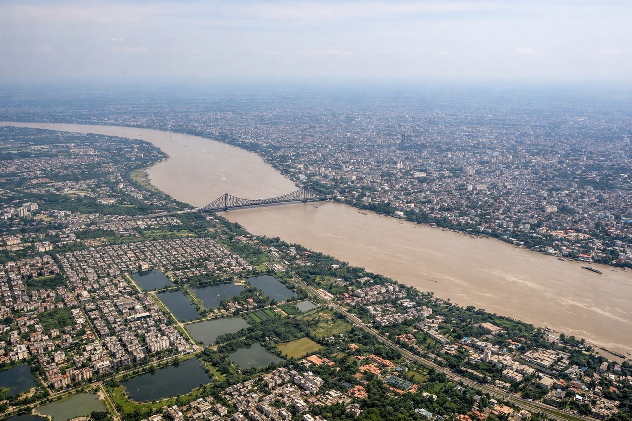
Takeoff from CCU
RIGHTRight-side seats offer views of the Hooghly River as it winds through Kolkata's industrial and urban landscape during the northeastward climb. You'll see the river's distinctive curves and the city's eastern sprawl receding below.
Landing at JRH
LEFTLeft-side seats provide excellent views of the Brahmaputra River's broad valley and the surrounding Assam plains during descent into Jorhat. The river's massive width and the tea gardens of upper Assam become increasingly visible as you descend.
Landmarks on this routeAll landmarks →
Will your flight be in sunlight?
Pick a date and time in the Sun Map to watch the sun move across your whole flight.
About This Route
Which side of the plane should I sit on flying from Netaji Subhash Chandra Bose International (CCU) to Jorhat (JRH)?
Sit on the Left side of the plane for the best views on flights from Calcutta to Jorhat. While takeoff offers river views, the landing approach provides more dramatic and extended scenery—the Brahmaputra River's scale and the distinctive tea garden landscape of Assam are more visually striking than Kolkata's urban sprawl. Left-side seats capture the best of the descent.
What can I see during takeoff from Netaji Subhash Chandra Bose International in Calcutta?
During takeoff from Netaji Subhash Chandra Bose International (CCU), sit on the Right side for the best views. Right-side seats offer views of the Hooghly River as it winds through Kolkata's industrial and urban landscape during the northeastward climb. You'll see the river's distinctive curves and the city's eastern sprawl receding below. Notable sights include: Hooghly River (main channel through Kolkata), Kolkata's eastern industrial belt, Sundarbans mangrove forest edge (distant, to the south), Darjeeling Himalayan foothills (far horizon to the north).
What can I see when landing at Jorhat in Jorhat?
When landing at Jorhat (JRH), sit on the Left side for the best views. Left-side seats provide excellent views of the Brahmaputra River's broad valley and the surrounding Assam plains during descent into Jorhat. The river's massive width and the tea gardens of upper Assam become increasingly visible as you descend. Notable sights include: Brahmaputra River (wide, meandering channel), Assam tea gardens (visible as organized plantation patterns), Jorhat town and airfield, Nagaland hills (distant, to the northeast).
How long is the flight from Calcutta to Jorhat?
The flight from Netaji Subhash Chandra Bose International (CCU) to Jorhat (JRH) takes about 1 hour 15 minutes. The shortest flight path between them is 457 miles (735 km); winds and air traffic control usually add a few percent.
What does the Calcutta to Jorhat flight path pass over?
The flight path crosses the Ganges Delta's eastern edge, then transitions over rural West Bengal and Jharkhand before entering Assam. Notable midpoint features include the Damodar River valley (visible around 30 minutes into flight), the transition from the Indo-Gangetic Plain to the Assam plateau, and scattered tea gardens beginning to appear as you approach Assam. The Brahmaputra River becomes visible approximately 20 minutes before landing, initially as a narrow ribbon that widens dramatically as you descend toward Jorhat.