Campo Grande to Sao Paulo is 564 miles (908 km), a flight of about 1 hour 15 minutes.
While both sides score equally at 2.0 due to the short flight duration (1h 15m) over relatively flat-to-gently-rolling terrain with limited dramatic features, the right side edges ahead for the landing sequence. The approach to São Paulo offers genuine urban scenery (the metropolitan area and industrial zones) plus the Serra da Cantareira mountains, which provide the only significant topographic feature on this route. The left side during takeoff has marginal advantage but is outweighed by the right side's landing experience.
Flight Path
The flight path crosses the Planalto Central plateau at cruise altitude (approximately 25,000-28,000 feet), passing over central São Paulo state. Notable features include the Paraná River basin to the west (not directly visible but defines the regional hydrology), scattered cerrado and agricultural transition zones, and the gradual approach to the Atlantic coastal plateau's eastern edge. The Serra da Cantareira becomes visible approximately 30 minutes before landing. No major rivers, canyons, or dramatic terrain features are encountered at cruise altitude on this route.
Great circle distance and headings ›Phase by phase
Takeoff from CGR
LEFTCampo Grande sits on a plateau with gentle rolling terrain to the west and south. The left (west/southwest) side offers slightly more topographic variation as the aircraft climbs out over the Planalto Central, with subtle elevation changes and scattered vegetation patterns visible. The right side faces relatively flat agricultural plains.
Landing at GRU
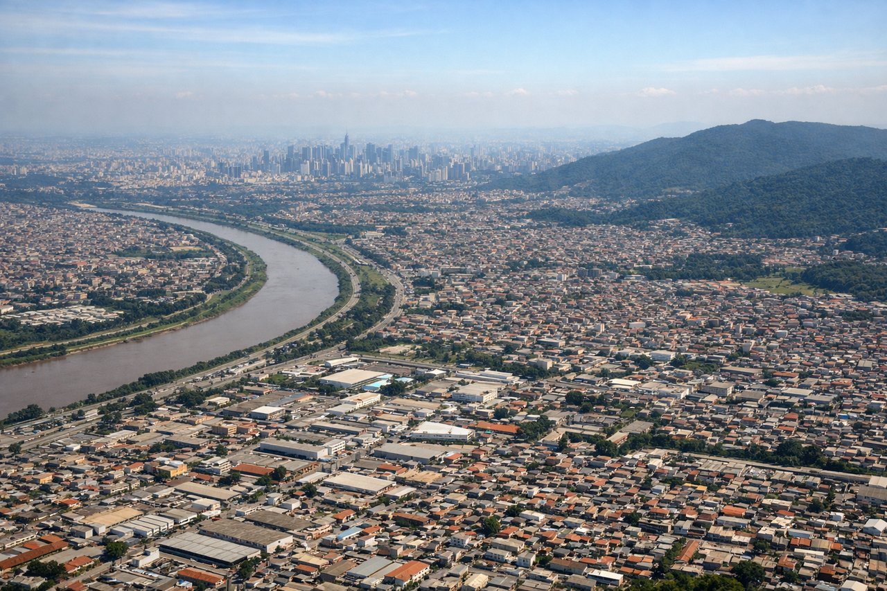
RIGHTThe approach to Guarulhos (GRU) from the west brings the aircraft over the São Paulo metropolitan area and surrounding terrain. The right (north/northeast) side during descent offers views of the city's sprawling urban landscape, industrial zones, and the Serra da Cantareira mountains to the north. The left side faces open agricultural areas with less visual interest.
Landmarks on this routeAll landmarks →
Will your flight be in sunlight?
Pick a date and time in the Sun Map to watch the sun move across your whole flight.
About This Route
Which side of the plane should I sit on flying from Campo Grande (CGR) to Guarulhos (GRU)?
Sit on the Right side of the plane for the best views on flights from Campo Grande to Sao Paulo. While both sides score equally at 2.0 due to the short flight duration (1h 15m) over relatively flat-to-gently-rolling terrain with limited dramatic features, the right side edges ahead for the landing sequence. The approach to São Paulo offers genuine urban scenery (the metropolitan area and industrial zones) plus the Serra da Cantareira mountains, which provide the only significant topographic feature on this route. The left side during takeoff has marginal advantage but is outweighed by the right side's landing experience.
What can I see during takeoff from Campo Grande in Campo Grande?
During takeoff from Campo Grande (CGR), sit on the Left side for the best views. Campo Grande sits on a plateau with gentle rolling terrain to the west and south. The left (west/southwest) side offers slightly more topographic variation as the aircraft climbs out over the Planalto Central, with subtle elevation changes and scattered vegetation patterns visible. The right side faces relatively flat agricultural plains. Notable sights include: Planalto Central plateau edge, Rio Taquari valley to the southwest, scattered cerrado vegetation patterns, Campo Grande city grid receding below.
What can I see when landing at Guarulhos in Sao Paulo?
When landing at Guarulhos (GRU), sit on the Right side for the best views. The approach to Guarulhos (GRU) from the west brings the aircraft over the São Paulo metropolitan area and surrounding terrain. The right (north/northeast) side during descent offers views of the city's sprawling urban landscape, industrial zones, and the Serra da Cantareira mountains to the north. The left side faces open agricultural areas with less visual interest. Notable sights include: São Paulo metropolitan sprawl, Serra da Cantareira mountain range to the north, Tietê River valley, Guarulhos airport and surrounding industrial zones.
How long is the flight from Campo Grande to Sao Paulo?
The flight from Campo Grande (CGR) to Guarulhos (GRU) takes about 1 hour 15 minutes. The shortest flight path between them is 564 miles (908 km); winds and air traffic control usually add a few percent.
What does the Campo Grande to Sao Paulo flight path pass over?
The flight path crosses the Planalto Central plateau at cruise altitude (approximately 25,000-28,000 feet), passing over central São Paulo state. Notable features include the Paraná River basin to the west (not directly visible but defines the regional hydrology), scattered cerrado and agricultural transition zones, and the gradual approach to the Atlantic coastal plateau's eastern edge. The Serra da Cantareira becomes visible approximately 30 minutes before landing. No major rivers, canyons, or dramatic terrain features are encountered at cruise altitude on this route.