Right side dominates both takeoff and landing with water features—Charleston Harbor on departure and Detroit River on arrival. The midpoint over the Appalachian foothills offers less dramatic scenery from either side, making the water views at both ends the deciding factor.
Flown CHS to DTW? Did we get it right?
Flight Path
Charleston to Detroit is 669 miles (1,076 km), a flight of about 2 hours.
The flight path crosses the Appalachian Mountains (primarily the Cumberland Plateau and Ridge-and-Valley province) over eastern Tennessee and Kentucky. At cruise altitude (around 30,000 feet), these appear as a series of parallel ridges running northeast-southwest, with the Ohio River visible as a thin line threading through the valleys. The terrain transitions from coastal plain to foothills to mountains over the first 90 minutes, then gradually flattens as the route crosses into the Great Lakes basin over Ohio and Michigan.
Great circle distance and headings ›Phase by phase

Takeoff from CHS
RIGHTRight side offers views of Charleston Harbor and the Atlantic coastline during initial climb. Most departures from CHS use runways 15 or 33; runway 15 departures heading north give right-seat passengers clear views of the harbor, Cooper River, and barrier islands before turning northwest toward Detroit.
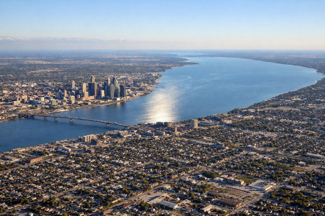
Landing at DTW
LEFTLeft side captures the Detroit River and Windsor, Ontario during approach. Most arrivals at DTW use runways 03R, 03L, or 21L/21R depending on wind. Westbound approaches descending toward runway 03 give left-seat passengers extended views of the Detroit River, the city skyline, and the Canadian shoreline across the water.
Will your flight be in sunlight?
Pick a date and time in the Sun Map to watch the sun move across your whole flight.
About This Route
Which side of the plane should I sit on flying from Charleston Afb International (CHS) to Detroit Metro Wayne Co (DTW)?
Sit on the Right side of the plane for the best views on flights from Charleston to Detroit. Right side dominates both takeoff and landing with water features—Charleston Harbor on departure and Detroit River on arrival. The midpoint over the Appalachian foothills offers less dramatic scenery from either side, making the water views at both ends the deciding factor.
What can I see during takeoff from Charleston Afb International in Charleston?
During takeoff from Charleston Afb International (CHS), sit on the Right side for the best views. Right side offers views of Charleston Harbor and the Atlantic coastline during initial climb. Most departures from CHS use runways 15 or 33; runway 15 departures heading north give right-seat passengers clear views of the harbor, Cooper River, and barrier islands before turning northwest toward Detroit. Notable sights include: Charleston Harbor, Cooper River, Fort Sumter (small but historically prominent on the harbor), Atlantic barrier islands and beaches.
What can I see when landing at Detroit Metro Wayne Co in Detroit?
When landing at Detroit Metro Wayne Co (DTW), sit on the Left side for the best views. Left side captures the Detroit River and Windsor, Ontario during approach. Most arrivals at DTW use runways 03R, 03L, or 21L/21R depending on wind. Westbound approaches descending toward runway 03 give left-seat passengers extended views of the Detroit River, the city skyline, and the Canadian shoreline across the water. Notable sights include: Detroit River, Windsor Ontario skyline, Lake St. Clair (visible on approach from the east), Detroit downtown skyline and Renaissance Center.
How long is the flight from Charleston to Detroit?
The flight from Charleston Afb International (CHS) to Detroit Metro Wayne Co (DTW) takes about 2 hours. The shortest flight path between them is 669 miles (1,076 km); winds and air traffic control usually add a few percent.
What does the Charleston to Detroit flight path pass over?
The flight path crosses the Appalachian Mountains (primarily the Cumberland Plateau and Ridge-and-Valley province) over eastern Tennessee and Kentucky. At cruise altitude (around 30,000 feet), these appear as a series of parallel ridges running northeast-southwest, with the Ohio River visible as a thin line threading through the valleys. The terrain transitions from coastal plain to foothills to mountains over the first 90 minutes, then gradually flattens as the route crosses into the Great Lakes basin over Ohio and Michigan.