Right side scores higher (3.5 vs 2.5) due to superior scenic variety across the full flight. Takeoff offers dramatic river gorges and urban topography around Chongqing; the cruise phase crosses the Yangtze River valley and central Java's volcanic plateau; landing provides compelling coastal and urban views of Jakarta Bay and the port. Left side remains relatively flat and featureless throughout, with minimal landmark density except during the initial climb.
Flown CKG to CGK? Did we get it right?
Flight Path
Chongqing to Jakarta is 2,476 miles (3,985 km), a flight of about 5 hours 20 minutes.
Yangtze River valley and Three Gorges region (visible during climb-out and early cruise), central China plateau terrain, transition to Southeast Asian lowlands, Java's volcanic plateau with Mount Merapi and Mount Semeru visible as distant peaks during descent, Java Sea coastline approaching Jakarta
Great circle distance and headings ›


Phase by phase
Takeoff from CKG
RIGHTRight side captures the Jialing River confluence and Chongqing's urban sprawl across the peninsula formed by the Yangtze and Jialing rivers. The city's dramatic hillside development and river gorges are visible during northbound climb-out. Left side shows inland plateau terrain with less distinctive features.
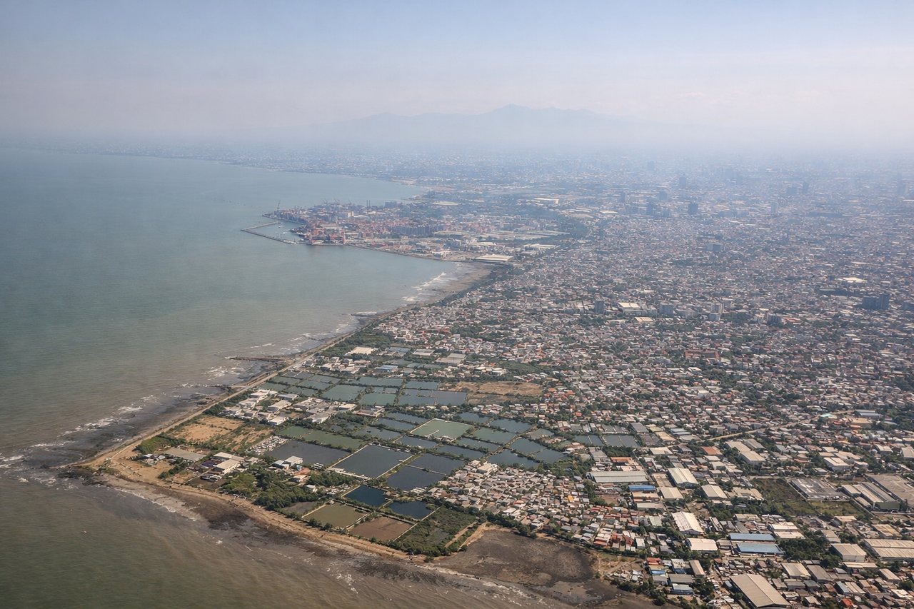
Landing at CGK
RIGHTRight side offers superior approach views of Jakarta's coastal geography. Descending from the northeast, passengers see the Java Sea, Jakarta Bay, and the city's waterfront development including the port and northern coastal districts. Left side shows inland Java terrain with less dramatic features during the final approach.
Will your flight be in sunlight?
Pick a date and time in the Sun Map to watch the sun move across your whole flight.
About This Route
Which side of the plane should I sit on flying from Jiangbei (CKG) to Soekarno Hatta International (CGK)?
Sit on the Right side of the plane for the best views on flights from Chongqing to Jakarta. Right side scores higher (3.5 vs 2.5) due to superior scenic variety across the full flight. Takeoff offers dramatic river gorges and urban topography around Chongqing; the cruise phase crosses the Yangtze River valley and central Java's volcanic plateau; landing provides compelling coastal and urban views of Jakarta Bay and the port. Left side remains relatively flat and featureless throughout, with minimal landmark density except during the initial climb.
What can I see during takeoff from Jiangbei in Chongqing?
During takeoff from Jiangbei (CKG), sit on the Right side for the best views. Right side captures the Jialing River confluence and Chongqing's urban sprawl across the peninsula formed by the Yangtze and Jialing rivers. The city's dramatic hillside development and river gorges are visible during northbound climb-out. Left side shows inland plateau terrain with less distinctive features. Notable sights include: Jialing River and Yangtze River confluence, Chongqing urban peninsula, surrounding limestone hills.
What can I see when landing at Soekarno Hatta International in Jakarta?
When landing at Soekarno Hatta International (CGK), sit on the Right side for the best views. Right side offers superior approach views of Jakarta's coastal geography. Descending from the northeast, passengers see the Java Sea, Jakarta Bay, and the city's waterfront development including the port and northern coastal districts. Left side shows inland Java terrain with less dramatic features during the final approach. Notable sights include: Jakarta Bay, Java Sea coastline, Soekarno Hatta International Airport runways, northern Jakarta waterfront and port facilities.
How long is the flight from Chongqing to Jakarta?
The flight from Jiangbei (CKG) to Soekarno Hatta International (CGK) takes about 5 hours 20 minutes. The shortest flight path between them is 2,476 miles (3,985 km); winds and air traffic control usually add a few percent.
What does the Chongqing to Jakarta flight path pass over?
Yangtze River valley and Three Gorges region (visible during climb-out and early cruise), central China plateau terrain, transition to Southeast Asian lowlands, Java's volcanic plateau with Mount Merapi and Mount Semeru visible as distant peaks during descent, Java Sea coastline approaching Jakarta