While Cleveland's takeoff offers urban and lake scenery, the landing approach to Panama City provides superior visual drama with the Caribbean coastline, Panama Canal infrastructure, and Darien rainforest. The right side captures more varied and geographically distinctive terrain over the full flight duration, particularly during the final descent where tropical geography becomes increasingly prominent.
Flown CLE to PTY? Did we get it right?
Flight Path
Cleveland to Panama City is 2,240 miles (3,604 km), a flight of about 4 hours 15 minutes.
The flight path crosses the Appalachian Mountains (visible during initial climb as ridgelines and valleys in West Virginia and Kentucky), then transitions over the Mississippi River valley and Gulf Coastal Plain. Over the Gulf of Mexico, the flight crosses open water for approximately 2.5 hours with no significant landmarks. As the aircraft approaches Central America, the Yucatan Peninsula's flat limestone terrain becomes visible, followed by the Caribbean coast of Honduras and the mountainous terrain of Central America. The Sierra Madre mountain range in Honduras and Guatemala appears as a distant ridge line before descent into Panama.
Great circle distance and headings ›


Phase by phase
Takeoff from CLE
LEFTCleveland's urban landscape and Lake Erie shoreline provide immediate visual interest during climb-out. The left side captures the city grid, harbor, and the southern shore of Lake Erie as the aircraft departs northeastward before turning south.
Landing at PTY
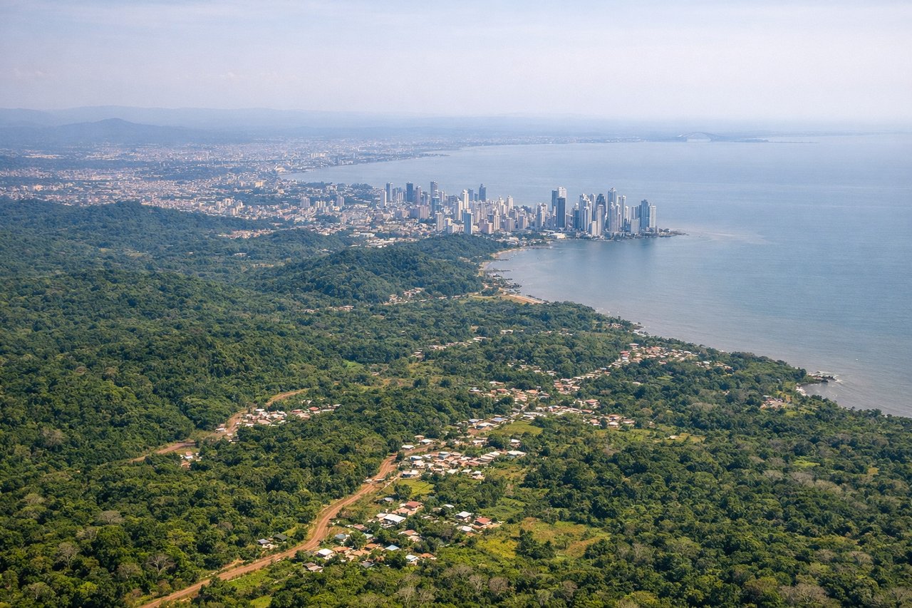
RIGHTThe approach to Panama City from the northwest reveals the dramatic Caribbean coastline, the Panama Canal's northern reaches, and the Darien Gap's dense jungle terrain. The right side captures the transition from open Caribbean waters to the intricate waterways and forested landscape surrounding Tocumen.
Will your flight be in sunlight?
Pick a date and time in the Sun Map to watch the sun move across your whole flight.
About This Route
Which side of the plane should I sit on flying from Cleveland Hopkins International (CLE) to Tocumen International (PTY)?
Sit on the Right side of the plane for the best views on flights from Cleveland to Panama City. While Cleveland's takeoff offers urban and lake scenery, the landing approach to Panama City provides superior visual drama with the Caribbean coastline, Panama Canal infrastructure, and Darien rainforest. The right side captures more varied and geographically distinctive terrain over the full flight duration, particularly during the final descent where tropical geography becomes increasingly prominent.
What can I see during takeoff from Cleveland Hopkins International in Cleveland?
During takeoff from Cleveland Hopkins International (CLE), sit on the Left side for the best views. Cleveland's urban landscape and Lake Erie shoreline provide immediate visual interest during climb-out. The left side captures the city grid, harbor, and the southern shore of Lake Erie as the aircraft departs northeastward before turning south. Notable sights include: Lake Erie southern shoreline, Cleveland downtown skyline and harbor, Cuyahoga River mouth, suburban sprawl extending south toward Akron.
What can I see when landing at Tocumen International in Panama City?
When landing at Tocumen International (PTY), sit on the Right side for the best views. The approach to Panama City from the northwest reveals the dramatic Caribbean coastline, the Panama Canal's northern reaches, and the Darien Gap's dense jungle terrain. The right side captures the transition from open Caribbean waters to the intricate waterways and forested landscape surrounding Tocumen. Notable sights include: Caribbean Sea and Colón coastline, Panama Canal northern section and Gatun Lake, Darien Gap rainforest, Panama City skyline and Tocumen airport approach.
How long is the flight from Cleveland to Panama City?
The flight from Cleveland Hopkins International (CLE) to Tocumen International (PTY) takes about 4 hours 15 minutes. The shortest flight path between them is 2,240 miles (3,604 km); winds and air traffic control usually add a few percent.
What does the Cleveland to Panama City flight path pass over?
The flight path crosses the Appalachian Mountains (visible during initial climb as ridgelines and valleys in West Virginia and Kentucky), then transitions over the Mississippi River valley and Gulf Coastal Plain. Over the Gulf of Mexico, the flight crosses open water for approximately 2.5 hours with no significant landmarks. As the aircraft approaches Central America, the Yucatan Peninsula's flat limestone terrain becomes visible, followed by the Caribbean coast of Honduras and the mountainous terrain of Central America. The Sierra Madre mountain range in Honduras and Guatemala appears as a distant ridge line before descent into Panama.