Right side scores 3.5 vs left's 2.5 due to superior scenery at both ends of the flight. Colombo's harbor and coastal departure, combined with Rangitoto Island and Auckland Harbour's dramatic approach, provide genuine visual landmarks and geographic variety. The left side faces predominantly open ocean during cruise and suburban flatness during landing, offering minimal scenic reward over 20+ hours of flight time.
Flown CMB to AKL? Did we get it right?
Flight Path
Colombo to Auckland is 6,786 miles (10,921 km), a flight of about 13 hours 5 minutes.
The flight crosses the entire Indian Ocean for approximately 12 hours with no visible landmass—only open water, occasional weather systems, and the curvature of Earth at altitude. The Chagos Archipelago (Diego Garcia) lies roughly 8 hours into the flight but is too small to reliably spot. After crossing the Indian Ocean, the flight enters the South Pacific, passing east of Australia (not visible on typical routing) and approaching New Zealand from the northeast across the Tasman Sea. The Southern Ocean's waters gradually show increased wave patterns and weather activity as the aircraft descends toward New Zealand's latitude.
Great circle distance and headings ›Phase by phase
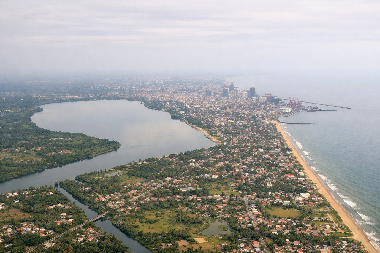
Takeoff from CMB
RIGHTRight side captures Colombo's harbor and coastal cityscape during initial climb, with the Indian Ocean stretching south. Left side faces inland toward flat central plains with minimal visual interest during departure.
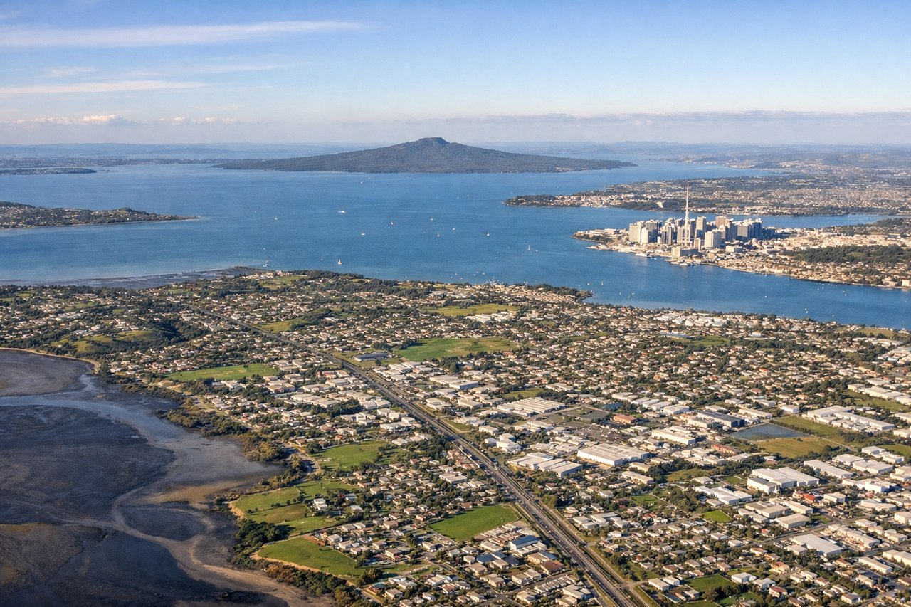
Landing at AKL
RIGHTRight side offers superior approach scenery: the Waitemata Harbour, Rangitoto Island's volcanic cone, and Auckland's downtown skyline are all visible during the standard southwest approach to runway 23L. Left side faces the Tasman Sea and flat suburban sprawl with minimal drama.
Will your flight be in sunlight?
Pick a date and time in the Sun Map to watch the sun move across your whole flight.
About This Route
Which side of the plane should I sit on flying from Bandaranaike International (CMB) to Auckland International (AKL)?
Sit on the Right side of the plane for the best views on flights from Colombo to Auckland. Right side scores 3.5 vs left's 2.5 due to superior scenery at both ends of the flight. Colombo's harbor and coastal departure, combined with Rangitoto Island and Auckland Harbour's dramatic approach, provide genuine visual landmarks and geographic variety. The left side faces predominantly open ocean during cruise and suburban flatness during landing, offering minimal scenic reward over 20+ hours of flight time.
What can I see during takeoff from Bandaranaike International in Colombo?
During takeoff from Bandaranaike International (CMB), sit on the Right side for the best views. Right side captures Colombo's harbor and coastal cityscape during initial climb, with the Indian Ocean stretching south. Left side faces inland toward flat central plains with minimal visual interest during departure. Notable sights include: Colombo harbor and port facilities, Indian Ocean coastline, Kelani River delta.
What can I see when landing at Auckland International in Auckland?
When landing at Auckland International (AKL), sit on the Right side for the best views. Right side offers superior approach scenery: the Waitemata Harbour, Rangitoto Island's volcanic cone, and Auckland's downtown skyline are all visible during the standard southwest approach to runway 23L. Left side faces the Tasman Sea and flat suburban sprawl with minimal drama. Notable sights include: Rangitoto Island (volcanic cone), Waitemata Harbour, Auckland CBD skyline, Devonport peninsula.
How long is the flight from Colombo to Auckland?
The flight from Bandaranaike International (CMB) to Auckland International (AKL) takes about 13 hours 5 minutes. The shortest flight path between them is 6,786 miles (10,921 km); winds and air traffic control usually add a few percent.
What does the Colombo to Auckland flight path pass over?
The flight crosses the entire Indian Ocean for approximately 12 hours with no visible landmass—only open water, occasional weather systems, and the curvature of Earth at altitude. The Chagos Archipelago (Diego Garcia) lies roughly 8 hours into the flight but is too small to reliably spot. After crossing the Indian Ocean, the flight enters the South Pacific, passing east of Australia (not visible on typical routing) and approaching New Zealand from the northeast across the Tasman Sea. The Southern Ocean's waters gradually show increased wave patterns and weather activity as the aircraft descends toward New Zealand's latitude.