Right side scores higher (3.5 vs 2.5) because it captures scenic coastal and urban features at both takeoff and landing. Colombo's harbor departure and Karachi's Arabian Sea approach provide genuine visual interest and landmark density. Left side remains dominated by flat terrain and open ocean with minimal distinguishing features across the entire flight.
Flown CMB to KHI? Did we get it right?
Flight Path
Colombo to Karachi is 1,485 miles (2,390 km), a flight of about 3 hours 15 minutes.
The flight path crosses the Arabian Sea for approximately 2 hours. Notable geographic features include the Thar Desert visible to the left (west) during cruise at altitude, the Indus River valley and delta region approaching Karachi from the southeast, and the coastal plains of Sindh province. No major mountain ranges or dramatic terrain features are visible from cruise altitude on this route; the journey is primarily over water and flat to gently rolling desert and agricultural lowlands.
Great circle distance and headings ›Phase by phase
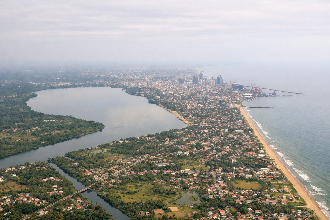
Takeoff from CMB
RIGHTRight side captures Colombo's harbor and coastal cityscape during initial climb, with the Indian Ocean stretching westward. Left side departs over inland terrain with minimal urban or dramatic natural features.
Landing at KHI
RIGHTRight side (eastern approach over Arabian Sea) provides extended views of the Karachi coastline, harbor, and city skyline during descent and final approach. Left side (western approach over inland Sindh) shows flat desert and agricultural plains with minimal visual interest.
Will your flight be in sunlight?
Pick a date and time in the Sun Map to watch the sun move across your whole flight.
About This Route
Which side of the plane should I sit on flying from Bandaranaike International (CMB) to Jinnah International (KHI)?
Sit on the Right side of the plane for the best views on flights from Colombo to Karachi. Right side scores higher (3.5 vs 2.5) because it captures scenic coastal and urban features at both takeoff and landing. Colombo's harbor departure and Karachi's Arabian Sea approach provide genuine visual interest and landmark density. Left side remains dominated by flat terrain and open ocean with minimal distinguishing features across the entire flight.
What can I see during takeoff from Bandaranaike International in Colombo?
During takeoff from Bandaranaike International (CMB), sit on the Right side for the best views. Right side captures Colombo's harbor and coastal cityscape during initial climb, with the Indian Ocean stretching westward. Left side departs over inland terrain with minimal urban or dramatic natural features. Notable sights include: Colombo harbor and port facilities, Indian Ocean coastline, Colombo city grid extending inland.
What can I see when landing at Jinnah International in Karachi?
When landing at Jinnah International (KHI), sit on the Right side for the best views. Right side (eastern approach over Arabian Sea) provides extended views of the Karachi coastline, harbor, and city skyline during descent and final approach. Left side (western approach over inland Sindh) shows flat desert and agricultural plains with minimal visual interest. Notable sights include: Karachi harbor and port, Arabian Sea coastline, Karachi city skyline, Indus River delta region to the northeast.
How long is the flight from Colombo to Karachi?
The flight from Bandaranaike International (CMB) to Jinnah International (KHI) takes about 3 hours 15 minutes. The shortest flight path between them is 1,485 miles (2,390 km); winds and air traffic control usually add a few percent.
What does the Colombo to Karachi flight path pass over?
The flight path crosses the Arabian Sea for approximately 2 hours. Notable geographic features include the Thar Desert visible to the left (west) during cruise at altitude, the Indus River valley and delta region approaching Karachi from the southeast, and the coastal plains of Sindh province. No major mountain ranges or dramatic terrain features are visible from cruise altitude on this route; the journey is primarily over water and flat to gently rolling desert and agricultural lowlands.