The right side offers the most consistent scenic value across both segments: Atlantic coastal views during departure and the approach over Taiwan's western plains and mountain rim during arrival. Left side has strong landing views but limited takeoff interest.
Flown CMN to TPE? Did we get it right?
Flight Path
Casablanca to Taipei is 7,182 miles (11,559 km), a flight of about 13 hours 30 minutes.
This route typically crosses the Mediterranean Sea (southern coast visible near Greece/Cyprus), then overflies the Middle East (Syrian/Iraqi terrain, Persian Gulf), continues across the Arabian Sea, and enters South Asia over Pakistan/India before crossing the Bay of Bengal to Southeast Asia. Notable landmarks include the Nile Delta (if routed via Egypt), the Zagros Mountains (Iran), the Indus River valley (Pakistan), and the Himalayas (northern horizon during approach to Southeast Asia). The flight path is heavily dependent on geopolitical routing and wind patterns; actual waypoints may vary significantly.
Great circle distance and headings ›


Phase by phase
Takeoff from CMN
RIGHTRight side captures the Atlantic coastline and the city of Casablanca receding southward. The Hassan II Mosque and port facilities are visible on the immediate left bank of the Draa Estuary, but the broader coastal perspective—including the curve of the Moroccan shore heading toward El Jadida—is best from the right window.
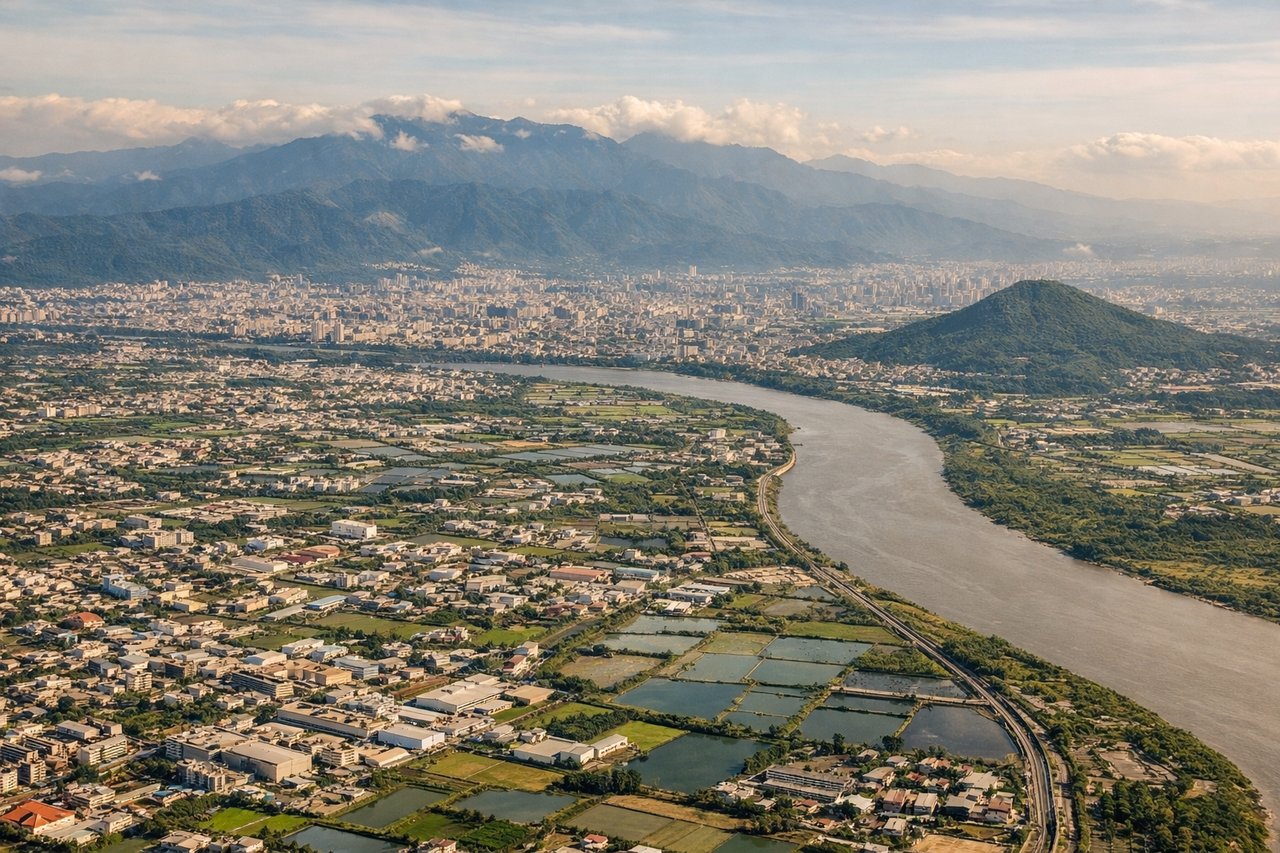
Landing at TPE
LEFTTaipei's descent approach from the west brings the city and surrounding geography into view on the left side. The Taipei Basin, Keelung River, and the urban core with Taipei 101 are positioned on the left as the aircraft descends toward Taoyuan International (located southwest of the city). The Yangmingshan volcanic plateau and northern mountains frame the approach.
Will your flight be in sunlight?
Pick a date and time in the Sun Map to watch the sun move across your whole flight.
About This Route
Which side of the plane should I sit on flying from Mohammed V (CMN) to Chiang Kai Shek International (TPE)?
Sit on the Right side of the plane for the best views on flights from Casablanca to Taipei. The right side offers the most consistent scenic value across both segments: Atlantic coastal views during departure and the approach over Taiwan's western plains and mountain rim during arrival. Left side has strong landing views but limited takeoff interest.
What can I see during takeoff from Mohammed V in Casablanca?
During takeoff from Mohammed V (CMN), sit on the Right side for the best views. Right side captures the Atlantic coastline and the city of Casablanca receding southward. The Hassan II Mosque and port facilities are visible on the immediate left bank of the Draa Estuary, but the broader coastal perspective—including the curve of the Moroccan shore heading toward El Jadida—is best from the right window. Notable sights include: Atlantic Ocean coastline, Casablanca urban sprawl, Draa Estuary, Hassan II Mosque complex (white structure near water).
What can I see when landing at Chiang Kai Shek International in Taipei?
When landing at Chiang Kai Shek International (TPE), sit on the Left side for the best views. Taipei's descent approach from the west brings the city and surrounding geography into view on the left side. The Taipei Basin, Keelung River, and the urban core with Taipei 101 are positioned on the left as the aircraft descends toward Taoyuan International (located southwest of the city). The Yangmingshan volcanic plateau and northern mountains frame the approach. Notable sights include: Taipei 101 tower, Taipei Basin urban area, Keelung River, Yangmingshan volcanic plateau (northern rim).
How long is the flight from Casablanca to Taipei?
The flight from Mohammed V (CMN) to Chiang Kai Shek International (TPE) takes about 13 hours 30 minutes. The shortest flight path between them is 7,182 miles (11,559 km); winds and air traffic control usually add a few percent.
What does the Casablanca to Taipei flight path pass over?
This route typically crosses the Mediterranean Sea (southern coast visible near Greece/Cyprus), then overflies the Middle East (Syrian/Iraqi terrain, Persian Gulf), continues across the Arabian Sea, and enters South Asia over Pakistan/India before crossing the Bay of Bengal to Southeast Asia. Notable landmarks include the Nile Delta (if routed via Egypt), the Zagros Mountains (Iran), the Indus River valley (Pakistan), and the Himalayas (northern horizon during approach to Southeast Asia). The flight path is heavily dependent on geopolitical routing and wind patterns; actual waypoints may vary significantly.