Carlsbad to Phoenix is 455 miles (733 km), a flight of about 1 hour 15 minutes.
The takeoff climb from Carlsbad offers more dramatic natural scenery with the Guadalupe Mountains and surrounding high desert plateau. While the Phoenix landing provides urban interest, the geological features visible during departure are more visually distinctive and less obscured by haze.
Flight Path
San Simon Valley (Arizona), Chiricahua Mountains (distant southeast), Dragoon Mountains (south-central), transition from Sonoran Desert scrubland to lower Sonoran Desert basin
Great circle distance and headings ›Phase by phase
Takeoff from CNM
RIGHTRight-side seats offer views of the Guadalupe Mountains and the Carlsbad Caverns plateau as the aircraft climbs northwest. The terrain rises dramatically to the east and north, making the right wing the scenic side during departure.
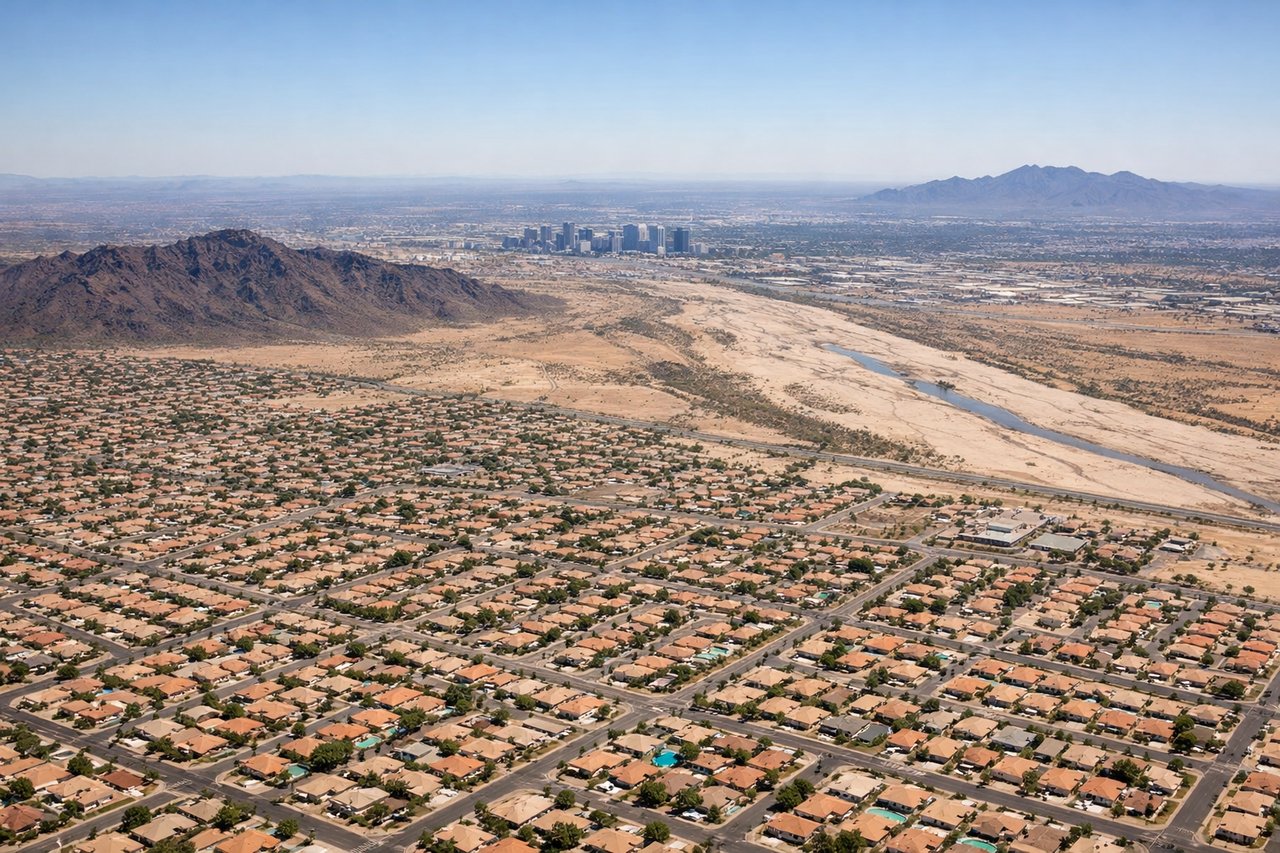
Landing at PHX
LEFTLeft-side seats provide excellent views of the Phoenix metropolitan area and the Salt River valley as the aircraft descends from the northeast. The city sprawl, downtown Phoenix, and surrounding desert basins are clearly visible on the left wing during approach.
Landmarks on this routeAll landmarks →
Will your flight be in sunlight?
Pick a date and time in the Sun Map to watch the sun move across your whole flight.
About This Route
Which side of the plane should I sit on flying from Cavern City Air Terminal (CNM) to Phoenix Sky Harbor International (PHX)?
Sit on the Right side of the plane for the best views on flights from Carlsbad to Phoenix. The takeoff climb from Carlsbad offers more dramatic natural scenery with the Guadalupe Mountains and surrounding high desert plateau. While the Phoenix landing provides urban interest, the geological features visible during departure are more visually distinctive and less obscured by haze.
What can I see during takeoff from Cavern City Air Terminal in Carlsbad?
During takeoff from Cavern City Air Terminal (CNM), sit on the Right side for the best views. Right-side seats offer views of the Guadalupe Mountains and the Carlsbad Caverns plateau as the aircraft climbs northwest. The terrain rises dramatically to the east and north, making the right wing the scenic side during departure. Notable sights include: Guadalupe Mountains (southeast), Carlsbad Caverns plateau (immediate vicinity), Pecos River valley (west), Delaware Basin (north).
What can I see when landing at Phoenix Sky Harbor International in Phoenix?
When landing at Phoenix Sky Harbor International (PHX), sit on the Left side for the best views. Left-side seats provide excellent views of the Phoenix metropolitan area and the Salt River valley as the aircraft descends from the northeast. The city sprawl, downtown Phoenix, and surrounding desert basins are clearly visible on the left wing during approach. Notable sights include: Phoenix downtown skyline (west-southwest), Salt River valley (south), South Mountain Park (south), Superstition Mountains (southeast).
How long is the flight from Carlsbad to Phoenix?
The flight from Cavern City Air Terminal (CNM) to Phoenix Sky Harbor International (PHX) takes about 1 hour 15 minutes. The shortest flight path between them is 455 miles (733 km); winds and air traffic control usually add a few percent.
What does the Carlsbad to Phoenix flight path pass over?
San Simon Valley (Arizona), Chiricahua Mountains (distant southeast), Dragoon Mountains (south-central), transition from Sonoran Desert scrubland to lower Sonoran Desert basin