Left side scores higher due to superior terrain drama on both legs. Departure from Chiang Mai offers immediate mountain scenery (Doi Luang range), while arrival at Incheon provides coastal and estuarine views with industrial port complexity. Right side is dominated by flatter agricultural plains on departure and suburban sprawl on arrival, with minimal elevation change or distinctive landmarks. The left side delivers consistent visual interest across the full flight.
Flown CNX to ICN? Did we get it right?
Flight Path
Chiang Mai to Seoul is 2,102 miles (3,382 km), a flight of about 4 hours 35 minutes.
Laos-Thailand border region (Mekong River valley), northern Thailand plateau transitioning to Laos highlands, Vientiane area, central Laos karst terrain, Laos-Vietnam border mountains, northern Vietnam highlands (Tonkin region), Red River valley, Hanoi area, Gulf of Tonkin coastline, Hainan Island (China), Yellow Sea crossing, Korean Peninsula west coast approaching Incheon
Great circle distance and headings ›Phase by phase
Takeoff from CNX
LEFTLeft side captures the dramatic Doi Luang mountain range and the Ping River valley immediately after departure. The terrain rises steeply to the west, creating immediate visual interest during climb-out. Right side shows flatter agricultural plains extending eastward with minimal elevation change.
Landing at ICN
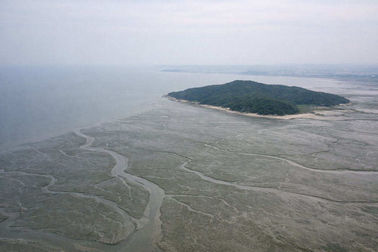
LEFTLeft side during approach to Incheon offers views of the Yellow Sea coastline, Ganghwa Island, and the industrial port complex. The descent path typically provides extended views of the coastal geography and Seoul's western urban sprawl. Right side shows inland plains and suburban development with less dramatic terrain variation.
Will your flight be in sunlight?
Pick a date and time in the Sun Map to watch the sun move across your whole flight.
About This Route
Which side of the plane should I sit on flying from Chiang Mai International Airport (CNX) to Incheon International (ICN)?
Sit on the Left side of the plane for the best views on flights from Chiang Mai to Seoul. Left side scores higher due to superior terrain drama on both legs. Departure from Chiang Mai offers immediate mountain scenery (Doi Luang range), while arrival at Incheon provides coastal and estuarine views with industrial port complexity. Right side is dominated by flatter agricultural plains on departure and suburban sprawl on arrival, with minimal elevation change or distinctive landmarks. The left side delivers consistent visual interest across the full flight.
What can I see during takeoff from Chiang Mai International Airport in Chiang Mai?
During takeoff from Chiang Mai International Airport (CNX), sit on the Left side for the best views. Left side captures the dramatic Doi Luang mountain range and the Ping River valley immediately after departure. The terrain rises steeply to the west, creating immediate visual interest during climb-out. Right side shows flatter agricultural plains extending eastward with minimal elevation change. Notable sights include: Doi Luang (2,085 m peak visible to the northwest), Ping River winding through the valley below, Chiang Mai city grid, forested hills of the western range.
What can I see when landing at Incheon International in Seoul?
When landing at Incheon International (ICN), sit on the Left side for the best views. Left side during approach to Incheon offers views of the Yellow Sea coastline, Ganghwa Island, and the industrial port complex. The descent path typically provides extended views of the coastal geography and Seoul's western urban sprawl. Right side shows inland plains and suburban development with less dramatic terrain variation. Notable sights include: Ganghwa Island and its straits, Incheon harbor and container terminals, Han River estuary, Seoul's western districts (Incheon and Gyeonggi Province sprawl).
How long is the flight from Chiang Mai to Seoul?
The flight from Chiang Mai International Airport (CNX) to Incheon International (ICN) takes about 4 hours 35 minutes. The shortest flight path between them is 2,102 miles (3,382 km); winds and air traffic control usually add a few percent.
What does the Chiang Mai to Seoul flight path pass over?
Laos-Thailand border region (Mekong River valley), northern Thailand plateau transitioning to Laos highlands, Vientiane area, central Laos karst terrain, Laos-Vietnam border mountains, northern Vietnam highlands (Tonkin region), Red River valley, Hanoi area, Gulf of Tonkin coastline, Hainan Island (China), Yellow Sea crossing, Korean Peninsula west coast approaching Incheon