Right side edges ahead due to superior takeoff scenery from Cotonou. The Atlantic coastline, harbor, and lagoon system provide immediate visual drama and geographic distinctiveness during departure. While landing views are comparable on both sides (both score 2.5), the right side's takeoff advantage—featuring genuine water features and coastal contrast versus flat inland plains—gives it the edge. This is a relatively short, flat-terrain route with limited mountain or dramatic topography; both sides remain modest in scenic value, but right captures the most memorable moments.
Flown COO to BRU? Did we get it right?
Flight Path
Cotonou to Brussels is 3,080 miles (4,957 km), a flight of about 5 hours 45 minutes.
Sahara Desert (southern Algeria and Mali), Niger River valley, Atlas Mountains foothills (northern Algeria), Mediterranean coast (southern Spain/Morocco), Pyrenees Mountains (Spain-France border), Loire Valley (central France), Seine River valley approaching Paris region
Great circle distance and headings ›Phase by phase
Takeoff from COO
RIGHTRight side captures the Atlantic coastline and Cotonou harbor during departure. Runway 24 (southwest) takeoffs climb over the coastal lagoons and Gulf of Guinea, offering immediate water and urban contrast. Left side departs inland over flat Beninese terrain with minimal visual interest.
Landing at BRU
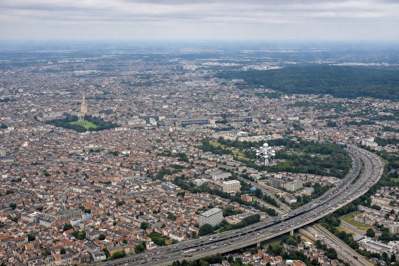
LEFTLeft side (north/northwest) captures the approach over the Low Countries' patchwork farmland, rivers, and urban sprawl leading into Brussels. Typical eastbound arrivals on runways 07L/07R descend from the west, offering views of the Meuse River valley, Belgian countryside, and the Brussels metropolitan area. Right side (south/southeast) approaches over relatively flat terrain with less dramatic visual progression.
Will your flight be in sunlight?
Pick a date and time in the Sun Map to watch the sun move across your whole flight.
About This Route
Which side of the plane should I sit on flying from Cotonou Cadjehoun (COO) to Brussels Natl (BRU)?
Sit on the Right side of the plane for the best views on flights from Cotonou to Brussels. Right side edges ahead due to superior takeoff scenery from Cotonou. The Atlantic coastline, harbor, and lagoon system provide immediate visual drama and geographic distinctiveness during departure. While landing views are comparable on both sides (both score 2.5), the right side's takeoff advantage—featuring genuine water features and coastal contrast versus flat inland plains—gives it the edge. This is a relatively short, flat-terrain route with limited mountain or dramatic topography; both sides remain modest in scenic value, but right captures the most memorable moments.
What can I see during takeoff from Cotonou Cadjehoun in Cotonou?
During takeoff from Cotonou Cadjehoun (COO), sit on the Right side for the best views. Right side captures the Atlantic coastline and Cotonou harbor during departure. Runway 24 (southwest) takeoffs climb over the coastal lagoons and Gulf of Guinea, offering immediate water and urban contrast. Left side departs inland over flat Beninese terrain with minimal visual interest. Notable sights include: Cotonou harbor and lagoon system, Atlantic coastline, Gulf of Guinea, flat inland plains receding northward.
What can I see when landing at Brussels Natl in Brussels?
When landing at Brussels Natl (BRU), sit on the Left side for the best views. Left side (north/northwest) captures the approach over the Low Countries' patchwork farmland, rivers, and urban sprawl leading into Brussels. Typical eastbound arrivals on runways 07L/07R descend from the west, offering views of the Meuse River valley, Belgian countryside, and the Brussels metropolitan area. Right side (south/southeast) approaches over relatively flat terrain with less dramatic visual progression. Notable sights include: Meuse River valley, Belgian agricultural patchwork, Brussels metropolitan area and city center, Flemish towns and villages.
How long is the flight from Cotonou to Brussels?
The flight from Cotonou Cadjehoun (COO) to Brussels Natl (BRU) takes about 5 hours 45 minutes. The shortest flight path between them is 3,080 miles (4,957 km); winds and air traffic control usually add a few percent.
What does the Cotonou to Brussels flight path pass over?
Sahara Desert (southern Algeria and Mali), Niger River valley, Atlas Mountains foothills (northern Algeria), Mediterranean coast (southern Spain/Morocco), Pyrenees Mountains (Spain-France border), Loire Valley (central France), Seine River valley approaching Paris region