Copiapo to Santiago is 424 miles (682 km), a flight of about 1 hour 15 minutes.
The entire route parallels the Andes on the eastern side, giving left-side passengers continuous mountain and volcanic scenery from takeoff through landing, while the right side only offers the flat, monotonous coastal desert and open Pacific.
Flight Path
Andes foothills and scattered volcanic peaks of the Norte Chico region, arid coastal ranges, and the Pacific coastline visible intermittently to the west
Great circle distance and headings ›


Phase by phase
Takeoff from CPO
LEFTDeparting CPO southbound, the Andes rise dramatically to the east with high-altitude volcanic peaks visible almost immediately after liftoff. The right side only shows the flat, hazy Atacama desert floor stretching to the Pacific.
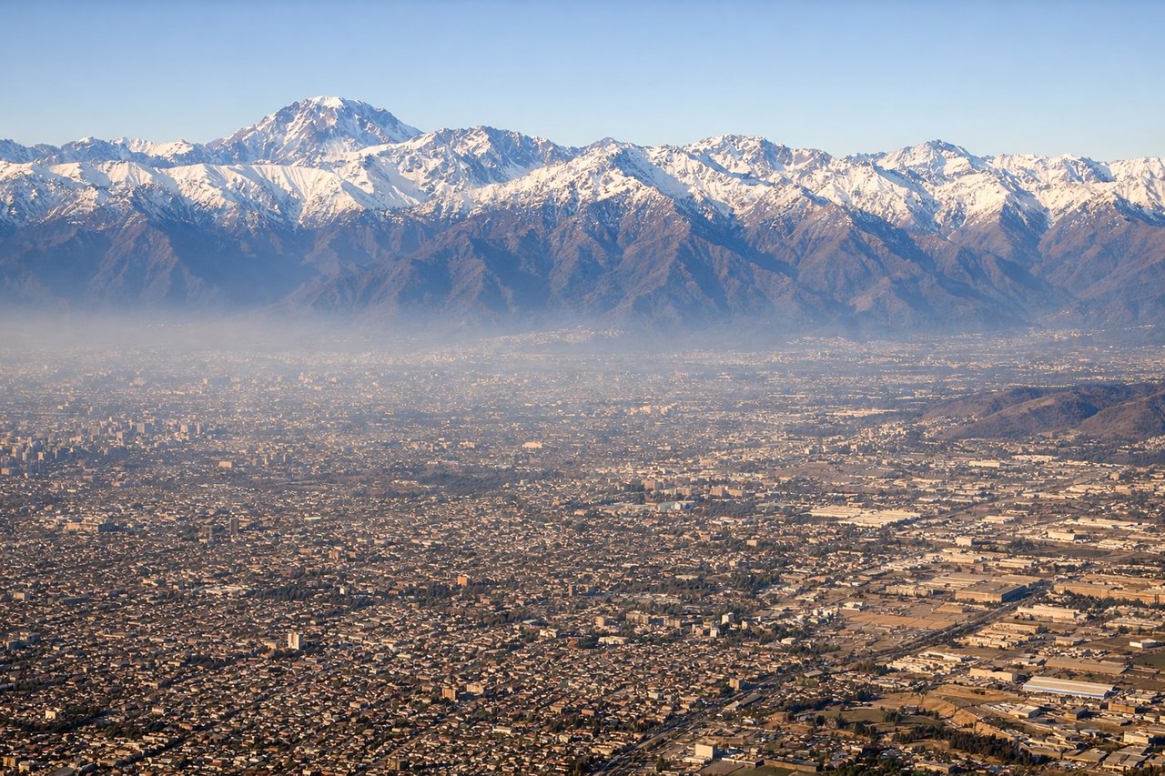
Landing at SCL
LEFTOn approach into SCL from the north, the aircraft tracks along the base of the Andes, giving left-side passengers a close view of the steep, snow-dusted range right up until touchdown. Santiago's skyline and the Maipo valley also become visible as the plane descends.
Landmarks on this routeAll landmarks →
Will your flight be in sunlight?
Pick a date and time in the Sun Map to watch the sun move across your whole flight.
About This Route
Which side of the plane should I sit on flying from Desierto de Atacama Airport (CPO) to Arturo Merino Benitez International (SCL)?
Sit on the Left side of the plane for the best views on flights from Copiapo to Santiago. The entire route parallels the Andes on the eastern side, giving left-side passengers continuous mountain and volcanic scenery from takeoff through landing, while the right side only offers the flat, monotonous coastal desert and open Pacific.
What can I see during takeoff from Desierto de Atacama Airport in Copiapo?
During takeoff from Desierto de Atacama Airport (CPO), sit on the Left side for the best views. Departing CPO southbound, the Andes rise dramatically to the east with high-altitude volcanic peaks visible almost immediately after liftoff. The right side only shows the flat, hazy Atacama desert floor stretching to the Pacific. Notable sights include: Andes foothills near Copiapo, Ojos del Salado volcanic massif in the distance, Atacama desert plateau.
What can I see when landing at Arturo Merino Benitez International in Santiago?
When landing at Arturo Merino Benitez International (SCL), sit on the Left side for the best views. On approach into SCL from the north, the aircraft tracks along the base of the Andes, giving left-side passengers a close view of the steep, snow-dusted range right up until touchdown. Santiago's skyline and the Maipo valley also become visible as the plane descends. Notable sights include: Andes front range east of Santiago, Cerro El Plomo, Santiago's eastern suburbs, Maipo river valley.
How long is the flight from Copiapo to Santiago?
The flight from Desierto de Atacama Airport (CPO) to Arturo Merino Benitez International (SCL) takes about 1 hour 15 minutes. The shortest flight path between them is 424 miles (682 km); winds and air traffic control usually add a few percent.
What does the Copiapo to Santiago flight path pass over?
Andes foothills and scattered volcanic peaks of the Norte Chico region, arid coastal ranges, and the Pacific coastline visible intermittently to the west