Left side wins at both ends of this short flight. During climb-out you get Casper Mountain and the North Platte valley; during the cruise you track southeast over the Laramie Range and then the Wyoming-Colorado border terrain; on descent the entire Front Range panorama and Denver skyline are on the left. The right side offers only the eastern plains throughout.
Flown CPR to DEN? Did we get it right?
Flight Path
Casper to Denver is 230 miles (370 km), a flight of about 50 minutes.
The flight crosses the Laramie Range and Medicine Bow Mountains in southern Wyoming, with the broad Laramie Basin visible below. As you cross into Colorado the terrain transitions through the high plains of Weld County. The Cheyenne area may be visible to the left on clear days, and the first glimpses of the Front Range appear on the left side well before descent begins.
Great circle distance and headings ›Phase by phase
Takeoff from CPR
LEFTCasper's runways typically favor departures to the southeast toward Denver. A left-side seat gives you a view back toward Casper Mountain and the Laramie Range rising to the south and southwest. You'll also see the North Platte River valley cutting through the high desert terrain below.
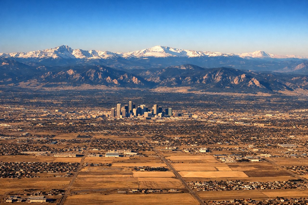
Landing at DEN
LEFTDenver International sits on the plains east of the city, and aircraft typically approach from the north or northwest on runways oriented roughly north-south. A left-side seat on approach gives a clear view of the Denver skyline to the west and the entire Front Range — including Longs Peak, Mount Evans, and Pikes Peak — lined up along the horizon. The right side faces east toward the featureless Great Plains.
Will your flight be in sunlight?
Pick a date and time in the Sun Map to watch the sun move across your whole flight.
About This Route
Which side of the plane should I sit on flying from Natrona Co International (CPR) to Denver International (DEN)?
Sit on the Left side of the plane for the best views on flights from Casper to Denver. Left side wins at both ends of this short flight. During climb-out you get Casper Mountain and the North Platte valley; during the cruise you track southeast over the Laramie Range and then the Wyoming-Colorado border terrain; on descent the entire Front Range panorama and Denver skyline are on the left. The right side offers only the eastern plains throughout.
What can I see during takeoff from Natrona Co International in Casper?
During takeoff from Natrona Co International (CPR), sit on the Left side for the best views. Casper's runways typically favor departures to the southeast toward Denver. A left-side seat gives you a view back toward Casper Mountain and the Laramie Range rising to the south and southwest. You'll also see the North Platte River valley cutting through the high desert terrain below. Notable sights include: Casper Mountain (8,130 ft) to the south, North Platte River valley, Laramie Range ridgeline, Casper city grid below.
What can I see when landing at Denver International in Denver?
When landing at Denver International (DEN), sit on the Left side for the best views. Denver International sits on the plains east of the city, and aircraft typically approach from the north or northwest on runways oriented roughly north-south. A left-side seat on approach gives a clear view of the Denver skyline to the west and the entire Front Range — including Longs Peak, Mount Evans, and Pikes Peak — lined up along the horizon. The right side faces east toward the featureless Great Plains. Notable sights include: Denver skyline to the west, Front Range including Longs Peak and Mount Evans, Rocky Mountain foothills, Denver metro grid.
How long is the flight from Casper to Denver?
The flight from Natrona Co International (CPR) to Denver International (DEN) takes about 50 minutes. The shortest flight path between them is 230 miles (370 km); winds and air traffic control usually add a few percent.
What does the Casper to Denver flight path pass over?
The flight crosses the Laramie Range and Medicine Bow Mountains in southern Wyoming, with the broad Laramie Basin visible below. As you cross into Colorado the terrain transitions through the high plains of Weld County. The Cheyenne area may be visible to the left on clear days, and the first glimpses of the Front Range appear on the left side well before descent begins.