Right side scores 3.5 vs left's 2.5 due to superior scenery on both legs. Takeoff offers the Zambales Mountains and Lingayen Gulf versus flat plains. Landing provides the Santa Monica Mountains, Los Angeles basin, and Long Beach harbor versus open ocean. The right side captures the most dramatic terrain and urban landmarks across the full flight.
Flown CRK to LAX? Did we get it right?
Flight Path
Mabalacat to Los Angeles is 7,286 miles (11,726 km), a flight of about 13 hours 15 minutes.
Pacific Ocean crossing (5+ hours over open water with minimal visual interest), Hawaiian Islands chain (visible on clear days, typically 500-800 miles northeast of direct routing but occasionally visible on northern track variants), Aleutian Islands (far northern horizon on some routing), California coast approaching LAX (Sierra Nevada mountains visible inland during descent, Central Valley agricultural patterns, San Francisco Bay area if routing permits northern approach)
Great circle distance and headings ›Phase by phase
Takeoff from CRK
RIGHTRight side captures the departure from Clark over the Zambales Mountains and Lingayen Gulf coastline, offering immediate terrain drama. Left side departs over flat central Luzon plains with minimal visual interest during climb-out.
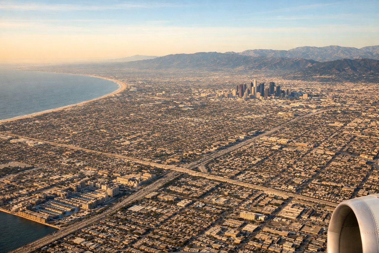
Landing at LAX
RIGHTRight side offers the most scenic arrival into LAX during standard west-flow operations. Passengers descend over the Pacific, then turn inland to approach from the west, seeing the Santa Monica Mountains, Los Angeles basin sprawl, and the Long Beach harbor complex. Left side sees mostly ocean and the approach path over open water with limited urban landmarks until final descent.
Will your flight be in sunlight?
Pick a date and time in the Sun Map to watch the sun move across your whole flight.
About This Route
Which side of the plane should I sit on flying from Clark International Airport / Clark Air Base (CRK) to Los Angeles International (LAX)?
Sit on the Right side of the plane for the best views on flights from Mabalacat to Los Angeles. Right side scores 3.5 vs left's 2.5 due to superior scenery on both legs. Takeoff offers the Zambales Mountains and Lingayen Gulf versus flat plains. Landing provides the Santa Monica Mountains, Los Angeles basin, and Long Beach harbor versus open ocean. The right side captures the most dramatic terrain and urban landmarks across the full flight.
What can I see during takeoff from Clark International Airport / Clark Air Base in Mabalacat?
During takeoff from Clark International Airport / Clark Air Base (CRK), sit on the Right side for the best views. Right side captures the departure from Clark over the Zambales Mountains and Lingayen Gulf coastline, offering immediate terrain drama. Left side departs over flat central Luzon plains with minimal visual interest during climb-out. Notable sights include: Zambales Mountains (eastern rim of departure corridor), Lingayen Gulf (western coastline), Mount Pinatubo caldera (visible on clear days during northbound departure), central Luzon agricultural plains.
What can I see when landing at Los Angeles International in Los Angeles?
When landing at Los Angeles International (LAX), sit on the Right side for the best views. Right side offers the most scenic arrival into LAX during standard west-flow operations. Passengers descend over the Pacific, then turn inland to approach from the west, seeing the Santa Monica Mountains, Los Angeles basin sprawl, and the Long Beach harbor complex. Left side sees mostly ocean and the approach path over open water with limited urban landmarks until final descent. Notable sights include: Santa Monica Mountains (northern approach boundary), Los Angeles downtown skyline and basin (visible during final turn), Long Beach harbor and container terminals (distinctive geometric pattern), Pacific coastline from Malibu to Long Beach.
How long is the flight from Mabalacat to Los Angeles?
The flight from Clark International Airport / Clark Air Base (CRK) to Los Angeles International (LAX) takes about 13 hours 15 minutes. The shortest flight path between them is 7,286 miles (11,726 km); winds and air traffic control usually add a few percent.
What does the Mabalacat to Los Angeles flight path pass over?
Pacific Ocean crossing (5+ hours over open water with minimal visual interest), Hawaiian Islands chain (visible on clear days, typically 500-800 miles northeast of direct routing but occasionally visible on northern track variants), Aleutian Islands (far northern horizon on some routing), California coast approaching LAX (Sierra Nevada mountains visible inland during descent, Central Valley agricultural patterns, San Francisco Bay area if routing permits northern approach)