Left side scores 3.5 vs right's 2.5 due to superior scenic variety across the entire flight: dramatic coastal departure from Cabo with the Sea of Cortez meeting the Pacific, extended cruise over the Pacific coastline and inland mountain ranges, and a spectacular approach into Portland featuring the Columbia River Gorge and Cascade Range with Mount Hood. Right side offers only desert plateau on departure and flat agricultural terrain on arrival, with minimal geographic drama throughout.
Flown CSW to PDX? Did we get it right?
Flight Path
Cabo San Lucas to Portland is 1,718 miles (2,765 km), a flight of about 4 hours 15 minutes.
Pacific coastline of Baja California Sur and Sonora, Sierra Madre Occidental mountain range in mainland Mexico, Colorado River delta region, Mojave Desert, Sierra Nevada range in California, Cascade Range volcanic peaks in Oregon including Mount Shasta (visible on clear days), Columbia River Gorge
Great circle distance and headings ›Phase by phase
Takeoff from CSW
LEFTLeft side captures Cabo's dramatic coastal geography during climb-out: the Sea of Cortez meeting the Pacific, rocky peninsulas, and the distinctive Cabo San Lucas headland. Right side faces inland desert plateau with minimal visual interest during initial climb.
Landing at PDX
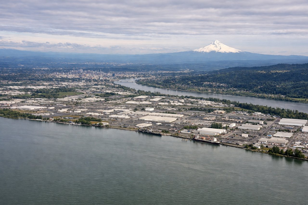
LEFTLeft side offers the most scenic approach into PDX: the Cascade Range dominates with Mount Hood visible on clear days, the Columbia River Gorge provides dramatic canyon scenery, and the Willamette Valley spreads below. Right side shows only flat agricultural land and suburban sprawl with minimal geographic interest.
Will your flight be in sunlight?
Pick a date and time in the Sun Map to watch the sun move across your whole flight.
About This Route
Which side of the plane should I sit on flying from Cabo San Lucas International Airport (CSW) to Portland International (PDX)?
Sit on the Left side of the plane for the best views on flights from Cabo San Lucas to Portland. Left side scores 3.5 vs right's 2.5 due to superior scenic variety across the entire flight: dramatic coastal departure from Cabo with the Sea of Cortez meeting the Pacific, extended cruise over the Pacific coastline and inland mountain ranges, and a spectacular approach into Portland featuring the Columbia River Gorge and Cascade Range with Mount Hood. Right side offers only desert plateau on departure and flat agricultural terrain on arrival, with minimal geographic drama throughout.
What can I see during takeoff from Cabo San Lucas International Airport in Cabo San Lucas?
During takeoff from Cabo San Lucas International Airport (CSW), sit on the Left side for the best views. Left side captures Cabo's dramatic coastal geography during climb-out: the Sea of Cortez meeting the Pacific, rocky peninsulas, and the distinctive Cabo San Lucas headland. Right side faces inland desert plateau with minimal visual interest during initial climb. Notable sights include: Sea of Cortez coastline, Cabo San Lucas rocky peninsula, Pacific Ocean horizon, Sierra de la Laguna foothills to the northeast.
What can I see when landing at Portland International in Portland?
When landing at Portland International (PDX), sit on the Left side for the best views. Left side offers the most scenic approach into PDX: the Cascade Range dominates with Mount Hood visible on clear days, the Columbia River Gorge provides dramatic canyon scenery, and the Willamette Valley spreads below. Right side shows only flat agricultural land and suburban sprawl with minimal geographic interest. Notable sights include: Mount Hood (11,240 ft, visible on clear days), Columbia River Gorge canyon walls, Cascade Range ridgeline, Willamette Valley floor.
How long is the flight from Cabo San Lucas to Portland?
The flight from Cabo San Lucas International Airport (CSW) to Portland International (PDX) takes about 4 hours 15 minutes. The shortest flight path between them is 1,718 miles (2,765 km); winds and air traffic control usually add a few percent.
What does the Cabo San Lucas to Portland flight path pass over?
Pacific coastline of Baja California Sur and Sonora, Sierra Madre Occidental mountain range in mainland Mexico, Colorado River delta region, Mojave Desert, Sierra Nevada range in California, Cascade Range volcanic peaks in Oregon including Mount Shasta (visible on clear days), Columbia River Gorge