The right side strings together three distinct scenic phases: Cancun's lagoon and coastline at takeoff, a long cruise view of Central America's coastline and highlands (plus Colombia's San Andrés Island near the flight path), and a genuinely dramatic Panama City/Canal view on final approach. The left side is dominated by featureless open Caribbean water for most of the flight.
Flown CUN to PTY? Did we get it right?
Flight Path
Cancun to Panama City is 966 miles (1,554 km), a flight of about 2 hours 20 minutes.
The route tracks over the western Caribbean Sea, passing well offshore of Honduras and Nicaragua's Caribbean lowlands, with the Cordillera de Talamanca highlands of Costa Rica visible as a distant mountainous silhouette to the west. The flight path also passes close to Colombia's San Andrés Island before continuing toward Panama's Caribbean coast near Bocas del Toro.
Great circle distance and headings ›Phase by phase

Takeoff from CUN
RIGHTDepartures off CUN's runway 30 climb out heading northwest, putting Cancun's Hotel Zone, the turquoise shallows of the Caribbean, and Nichupte Lagoon on the right side before the aircraft banks south toward Panama. The left side mostly shows the flat, undifferentiated Yucatan jungle and downtown Cancun rooftops.
Landing at PTY
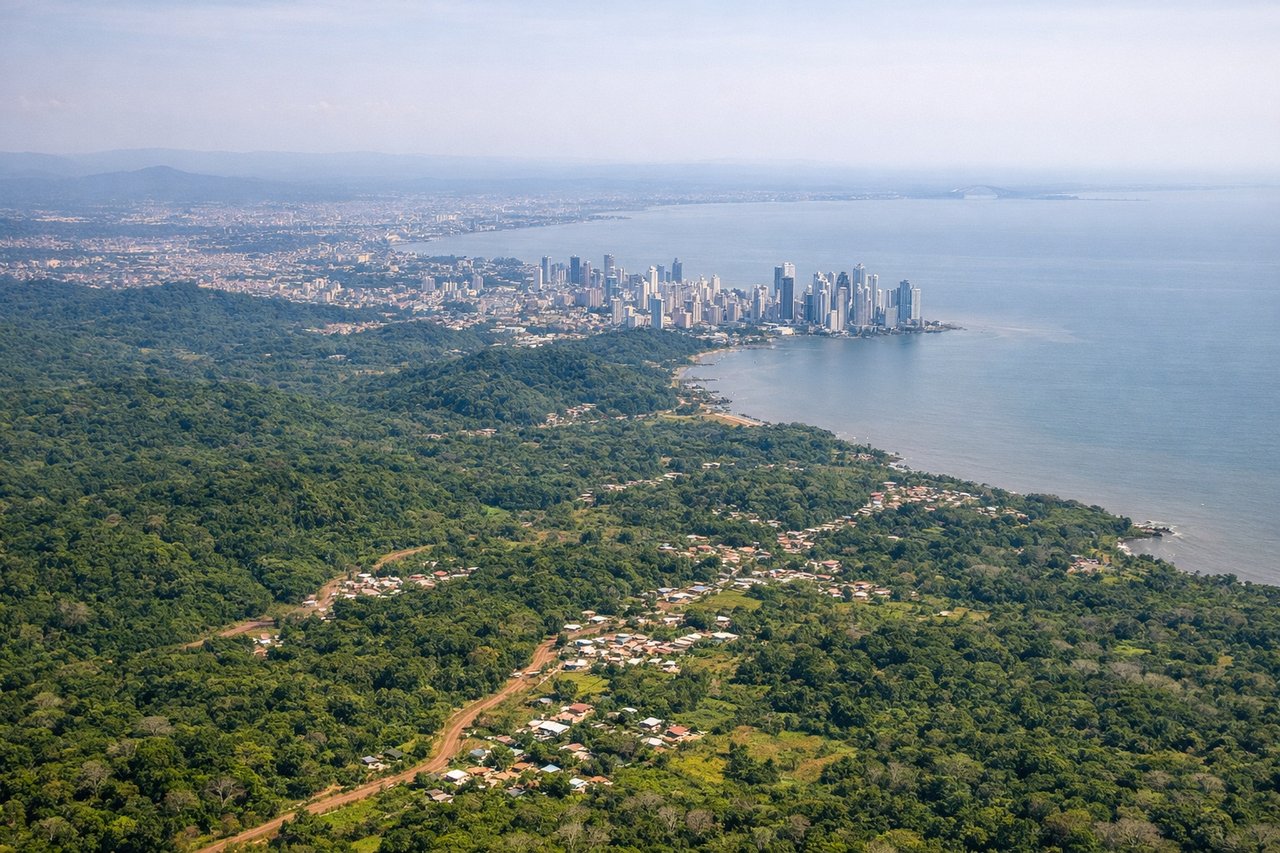
RIGHTPTY typically lands to the northeast (runway 03) when trade winds prevail, which means aircraft arriving from the north swing out over the Pacific side and Panama City before turning onto final approach. That turn puts the city skyline, the Bridge of the Americas, and the Canal's Pacific entrance on the right side of the aircraft.
Will your flight be in sunlight?
Pick a date and time in the Sun Map to watch the sun move across your whole flight.
About This Route
Which side of the plane should I sit on flying from Cancun International (CUN) to Tocumen International (PTY)?
Sit on the Right side of the plane for the best views on flights from Cancun to Panama City. The right side strings together three distinct scenic phases: Cancun's lagoon and coastline at takeoff, a long cruise view of Central America's coastline and highlands (plus Colombia's San Andrés Island near the flight path), and a genuinely dramatic Panama City/Canal view on final approach. The left side is dominated by featureless open Caribbean water for most of the flight.
What can I see during takeoff from Cancun International in Cancun?
During takeoff from Cancun International (CUN), sit on the Right side for the best views. Departures off CUN's runway 30 climb out heading northwest, putting Cancun's Hotel Zone, the turquoise shallows of the Caribbean, and Nichupte Lagoon on the right side before the aircraft banks south toward Panama. The left side mostly shows the flat, undifferentiated Yucatan jungle and downtown Cancun rooftops. Notable sights include: Cancun Hotel Zone barrier island, Nichupte Lagoon, turquoise Caribbean shallows, Isla Mujeres in the distance.
What can I see when landing at Tocumen International in Panama City?
When landing at Tocumen International (PTY), sit on the Right side for the best views. PTY typically lands to the northeast (runway 03) when trade winds prevail, which means aircraft arriving from the north swing out over the Pacific side and Panama City before turning onto final approach. That turn puts the city skyline, the Bridge of the Americas, and the Canal's Pacific entrance on the right side of the aircraft. Notable sights include: Panama City skyline, Bridge of the Americas, Pacific entrance to the Panama Canal, Bay of Panama.
How long is the flight from Cancun to Panama City?
The flight from Cancun International (CUN) to Tocumen International (PTY) takes about 2 hours 20 minutes. The shortest flight path between them is 966 miles (1,554 km); winds and air traffic control usually add a few percent.
What does the Cancun to Panama City flight path pass over?
The route tracks over the western Caribbean Sea, passing well offshore of Honduras and Nicaragua's Caribbean lowlands, with the Cordillera de Talamanca highlands of Costa Rica visible as a distant mountainous silhouette to the west. The flight path also passes close to Colombia's San Andrés Island before continuing toward Panama's Caribbean coast near Bocas del Toro.