While the right side gets a brief coastal highlight at takeoff, the left side offers the Rocky Mountain approach into Calgary, a far more dramatic and prolonged scenic payoff that outweighs a short coastal glimpse.
Flown CUN to YYC? Did we get it right?
Flight Path
Cancun to Calgary is 2,542 miles (4,091 km), a flight of about 5 hours 45 minutes.
Gulf of Mexico, Texas Panhandle plains, Great Plains of Kansas and Nebraska, Rocky Mountain foothills near the Alberta border
Great circle distance and headings ›Phase by phase

Takeoff from CUN
RIGHTDeparting Cancun on runway 30, the aircraft climbs out over the Yucatan coastline before turning onto its northbound course, giving right-side passengers a last look at the turquoise Caribbean, the Nichupté Lagoon, and Isla Mujeres offshore. The left side only shows flat jungle canopy stretching inland.
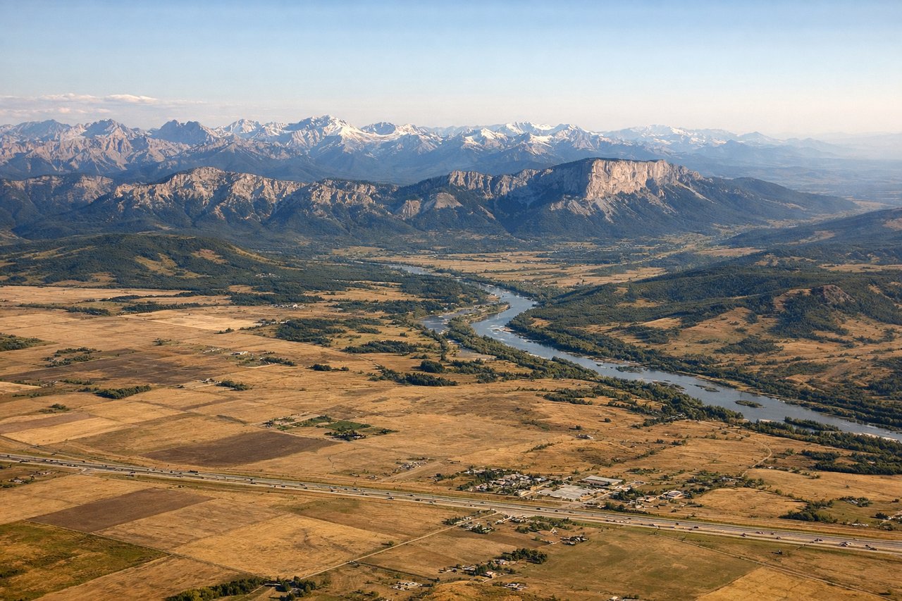
Landing at YYC
LEFTOn approach into Calgary from the south, the descent path passes east of the Rocky Mountain front ranges, putting the jagged, snow-capped peaks and foothills on the left side of the aircraft. The right side instead shows the flat prairie and the city's eastern suburbs, far less dramatic.
Will your flight be in sunlight?
Pick a date and time in the Sun Map to watch the sun move across your whole flight.
About This Route
Which side of the plane should I sit on flying from Cancun International (CUN) to Calgary International (YYC)?
Sit on the Left side of the plane for the best views on flights from Cancun to Calgary. While the right side gets a brief coastal highlight at takeoff, the left side offers the Rocky Mountain approach into Calgary, a far more dramatic and prolonged scenic payoff that outweighs a short coastal glimpse.
What can I see during takeoff from Cancun International in Cancun?
During takeoff from Cancun International (CUN), sit on the Right side for the best views. Departing Cancun on runway 30, the aircraft climbs out over the Yucatan coastline before turning onto its northbound course, giving right-side passengers a last look at the turquoise Caribbean, the Nichupté Lagoon, and Isla Mujeres offshore. The left side only shows flat jungle canopy stretching inland. Notable sights include: Caribbean Sea and reef line, Isla Mujeres, Nichupté Lagoon, Cancun's hotel zone beaches.
What can I see when landing at Calgary International in Calgary?
When landing at Calgary International (YYC), sit on the Left side for the best views. On approach into Calgary from the south, the descent path passes east of the Rocky Mountain front ranges, putting the jagged, snow-capped peaks and foothills on the left side of the aircraft. The right side instead shows the flat prairie and the city's eastern suburbs, far less dramatic. Notable sights include: Rocky Mountain front ranges, foothills grassland, Bow River valley, Calgary's downtown skyline.
How long is the flight from Cancun to Calgary?
The flight from Cancun International (CUN) to Calgary International (YYC) takes about 5 hours 45 minutes. The shortest flight path between them is 2,542 miles (4,091 km); winds and air traffic control usually add a few percent.
What does the Cancun to Calgary flight path pass over?
Gulf of Mexico, Texas Panhandle plains, Great Plains of Kansas and Nebraska, Rocky Mountain foothills near the Alberta border