Right-side seats capture the Ohio River and Cincinnati during departure, which is the most visually distinctive phase of this short flight. The landing approach over the Blue Ridge is scenic but brief, and the flight path is relatively short with limited midpoint features.
Flown CVG to IAD? Did we get it right?
Flight Path
Cincinnati to Washington is 387 miles (623 km), a flight of about 1 hour 15 minutes.
The flight path crosses the Appalachian foothills and the Shenandoah Valley. Passengers may glimpse the New River valley in southern West Virginia and the transition from Ohio's glaciated terrain to the ridge-and-valley topography of the Appalachian region. The Potomac River becomes visible in the final descent phase as it winds through the Piedmont toward Washington.
Great circle distance and headings ›Phase by phase
Takeoff from CVG
RIGHTRight-side seats offer views of the Ohio River valley and the Cincinnati urban area during climb-out. The river's distinctive curves and the city's position along it are clearly visible from altitude, providing immediate geographic context.
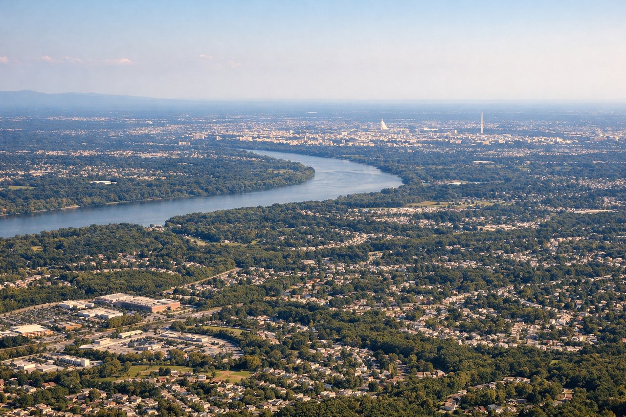
Landing at IAD
LEFTLeft-side seats provide views of the Shenandoah Valley and Blue Ridge Mountains during descent into Dulles. These prominent ridgelines are clearly visible from cruise altitude and remain visible through much of the approach, offering dramatic topographic contrast.
Will your flight be in sunlight?
Pick a date and time in the Sun Map to watch the sun move across your whole flight.
About This Route
Which side of the plane should I sit on flying from Cincinnati Northern Kentucky International (CVG) to Washington Dulles International (IAD)?
Sit on the Right side of the plane for the best views on flights from Cincinnati to Washington. Right-side seats capture the Ohio River and Cincinnati during departure, which is the most visually distinctive phase of this short flight. The landing approach over the Blue Ridge is scenic but brief, and the flight path is relatively short with limited midpoint features.
What can I see during takeoff from Cincinnati Northern Kentucky International in Cincinnati?
During takeoff from Cincinnati Northern Kentucky International (CVG), sit on the Right side for the best views. Right-side seats offer views of the Ohio River valley and the Cincinnati urban area during climb-out. The river's distinctive curves and the city's position along it are clearly visible from altitude, providing immediate geographic context. Notable sights include: Ohio River, Cincinnati downtown skyline, Mill Creek valley, Northern Kentucky terrain.
What can I see when landing at Washington Dulles International in Washington?
When landing at Washington Dulles International (IAD), sit on the Left side for the best views. Left-side seats provide views of the Shenandoah Valley and Blue Ridge Mountains during descent into Dulles. These prominent ridgelines are clearly visible from cruise altitude and remain visible through much of the approach, offering dramatic topographic contrast. Notable sights include: Blue Ridge Mountains, Shenandoah Valley, Potomac River, Washington DC metropolitan area.
How long is the flight from Cincinnati to Washington?
The flight from Cincinnati Northern Kentucky International (CVG) to Washington Dulles International (IAD) takes about 1 hour 15 minutes. The shortest flight path between them is 387 miles (623 km); winds and air traffic control usually add a few percent.
What does the Cincinnati to Washington flight path pass over?
The flight path crosses the Appalachian foothills and the Shenandoah Valley. Passengers may glimpse the New River valley in southern West Virginia and the transition from Ohio's glaciated terrain to the ridge-and-valley topography of the Appalachian region. The Potomac River becomes visible in the final descent phase as it winds through the Piedmont toward Washington.