Right side scores higher (3.5 vs 2.5) due to superior scenic variety across the full flight. Takeoff offers Cam Ranh Bay's striking coastal geometry; cruise crosses the Gulf of Tonkin with occasional Vietnamese and Chinese coastal features; landing delivers the dramatic Nakdong estuary and Busan's dense urban-industrial harbor complex. Left side sees primarily open water and flat terrain with minimal landmark density.
Flown CXR to PUS? Did we get it right?
Flight Path
Nha Trang/nha Trang aiurportCam Ranh to Kimhae is 2,022 miles (3,254 km), a flight of about 4 hours 30 minutes.
Gulf of Tonkin (open water, occasional fishing vessels and small islands near Vietnamese coast), Hainan Island's southern coast (if visible at cruise altitude on clear days), scattered Vietnamese coastal towns and fishing communities along the northern approach to the gulf, transition to Korean peninsula with mountainous terrain becoming visible 30-40 minutes before descent into Gimhae
Great circle distance and headings ›Phase by phase
Takeoff from CXR
RIGHTRight side captures Cam Ranh Bay's dramatic coastline and the sheltered harbor immediately after departure. The bay's distinctive crescent shape and turquoise waters are striking during initial climb, with the Nha Trang peninsula visible to the north.
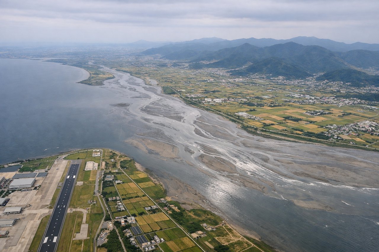
Landing at PUS
RIGHTRight side offers superior approach scenery into Gimhae. The descent path typically crosses the Nakdong River estuary and Busan's harbor complex, with Geoje Island and the Korea Strait visible. The urban sprawl of Busan and surrounding industrial zones create dramatic density contrast against water.
Will your flight be in sunlight?
Pick a date and time in the Sun Map to watch the sun move across your whole flight.
About This Route
Which side of the plane should I sit on flying from Cam Ranh International Airport / Cam Ranh Air Base (CXR) to Gimhae International (PUS)?
Sit on the Right side of the plane for the best views on flights from Nha Trang/nha Trang aiurportCam Ranh to Kimhae. Right side scores higher (3.5 vs 2.5) due to superior scenic variety across the full flight. Takeoff offers Cam Ranh Bay's striking coastal geometry; cruise crosses the Gulf of Tonkin with occasional Vietnamese and Chinese coastal features; landing delivers the dramatic Nakdong estuary and Busan's dense urban-industrial harbor complex. Left side sees primarily open water and flat terrain with minimal landmark density.
What can I see during takeoff from Cam Ranh International Airport / Cam Ranh Air Base in Nha Trang/nha Trang aiurportCam Ranh?
During takeoff from Cam Ranh International Airport / Cam Ranh Air Base (CXR), sit on the Right side for the best views. Right side captures Cam Ranh Bay's dramatic coastline and the sheltered harbor immediately after departure. The bay's distinctive crescent shape and turquoise waters are striking during initial climb, with the Nha Trang peninsula visible to the north. Notable sights include: Cam Ranh Bay (crescent-shaped harbor), Nha Trang Peninsula, South China Sea coastline, Cam Ranh Air Base runway complex.
What can I see when landing at Gimhae International in Kimhae?
When landing at Gimhae International (PUS), sit on the Right side for the best views. Right side offers superior approach scenery into Gimhae. The descent path typically crosses the Nakdong River estuary and Busan's harbor complex, with Geoje Island and the Korea Strait visible. The urban sprawl of Busan and surrounding industrial zones create dramatic density contrast against water. Notable sights include: Nakdong River estuary, Busan harbor and container terminals, Geoje Island, Korea Strait coastline.
How long is the flight from Nha Trang/nha Trang aiurportCam Ranh to Kimhae?
The flight from Cam Ranh International Airport / Cam Ranh Air Base (CXR) to Gimhae International (PUS) takes about 4 hours 30 minutes. The shortest flight path between them is 2,022 miles (3,254 km); winds and air traffic control usually add a few percent.
What does the Nha Trang/nha Trang aiurportCam Ranh to Kimhae flight path pass over?
Gulf of Tonkin (open water, occasional fishing vessels and small islands near Vietnamese coast), Hainan Island's southern coast (if visible at cruise altitude on clear days), scattered Vietnamese coastal towns and fishing communities along the northern approach to the gulf, transition to Korean peninsula with mountainous terrain becoming visible 30-40 minutes before descent into Gimhae