Both sides score equally at 2.0 due to the short flight duration (2h 15m) over predominantly flat Midwestern terrain with minimal dramatic topography. However, the right side edges ahead for the full flight experience: it captures Dallas's urban departure over the Trinity River and downtown skyline, then offers Lake Michigan and Milwaukee's waterfront during approach—providing more recognizable urban landmarks and water features than the left side's flat plains and agricultural landscape.
Flown DAL to MKE? Did we get it right?
Flight Path
Dallas to Milwaukee is 851 miles (1,369 km), a flight of about 2 hours 15 minutes.
The flight path crosses central Oklahoma and southern Kansas, passing over the Red River valley, the Cimarron River drainage, and the flat High Plains. No significant mountains or dramatic terrain features are visible; the landscape is predominantly agricultural with scattered towns and reservoirs. The Arkansas River valley near the Oklahoma-Kansas border may be visible as a subtle linear feature. No major water bodies or distinctive landmarks interrupt the 600-mile route at cruise altitude.
Great circle distance and headings ›Phase by phase
Takeoff from DAL
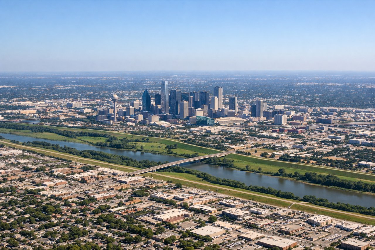
RIGHTRight side captures Dallas Love Field's urban setting and the initial climb over downtown Dallas and its surrounding metropolitan area. Left side departs over less developed terrain northwest of the airport.
Landing at MKE
RIGHTRight side offers views of Milwaukee's urban waterfront and Lake Michigan during the approach to MKE. The descent path typically brings the lake and harbor into view on the right side as the aircraft lines up for runway 01L or 19R.
Will your flight be in sunlight?
Pick a date and time in the Sun Map to watch the sun move across your whole flight.
About This Route
Which side of the plane should I sit on flying from Dallas Love Fld (DAL) to General Mitchell International (MKE)?
Sit on the Right side of the plane for the best views on flights from Dallas to Milwaukee. Both sides score equally at 2.0 due to the short flight duration (2h 15m) over predominantly flat Midwestern terrain with minimal dramatic topography. However, the right side edges ahead for the full flight experience: it captures Dallas's urban departure over the Trinity River and downtown skyline, then offers Lake Michigan and Milwaukee's waterfront during approach—providing more recognizable urban landmarks and water features than the left side's flat plains and agricultural landscape.
What can I see during takeoff from Dallas Love Fld in Dallas?
During takeoff from Dallas Love Fld (DAL), sit on the Right side for the best views. Right side captures Dallas Love Field's urban setting and the initial climb over downtown Dallas and its surrounding metropolitan area. Left side departs over less developed terrain northwest of the airport. Notable sights include: Downtown Dallas skyline, Trinity River corridor, Love Field runway complex.
What can I see when landing at General Mitchell International in Milwaukee?
When landing at General Mitchell International (MKE), sit on the Right side for the best views. Right side offers views of Milwaukee's urban waterfront and Lake Michigan during the approach to MKE. The descent path typically brings the lake and harbor into view on the right side as the aircraft lines up for runway 01L or 19R. Notable sights include: Lake Michigan shoreline, Milwaukee harbor and downtown waterfront, Mitchell International Airport runways.
How long is the flight from Dallas to Milwaukee?
The flight from Dallas Love Fld (DAL) to General Mitchell International (MKE) takes about 2 hours 15 minutes. The shortest flight path between them is 851 miles (1,369 km); winds and air traffic control usually add a few percent.
What does the Dallas to Milwaukee flight path pass over?
The flight path crosses central Oklahoma and southern Kansas, passing over the Red River valley, the Cimarron River drainage, and the flat High Plains. No significant mountains or dramatic terrain features are visible; the landscape is predominantly agricultural with scattered towns and reservoirs. The Arkansas River valley near the Oklahoma-Kansas border may be visible as a subtle linear feature. No major water bodies or distinctive landmarks interrupt the 600-mile route at cruise altitude.