While takeoff from Dallas offers some urban interest on the right, the landing approach into Knoxville on the left provides superior scenery with the Great Smoky Mountains and Tennessee Valley—genuinely dramatic natural features that dominate the view during descent.
Flown DAL to TYS? Did we get it right?
Flight Path
Dallas to Knoxville is 761 miles (1,224 km), a flight of about 2 hours 15 minutes.
The flight path crosses the Cumberland Plateau in Tennessee, with the Tennessee River visible in sections, and passes over the transition zone between the Mississippi Valley and the Appalachian highlands. Notable features include the plateau's forested terrain and scattered reservoirs (Watts Bar Lake, Tellico Lake) visible at altitude in the descent phase.
Great circle distance and headings ›Phase by phase
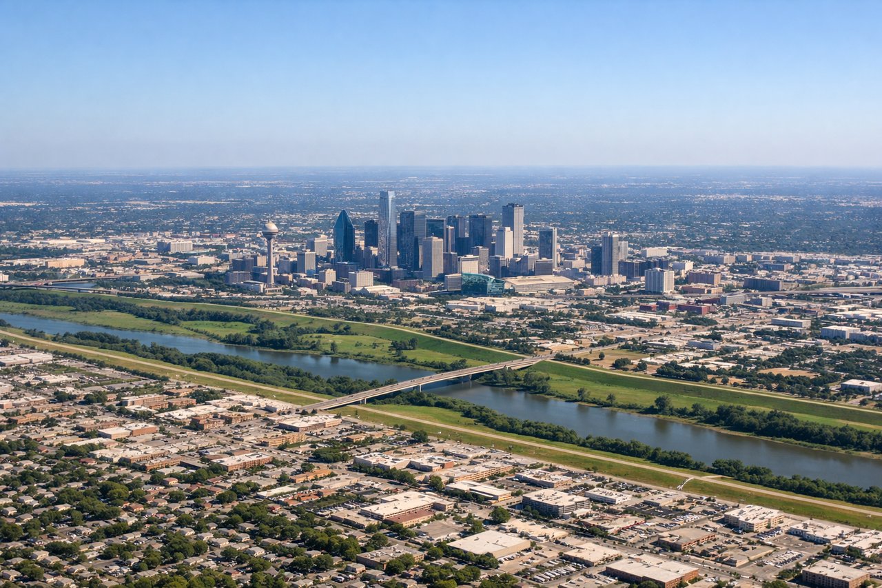
Takeoff from DAL
RIGHTRight side offers views of the Trinity River system and downtown Dallas skyline during initial climb. The left side faces industrial areas and suburban sprawl with less visual interest.
Landing at TYS
LEFTLeft side provides excellent views of the Great Smoky Mountains and the Tennessee Valley during descent into Knoxville. The right side faces less dramatic terrain with rolling foothills and industrial areas.
Will your flight be in sunlight?
Pick a date and time in the Sun Map to watch the sun move across your whole flight.
About This Route
Which side of the plane should I sit on flying from Dallas Love Fld (DAL) to Mc Ghee Tyson (TYS)?
Sit on the Left side of the plane for the best views on flights from Dallas to Knoxville. While takeoff from Dallas offers some urban interest on the right, the landing approach into Knoxville on the left provides superior scenery with the Great Smoky Mountains and Tennessee Valley—genuinely dramatic natural features that dominate the view during descent.
What can I see during takeoff from Dallas Love Fld in Dallas?
During takeoff from Dallas Love Fld (DAL), sit on the Right side for the best views. Right side offers views of the Trinity River system and downtown Dallas skyline during initial climb. The left side faces industrial areas and suburban sprawl with less visual interest. Notable sights include: Trinity River, downtown Dallas high-rises, Lake Lewisville (visible at altitude during northeastward climb), White Rock Lake.
What can I see when landing at Mc Ghee Tyson in Knoxville?
When landing at Mc Ghee Tyson (TYS), sit on the Left side for the best views. Left side provides excellent views of the Great Smoky Mountains and the Tennessee Valley during descent into Knoxville. The right side faces less dramatic terrain with rolling foothills and industrial areas. Notable sights include: Great Smoky Mountains (main ridge line), Tennessee River valley, Knoxville urban area, Holston River.
How long is the flight from Dallas to Knoxville?
The flight from Dallas Love Fld (DAL) to Mc Ghee Tyson (TYS) takes about 2 hours 15 minutes. The shortest flight path between them is 761 miles (1,224 km); winds and air traffic control usually add a few percent.
What does the Dallas to Knoxville flight path pass over?
The flight path crosses the Cumberland Plateau in Tennessee, with the Tennessee River visible in sections, and passes over the transition zone between the Mississippi Valley and the Appalachian highlands. Notable features include the plateau's forested terrain and scattered reservoirs (Watts Bar Lake, Tellico Lake) visible at altitude in the descent phase.