While takeoff offers good ocean views on the right, the landing approach into Addis Ababa provides more dramatic and sustained geography—the Ethiopian Highlands escarpment and plateau basin are visually distinctive and geologically significant. The left side captures the most impressive terrain transition of the entire flight.
Flight Path
The flight path crosses central Tanzania and southern Kenya, passing east of Lake Tanganyika (not visible—too far west) and over the East African plateau. Around the midpoint near the Kenya-Ethiopia border, you'll see the Rift Valley's northern reaches and scattered volcanic features. The terrain gradually rises as you approach the Ethiopian Highlands. No major lakes or dramatic landmarks are directly on the typical flight corridor, but the gradual elevation gain from ~500 feet (Dar) to ~7,500 feet (Addis) is noticeable in the landscape's character—from coastal plains to highland plateau.
Great circle distance and headings ›

Phase by phase
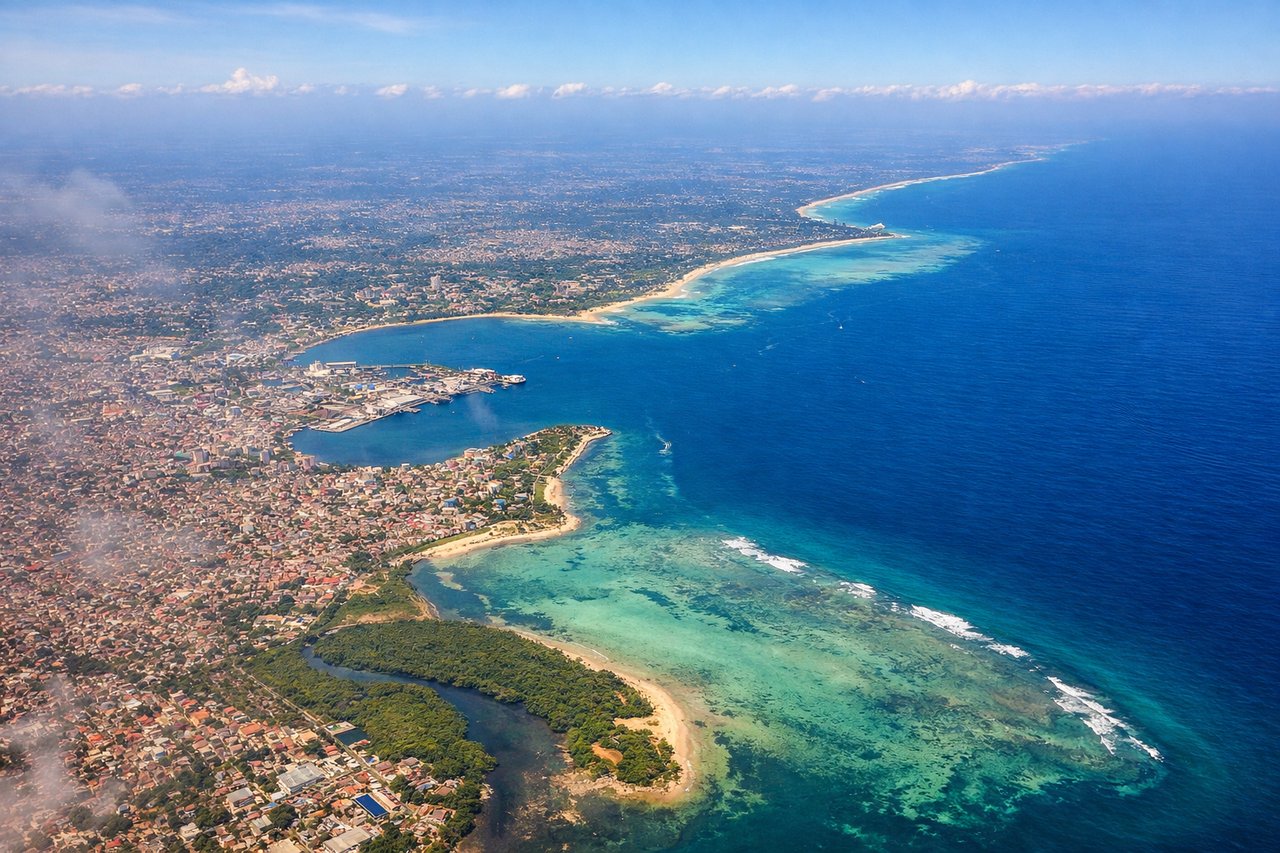
Takeoff from DAR
RIGHTDar es Salaam typically departs runway 09 or 27 depending on wind. Right-side seats offer views of the Indian Ocean coastline and the city's waterfront as you climb northwestward. The contrast between urban sprawl and open water is striking during the initial climb.
Landing at ADD
LEFTApproaching Addis Ababa from the south typically uses runway 25 or 07. Left-side seats provide excellent views of the Ethiopian Highlands as you descend into the Addis Ababa plateau. You'll see the dramatic elevation changes and the city nestled in its highland basin.
Landmarks on this routeAll landmarks →
Will your flight be in sunlight?
See exactly which side of the plane gets sun and shade at your departure time.
About This Route
Which side of the plane should I sit on flying from Dar Es Salaam (DAR) to Bole International (ADD)?
Sit on the Left side of the plane for the best views on flights from Dar Es Salaam to Addis Ababa. While takeoff offers good ocean views on the right, the landing approach into Addis Ababa provides more dramatic and sustained geography—the Ethiopian Highlands escarpment and plateau basin are visually distinctive and geologically significant. The left side captures the most impressive terrain transition of the entire flight.
What can I see during takeoff from Dar Es Salaam in Dar Es Salaam?
During takeoff from Dar Es Salaam (DAR), sit on the Right side for the best views. Dar es Salaam typically departs runway 09 or 27 depending on wind. Right-side seats offer views of the Indian Ocean coastline and the city's waterfront as you climb northwestward. The contrast between urban sprawl and open water is striking during the initial climb. Notable sights include: Indian Ocean (immediate right), Dar es Salaam city grid (below and left), Msimbazi River valley (left side during climb), coastal mangrove areas (right, receding).
What can I see when landing at Bole International in Addis Ababa?
When landing at Bole International (ADD), sit on the Left side for the best views. Approaching Addis Ababa from the south typically uses runway 25 or 07. Left-side seats provide excellent views of the Ethiopian Highlands as you descend into the Addis Ababa plateau. You'll see the dramatic elevation changes and the city nestled in its highland basin. Notable sights include: Ethiopian Highlands escarpment (left, rising terrain), Addis Ababa plateau basin (center and below), Entoto Mountains (left background), scattered highland vegetation and agricultural patches (foreground and sides).
How long is the flight from Dar Es Salaam to Addis Ababa?
The flight from Dar Es Salaam (DAR) to Bole International (ADD) takes Approximately 3 hours 15 minutes.
What does the Dar Es Salaam to Addis Ababa flight path pass over?
The flight path crosses central Tanzania and southern Kenya, passing east of Lake Tanganyika (not visible—too far west) and over the East African plateau. Around the midpoint near the Kenya-Ethiopia border, you'll see the Rift Valley's northern reaches and scattered volcanic features. The terrain gradually rises as you approach the Ethiopian Highlands. No major lakes or dramatic landmarks are directly on the typical flight corridor, but the gradual elevation gain from ~500 feet (Dar) to ~7,500 feet (Addis) is noticeable in the landscape's character—from coastal plains to highland plateau.