Right seats provide the most consistent scenic value: coastal views during Dar departure, then the Red Sea and Gulf of Aden during the northbound flight path, and finally the Persian Gulf approach to Doha. Left seats miss most of the oceanic features on the outbound leg.
Flown DAR to DOH? Did we get it right?
Flight Path
Dar Es Salaam to Doha is 2,372 miles (3,818 km), a flight of about 5 hours.
The flight path crosses the Horn of Africa region, passing east of Somalia and Ethiopia. Notable features include the Red Sea to the west (visible from right side), the Gulf of Aden's narrow strait between Yemen and Somalia, and the Arabian Peninsula's eastern coastline. The Socotra Island region and the entrance to the Persian Gulf mark the final approach phase. Altitude typically cruises at 35,000-37,000 feet, making individual cities difficult to distinguish, but major water bodies and coastlines remain clearly visible.
Great circle distance and headings ›

Phase by phase
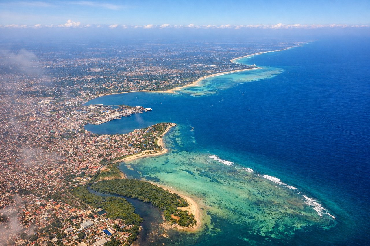
Takeoff from DAR
RIGHTDar es Salaam International typically departs to the southwest or west. Right-side seats offer views of the Indian Ocean coastline and the city's waterfront as you climb out, plus the Dar es Salaam harbor and surrounding coastal plains.
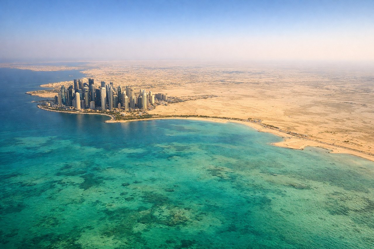
Landing at DOH
LEFTDoha International typically uses runways aligned north-south or northeast-southwest. Left-side seats during descent offer views of the Persian Gulf's distinctive turquoise shallow waters, the Qatar peninsula's flat desert terrain, and Doha's skyline as you approach from the east or northeast.
Will your flight be in sunlight?
Pick a date and time in the Sun Map to watch the sun move across your whole flight.
About This Route
Which side of the plane should I sit on flying from Dar Es Salaam (DAR) to Hamad International Airport (DOH)?
Sit on the Right side of the plane for the best views on flights from Dar Es Salaam to Doha. Right seats provide the most consistent scenic value: coastal views during Dar departure, then the Red Sea and Gulf of Aden during the northbound flight path, and finally the Persian Gulf approach to Doha. Left seats miss most of the oceanic features on the outbound leg.
What can I see during takeoff from Dar Es Salaam in Dar Es Salaam?
During takeoff from Dar Es Salaam (DAR), sit on the Right side for the best views. Dar es Salaam International typically departs to the southwest or west. Right-side seats offer views of the Indian Ocean coastline and the city's waterfront as you climb out, plus the Dar es Salaam harbor and surrounding coastal plains. Notable sights include: Indian Ocean (immediate coastline), Dar es Salaam city and harbor, Coastal plains extending inland, Bagamoyo region to the north.
What can I see when landing at Hamad International Airport in Doha?
When landing at Hamad International Airport (DOH), sit on the Left side for the best views. Doha International typically uses runways aligned north-south or northeast-southwest. Left-side seats during descent offer views of the Persian Gulf's distinctive turquoise shallow waters, the Qatar peninsula's flat desert terrain, and Doha's skyline as you approach from the east or northeast. Notable sights include: Persian Gulf (shallow turquoise waters), Qatar peninsula desert landscape, Doha skyline and harbor, Coastal salt flats and sabkha.
How long is the flight from Dar Es Salaam to Doha?
The flight from Dar Es Salaam (DAR) to Hamad International Airport (DOH) takes about 5 hours. The shortest flight path between them is 2,372 miles (3,818 km); winds and air traffic control usually add a few percent.
What does the Dar Es Salaam to Doha flight path pass over?
The flight path crosses the Horn of Africa region, passing east of Somalia and Ethiopia. Notable features include the Red Sea to the west (visible from right side), the Gulf of Aden's narrow strait between Yemen and Somalia, and the Arabian Peninsula's eastern coastline. The Socotra Island region and the entrance to the Persian Gulf mark the final approach phase. Altitude typically cruises at 35,000-37,000 feet, making individual cities difficult to distinguish, but major water bodies and coastlines remain clearly visible.