Left side wins at both ends of the flight. Departing David you get Volcán Barú and the Pacific coast; arriving Chicago you get the iconic lakefront skyline. Over the mid-flight the left side also tracks closer to the Gulf of Mexico coastline and the Mississippi River valley as the route curves north through Central America and Mexico.
Flown DAV to ORD? Did we get it right?
Flight Path
David to Chicago is 2,345 miles (3,773 km), a flight of about 6 hours.
The route typically passes over the Yucatán Peninsula and Gulf of Mexico, then crosses the Gulf Coast near the Texas-Mexico border region, traverses the flat agricultural plains of Texas and the lower Mississippi River valley, and crosses the Missouri and Illinois plains before descending into Chicago. The Mississippi River is often visible as a broad silver ribbon cutting through the flat midcontinent landscape.
Great circle distance and headings ›

Phase by phase
Takeoff from DAV
LEFTDavid's runway is oriented roughly east-west. Departing westward toward the north, the left (south) side gives you a clear view of the Barú Volcano, Panama's highest peak at 11,400 feet, rising dramatically above the surrounding lowlands. The Pacific coastal plain and Gulf of Chiriquí are also visible to the south.
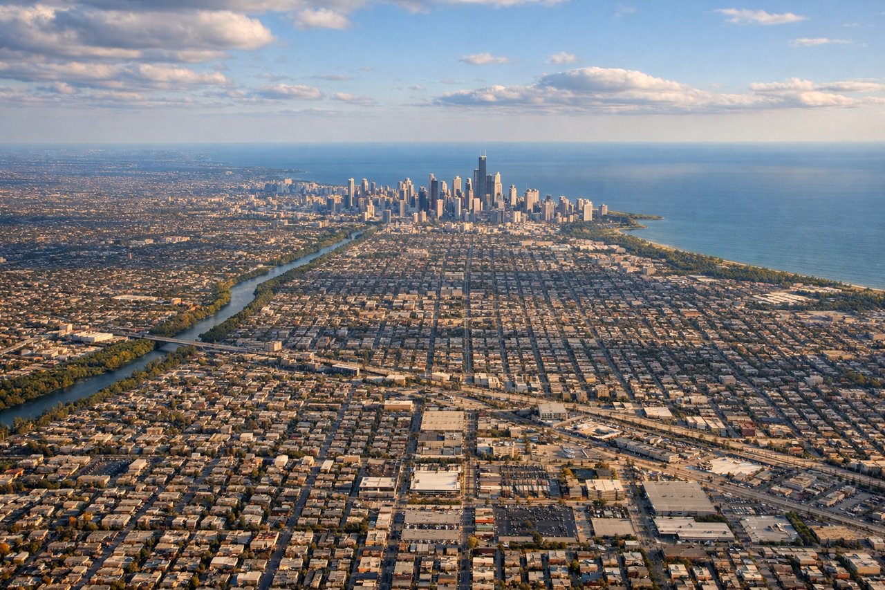
Landing at ORD
LEFTO'Hare's most common arrival paths from the south bring aircraft in from the southeast or south. The left (east) side gives a clear view of downtown Chicago's skyline along the lakefront, Lake Michigan's western shore, and the dense urban grid of the North Side neighborhoods. This is one of the most recognizable urban aerial views in North America.
Will your flight be in sunlight?
Pick a date and time in the Sun Map to watch the sun move across your whole flight.
About This Route
Which side of the plane should I sit on flying from Enrique Malek International (DAV) to Chicago Ohare International (ORD)?
Sit on the Left side of the plane for the best views on flights from David to Chicago. Left side wins at both ends of the flight. Departing David you get Volcán Barú and the Pacific coast; arriving Chicago you get the iconic lakefront skyline. Over the mid-flight the left side also tracks closer to the Gulf of Mexico coastline and the Mississippi River valley as the route curves north through Central America and Mexico.
What can I see during takeoff from Enrique Malek International in David?
During takeoff from Enrique Malek International (DAV), sit on the Left side for the best views. David's runway is oriented roughly east-west. Departing westward toward the north, the left (south) side gives you a clear view of the Barú Volcano, Panama's highest peak at 11,400 feet, rising dramatically above the surrounding lowlands. The Pacific coastal plain and Gulf of Chiriquí are also visible to the south. Notable sights include: Volcán Barú (11,400 ft), Gulf of Chiriquí, Chiriquí lowland agricultural plains, Talamanca mountain foothills to the north.
What can I see when landing at Chicago Ohare International in Chicago?
When landing at Chicago Ohare International (ORD), sit on the Left side for the best views. O'Hare's most common arrival paths from the south bring aircraft in from the southeast or south. The left (east) side gives a clear view of downtown Chicago's skyline along the lakefront, Lake Michigan's western shore, and the dense urban grid of the North Side neighborhoods. This is one of the most recognizable urban aerial views in North America. Notable sights include: Chicago downtown skyline (Willis Tower, John Hancock), Lake Michigan western shoreline, North Side urban grid, O'Hare suburban sprawl to the northwest.
How long is the flight from David to Chicago?
The flight from Enrique Malek International (DAV) to Chicago Ohare International (ORD) takes about 6 hours. The shortest flight path between them is 2,345 miles (3,773 km); winds and air traffic control usually add a few percent.
What does the David to Chicago flight path pass over?
The route typically passes over the Yucatán Peninsula and Gulf of Mexico, then crosses the Gulf Coast near the Texas-Mexico border region, traverses the flat agricultural plains of Texas and the lower Mississippi River valley, and crosses the Missouri and Illinois plains before descending into Chicago. The Mississippi River is often visible as a broad silver ribbon cutting through the flat midcontinent landscape.