While takeoff favors the right for Potomac River views, the landing approach provides superior scenery with Mount Rainier, the Cascades, and Lake Washington—iconic Pacific Northwest geography that dominates the left side during descent into BFI.
Flown DCA to BFI? Did we get it right?
Flight Path
Washington to Seattle is 2,322 miles (3,737 km), a flight of about 5 hours 15 minutes.
The flight path crosses the Appalachian Mountains (West Virginia/Kentucky ridgelines visible around 2.5 hours), then transitions to the Great Plains over Ohio and Indiana. Around the 3-hour mark, the terrain flattens dramatically over Illinois and Iowa. The Missouri River appears as a wide brown ribbon in the middle of the flight. By hour 4, the Rocky Mountains emerge on the western horizon (Colorado/Wyoming high peaks). The final hour crosses the High Plains of Montana and Wyoming before descending into the Pacific Northwest, where the Cascade Range becomes increasingly prominent.
Great circle distance and headings ›


Phase by phase

Takeoff from DCA
RIGHTDCA typically departs eastbound (Runway 01/19 operations favor 01 eastbound). Right-side seats offer views of the Potomac River winding through downtown Washington and the National Mall landmarks receding behind. Left side faces inland Virginia with fewer distinctive features during initial climb.
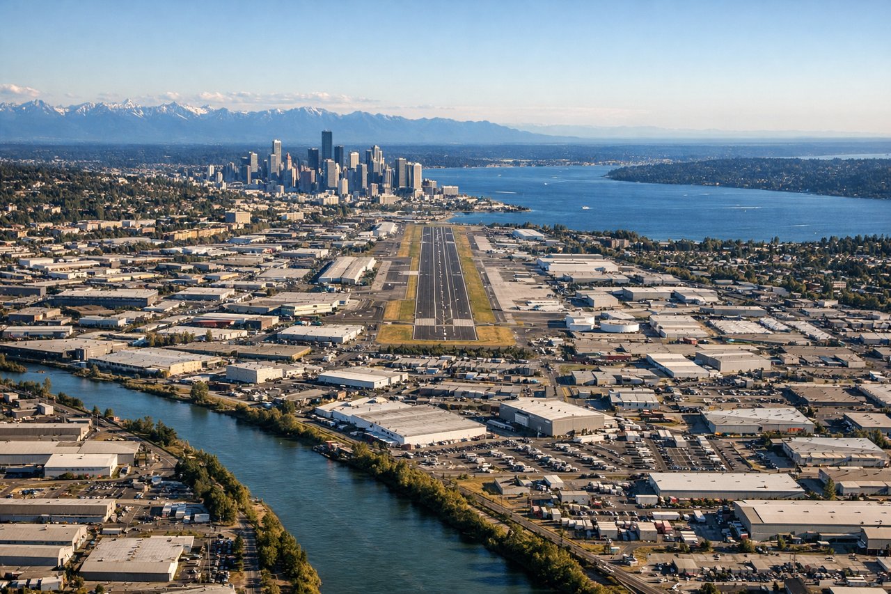
Landing at BFI
LEFTBFI approaches from the east (Runway 16L/34R operations typically use 16L from the east). Left-side seats provide unobstructed views of Lake Washington, the Cascade Range peaks, and Mount Rainier on the horizon during descent. Right side faces the city and Puget Sound but with less dramatic topography.
Will your flight be in sunlight?
Pick a date and time in the Sun Map to watch the sun move across your whole flight.
About This Route
Which side of the plane should I sit on flying from Ronald Reagan Washington National (DCA) to Boeing Fld King Co International (BFI)?
Sit on the Left side of the plane for the best views on flights from Washington to Seattle. While takeoff favors the right for Potomac River views, the landing approach provides superior scenery with Mount Rainier, the Cascades, and Lake Washington—iconic Pacific Northwest geography that dominates the left side during descent into BFI.
What can I see during takeoff from Ronald Reagan Washington National in Washington?
During takeoff from Ronald Reagan Washington National (DCA), sit on the Right side for the best views. DCA typically departs eastbound (Runway 01/19 operations favor 01 eastbound). Right-side seats offer views of the Potomac River winding through downtown Washington and the National Mall landmarks receding behind. Left side faces inland Virginia with fewer distinctive features during initial climb. Notable sights include: Potomac River (immediate foreground), National Mall and Capitol building (receding behind), Arlington National Cemetery (right side, middle distance), Dulles Corridor sprawl (left side, distant).
What can I see when landing at Boeing Fld King Co International in Seattle?
When landing at Boeing Fld King Co International (BFI), sit on the Left side for the best views. BFI approaches from the east (Runway 16L/34R operations typically use 16L from the east). Left-side seats provide unobstructed views of Lake Washington, the Cascade Range peaks, and Mount Rainier on the horizon during descent. Right side faces the city and Puget Sound but with less dramatic topography. Notable sights include: Lake Washington (immediate foreground during descent), Cascade Range peaks (eastern horizon), Mount Rainier (distant southeastern horizon), Seattle downtown skyline (right side, middle distance).
How long is the flight from Washington to Seattle?
The flight from Ronald Reagan Washington National (DCA) to Boeing Fld King Co International (BFI) takes about 5 hours 15 minutes. The shortest flight path between them is 2,322 miles (3,737 km); winds and air traffic control usually add a few percent.
What does the Washington to Seattle flight path pass over?
The flight path crosses the Appalachian Mountains (West Virginia/Kentucky ridgelines visible around 2.5 hours), then transitions to the Great Plains over Ohio and Indiana. Around the 3-hour mark, the terrain flattens dramatically over Illinois and Iowa. The Missouri River appears as a wide brown ribbon in the middle of the flight. By hour 4, the Rocky Mountains emerge on the western horizon (Colorado/Wyoming high peaks). The final hour crosses the High Plains of Montana and Wyoming before descending into the Pacific Northwest, where the Cascade Range becomes increasingly prominent.