The flight is extremely short — roughly 20 to 25 minutes — and most of the visual payoff happens at takeoff from DCA. The left side captures the iconic Potomac River, the National Mall monuments, and the Pentagon in the first few minutes of climb, which is the most visually rewarding part of this route. The landing views at IAD are pleasant but less dramatic.
Flown DCA to IAD? Did we get it right?
Flight Path
Ronald Reagan Washington National to Washington Dulles International is 23 miles (38 km), a flight of about 25 minutes.
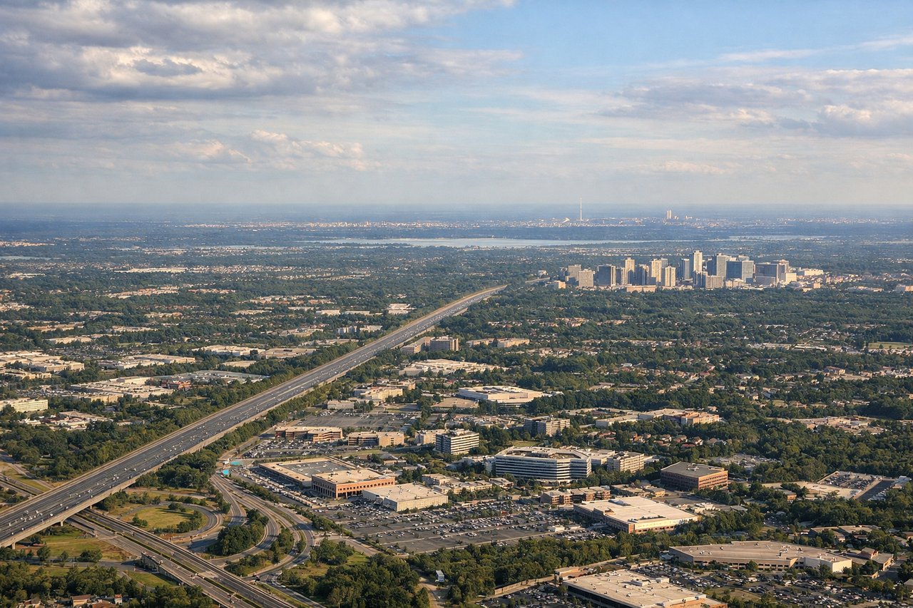
The flight path crosses northern Virginia's Fairfax County suburbs, the Dulles Corridor technology corridor along Route 28 and the Dulles Toll Road, and the transition from dense suburban development near the Beltway to the more open Loudoun County landscape approaching IAD. No significant terrain features — the area is low rolling Piedmont with elevations under 500 feet.
Great circle distance and headings ›Phase by phase

Takeoff from DCA
LEFTDCA's primary departure runway 01 heads north, putting the left (west) side over the Potomac River and with a view back toward the National Mall, Lincoln Memorial, and the monuments corridor. The right side faces east toward suburban Virginia and Maryland with less visual interest.
Landing at IAD
RIGHTIAD typically uses runways 01L/01R or 19L/19R depending on wind. On the common approach from the east on runway 01L/01R heading north, the right (east) side offers views over the Virginia Piedmont and the distant Blue Ridge Mountains on the western horizon. On runway 19 approaches heading south, the right side still captures the Blue Ridge to the west as the aircraft descends over Loudoun County farmland.
Will your flight be in sunlight?
Pick a date and time in the Sun Map to watch the sun move across your whole flight.
About This Route
Which side of the plane should I sit on flying from Ronald Reagan Washington National (DCA) to Washington Dulles International (IAD)?
Sit on the Left side of the plane for the best views on flights from Washington to Washington. The flight is extremely short — roughly 20 to 25 minutes — and most of the visual payoff happens at takeoff from DCA. The left side captures the iconic Potomac River, the National Mall monuments, and the Pentagon in the first few minutes of climb, which is the most visually rewarding part of this route. The landing views at IAD are pleasant but less dramatic.
What can I see during takeoff from Ronald Reagan Washington National in Washington?
During takeoff from Ronald Reagan Washington National (DCA), sit on the Left side for the best views. DCA's primary departure runway 01 heads north, putting the left (west) side over the Potomac River and with a view back toward the National Mall, Lincoln Memorial, and the monuments corridor. The right side faces east toward suburban Virginia and Maryland with less visual interest. Notable sights include: Potomac River, Lincoln Memorial and National Mall corridor, Arlington Memorial Bridge, Pentagon complex.
What can I see when landing at Washington Dulles International in Washington?
When landing at Washington Dulles International (IAD), sit on the Right side for the best views. IAD typically uses runways 01L/01R or 19L/19R depending on wind. On the common approach from the east on runway 01L/01R heading north, the right (east) side offers views over the Virginia Piedmont and the distant Blue Ridge Mountains on the western horizon. On runway 19 approaches heading south, the right side still captures the Blue Ridge to the west as the aircraft descends over Loudoun County farmland. Notable sights include: Blue Ridge Mountains, Loudoun County farmland patchwork, Dulles Toll Road corridor, Bull Run Mountains.
How long is the flight from Washington to Washington?
The flight from Ronald Reagan Washington National (DCA) to Washington Dulles International (IAD) takes about 25 minutes. The shortest flight path between them is 23 miles (38 km); winds and air traffic control usually add a few percent.
What does the Washington to Washington flight path pass over?
The flight path crosses northern Virginia's Fairfax County suburbs, the Dulles Corridor technology corridor along Route 28 and the Dulles Toll Road, and the transition from dense suburban development near the Beltway to the more open Loudoun County landscape approaching IAD. No significant terrain features — the area is low rolling Piedmont with elevations under 500 feet.