Dodge City to Denver is 292 miles (470 km), a flight of about 1 hour 15 minutes.
The right side captures the most dramatic scenery: the High Plains terrain during climb-out and the full Rocky Mountain Front Range during descent, including the iconic Front Range peaks that dominate the approach to Denver.
Flight Path
Arikaree River drainage, Bijou Creek valley, transition from High Plains grassland to Colorado foothills, Elbert County ranching terrain, South Platte River headwaters region
Great circle distance and headings ›Phase by phase
Takeoff from DDC
RIGHTClimbing eastbound from Dodge City, the right side offers views of the Arkansas River valley and the High Plains terrain rolling toward Colorado. The left side faces back toward the Texas Panhandle with less dramatic topography.
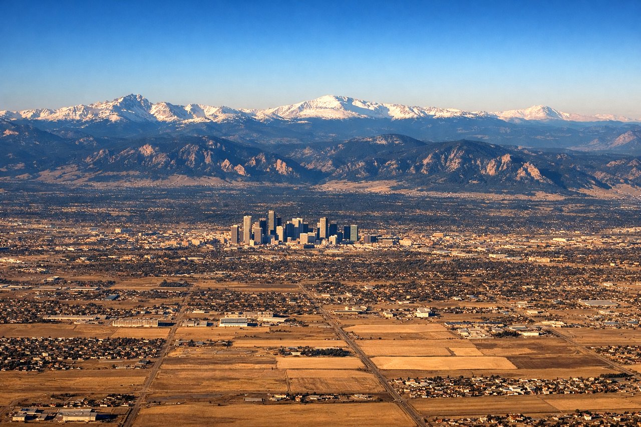
Landing at DEN
LEFTOn descent into Denver from the west, the left side provides direct views of the Front Range of the Rocky Mountains, including the dramatic eastern escarpment and foothills. The right side faces away from the mountains toward the plains.
Landmarks on this routeAll landmarks →
Will your flight be in sunlight?
Pick a date and time in the Sun Map to watch the sun move across your whole flight.
About This Route
Which side of the plane should I sit on flying from Dodge City Regional Airport (DDC) to Denver International (DEN)?
Sit on the Right side of the plane for the best views on flights from Dodge City to Denver. The right side captures the most dramatic scenery: the High Plains terrain during climb-out and the full Rocky Mountain Front Range during descent, including the iconic Front Range peaks that dominate the approach to Denver.
What can I see during takeoff from Dodge City Regional Airport in Dodge City?
During takeoff from Dodge City Regional Airport (DDC), sit on the Right side for the best views. Climbing eastbound from Dodge City, the right side offers views of the Arkansas River valley and the High Plains terrain rolling toward Colorado. The left side faces back toward the Texas Panhandle with less dramatic topography. Notable sights include: Arkansas River valley, High Plains grasslands, Cimarron River drainage, early views of Colorado foothills in distance.
What can I see when landing at Denver International in Denver?
When landing at Denver International (DEN), sit on the Left side for the best views. On descent into Denver from the west, the left side provides direct views of the Front Range of the Rocky Mountains, including the dramatic eastern escarpment and foothills. The right side faces away from the mountains toward the plains. Notable sights include: Front Range peaks (including Longs Peak and Mount Evans in distance), foothills terrain, South Platte River valley, Denver metropolitan area sprawl.
How long is the flight from Dodge City to Denver?
The flight from Dodge City Regional Airport (DDC) to Denver International (DEN) takes about 1 hour 15 minutes. The shortest flight path between them is 292 miles (470 km); winds and air traffic control usually add a few percent.
What does the Dodge City to Denver flight path pass over?
Arikaree River drainage, Bijou Creek valley, transition from High Plains grassland to Colorado foothills, Elbert County ranching terrain, South Platte River headwaters region