While takeoff favors the right for Himalayan views, the landing approach on Runway 10 makes left-side seats superior for the entire flight. The descent into Calcutta offers the most visually distinctive and geographically significant features—the Hooghly River's dramatic meanders and the city's iconic bridges are unmatched by any midpoint features on this route.
Flight Path
The flight path crosses the Indo-Gangetic Plain from west to east. Notable features include the Ganges River valley becoming visible around the midpoint (roughly over Uttar Pradesh/Bihar border), transitioning from the Himalayan foothills to flat alluvial plains. The landscape shifts from forested hills to agricultural fields and scattered towns. No major mountain ranges are crossed; the terrain gradually flattens as you approach the Ganges delta region. Visibility of the Ganges itself depends on water levels and haze, but the river's broad valley is often discernible as a lighter corridor through the plains.
Great circle distance and headings ›.jpg?width=600)

Phase by phase
Takeoff from DED
RIGHTDehradun airport typically departs eastward (Runway 03/21, favoring 03 for morning operations). Right-side seats face the Himalayan foothills and the Doon Valley's eastern extent as you climb out, offering the most dramatic topography.
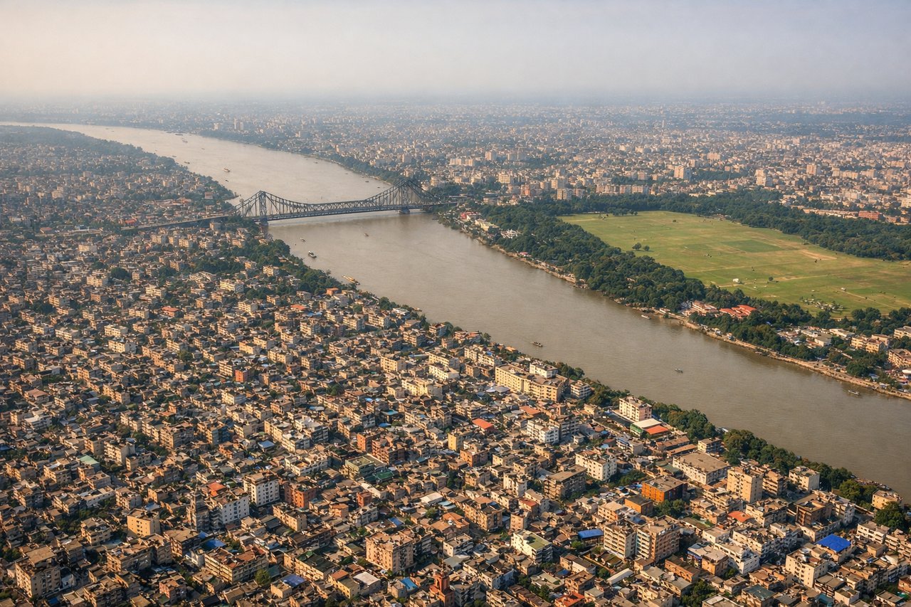
Landing at CCU
LEFTCalcutta's Netaji Subhash Chandra Bose airport typically uses Runway 10/28, with eastbound approaches on 10. Left-side seats on descent face the Hooghly River's dramatic curves and the city's eastern sprawl, including the Maidan and central Calcutta landmarks.
Landmarks on this routeAll landmarks →
Will your flight be in sunlight?
See exactly which side of the plane gets sun and shade at your departure time.
About This Route
Which side of the plane should I sit on flying from Dehradun (DED) to Netaji Subhash Chandra Bose International (CCU)?
Sit on the Left side of the plane for the best views on flights from Dehra Dun to Calcutta. While takeoff favors the right for Himalayan views, the landing approach on Runway 10 makes left-side seats superior for the entire flight. The descent into Calcutta offers the most visually distinctive and geographically significant features—the Hooghly River's dramatic meanders and the city's iconic bridges are unmatched by any midpoint features on this route.
What can I see during takeoff from Dehradun in Dehra Dun?
During takeoff from Dehradun (DED), sit on the Right side for the best views. Dehradun airport typically departs eastward (Runway 03/21, favoring 03 for morning operations). Right-side seats face the Himalayan foothills and the Doon Valley's eastern extent as you climb out, offering the most dramatic topography. Notable sights include: Lesser Himalayas (Mussoorie ridge to the north), Doon Valley floor with Rispana River visible as a thin line, Rajpur area settlements spreading eastward, forested slopes of the Shivalik Range.
What can I see when landing at Netaji Subhash Chandra Bose International in Calcutta?
When landing at Netaji Subhash Chandra Bose International (CCU), sit on the Left side for the best views. Calcutta's Netaji Subhash Chandra Bose airport typically uses Runway 10/28, with eastbound approaches on 10. Left-side seats on descent face the Hooghly River's dramatic curves and the city's eastern sprawl, including the Maidan and central Calcutta landmarks. Notable sights include: Hooghly River with its distinctive meanders and multiple bridges (Howrah Bridge, Vidyasagar Setu), Calcutta city grid and Maidan open space, industrial areas of Howrah on the western bank, Salt Lake City development to the northeast.
How long is the flight from Dehra Dun to Calcutta?
The flight from Dehradun (DED) to Netaji Subhash Chandra Bose International (CCU) takes Approximately 1 hour 15 minutes.
What does the Dehra Dun to Calcutta flight path pass over?
The flight path crosses the Indo-Gangetic Plain from west to east. Notable features include the Ganges River valley becoming visible around the midpoint (roughly over Uttar Pradesh/Bihar border), transitioning from the Himalayan foothills to flat alluvial plains. The landscape shifts from forested hills to agricultural fields and scattered towns. No major mountain ranges are crossed; the terrain gradually flattens as you approach the Ganges delta region. Visibility of the Ganges itself depends on water levels and haze, but the river's broad valley is often discernible as a lighter corridor through the plains.